Moravské Budějovice
| Moravské Budějovice | |||
| Town | |||
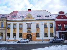 City hall in Moravské Budějovice | |||
|
|||
| Country | Czech Republic | ||
|---|---|---|---|
| Region | Vysočina | ||
| District | Třebíč | ||
| Commune | Moravské Budějovice | ||
| Elevation | 465 m (1,526 ft) | ||
| Coordinates | CZ 49°03′10″N 15°48′30″E / 49.05278°N 15.80833°ECoordinates: CZ 49°03′10″N 15°48′30″E / 49.05278°N 15.80833°E | ||
| Area | 37.15 km2 (14.34 sq mi) | ||
| Population | 7,957 | ||
| Density | 214/km2 (554/sq mi) | ||
| First mentioned | 1231 | ||
| Mayor | Vlastimil Bařinka | ||
| Timezone | CET (UTC+1) | ||
| - summer (DST) | CEST (UTC+2) | ||
| Postal code | 676 02 | ||
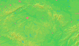  Location in the Czech Republic | |||
| Wikimedia Commons: Moravské Budějovice | |||
| Website: www.mbudejovice.cz | |||
.png)
Moravské Budějovice (Czech pronunciation: [ˈmorafskɛː ˈbuɟɛjovɪt͡sɛ]; German: (Mährisch) Budwitz) is a town in Vysočina Region, Czech Republic. It sits astride the E59 highway between Jihlava (Iglau) (45 km to the north) and Znojmo (Znaim) (30 km to the south). The town has around 8,000 inhabitants.
The villages Jackov, Lažínky, Vesce and Vranín are administrative parts of Moravské Budějovice.
History
Until 1918, Moravské Budějovice (as Mährisch Budwitz) was part of the Austrian monarchy (Austria side after the compromise of 1867), in the district with the same name, one of the 34 Bezirkshauptmannschaften in Moravia.[1]
References
- ↑ Die postalischen Abstempelungen auf den österreichischen Postwertzeichen-Ausgaben 1867, 1883 und 1890, Wilhelm KLEIN, 1967
External links
- Municipal website (en, cz, de, eo)
| Wikimedia Commons has media related to Moravské Budějovice. |
This article is issued from Wikipedia - version of the 10/8/2016. The text is available under the Creative Commons Attribution/Share Alike but additional terms may apply for the media files.