Želetava
| Želetava | |||
| Village | |||
|
|||
| Country | Czech Republic | ||
|---|---|---|---|
| Region | Vysočina | ||
| District | Třebíč | ||
| Commune | Moravské Budějovice | ||
| Elevation | 578 m (1,896 ft) | ||
| Coordinates | CZ 49°8′30″N 15°40′22″E / 49.14167°N 15.67278°ECoordinates: CZ 49°8′30″N 15°40′22″E / 49.14167°N 15.67278°E | ||
| Area | 27.57 km2 (10.64 sq mi) | ||
| Population | 1,554 | ||
| Density | 56/km2 (145/sq mi) | ||
| First mentioned | 1303 | ||
| Mayor | Ing. Radek Malý | ||
| Timezone | CET (UTC+1) | ||
| - summer (DST) | CEST (UTC+2) | ||
| Postal code | 675 26 | ||
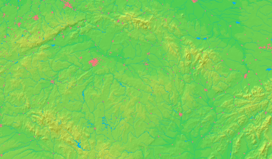  Location in the Czech Republic | |||
| Wikimedia Commons: Želetava | |||
| Statistics: statnisprava.cz | |||
| Website: www.mestyszeletava.cz/ | |||


Želetava (German: Scheletau) is a village in Vysočina Region, Czech Republic.
History
Želetava was founded in 1303.
External links
| Wikimedia Commons has media related to Želetava. |
This article is issued from Wikipedia - version of the 11/17/2016. The text is available under the Creative Commons Attribution/Share Alike but additional terms may apply for the media files.