Mooresboro, North Carolina
| Mooresboro, North Carolina | |
|---|---|
| Town | |
 Location of Mooresboro, North Carolina | |
| Coordinates: 35°17′59″N 81°42′2″W / 35.29972°N 81.70056°WCoordinates: 35°17′59″N 81°42′2″W / 35.29972°N 81.70056°W | |
| Country | United States |
| State | North Carolina |
| County | Cleveland |
| Area | |
| • Total | 1.8 sq mi (4.6 km2) |
| • Land | 1.8 sq mi (4.6 km2) |
| • Water | 0.0 sq mi (0.0 km2) |
| Elevation | 935 ft (285 m) |
| Population (2010) | |
| • Total | 311 |
| • Density | 178.3/sq mi (68.8/km2) |
| Time zone | Eastern (EST) (UTC-5) |
| • Summer (DST) | EDT (UTC-4) |
| ZIP code | 28114 |
| Area code(s) | 704, 828, 980 |
| FIPS code | 37-44160[1] |
| GNIS feature ID | 0990208[2] |
Mooresboro is a town in Cleveland County, North Carolina, United States. The population was 311 at the 2010 census.
Pro wrestler Chris Hamrick is from Mooresboro.
History
The Henrietta-Caroleen High School was added to the National Register of Historic Places in 2005.[3]
Geography
Mooresboro is located at 35°17′59″N 81°42′2″W / 35.29972°N 81.70056°W (35.299734, -81.700625).[4]
According to the United States Census Bureau, the town has a total area of 1.8 square miles (4.7 km2), all of it land.
Demographics
| Historical population | |||
|---|---|---|---|
| Census | Pop. | %± | |
| 1890 | 197 | — | |
| 1900 | 144 | −26.9% | |
| 1920 | 228 | — | |
| 1930 | 270 | 18.4% | |
| 1980 | 405 | — | |
| 1990 | 294 | −27.4% | |
| 2000 | 314 | 6.8% | |
| 2010 | 311 | −1.0% | |
| Est. 2015 | 308 | [5] | −1.0% |
As of the census[1] of 2000, there were 314 people, 131 households, and 94 families residing in the town. The population density was 178.3 people per square mile (68.9/km²). There were 140 housing units at an average density of 79.5 per square mile (30.7/km²). The racial makeup of the town was 88.22% White, 11.46% African American and 0.32% Pacific Islander.
There were 131 households out of which 33.6% had children under the age of 18 living with them, 51.1% were married couples living together, 16.8% had a female householder with no husband present, and 28.2% were non-families. 27.5% of all households were made up of individuals and 9.9% had someone living alone who was 65 years of age or older. The average household size was 2.40 and the average family size was 2.88.
In the town the population was spread out with 25.2% under the age of 18, 5.7% from 18 to 24, 30.9% from 25 to 44, 25.2% from 45 to 64, and 13.1% who were 65 years of age or older. The median age was 38 years. For every 100 females there were 95.0 males. For every 100 females age 18 and over, there were 91.1 males.
The median income for a household in the town was $33,125, and the median income for a family was $36,500. Males had a median income of $29,219 versus $27,083 for females. The per capita income for the town was $19,791. About 8.5% of families and 13.7% of the population were below the poverty line, including 29.4% of those under age 18 and 28.9% of those age 65 or over.
References
- 1 2 "American FactFinder". United States Census Bureau. Retrieved 2008-01-31.
- ↑ "US Board on Geographic Names". United States Geological Survey. 2007-10-25. Retrieved 2008-01-31.
- ↑ National Park Service (2010-07-09). "National Register Information System". National Register of Historic Places. National Park Service.
- ↑ "US Gazetteer files: 2010, 2000, and 1990". United States Census Bureau. 2011-02-12. Retrieved 2011-04-23.
- ↑ "Annual Estimates of the Resident Population for Incorporated Places: April 1, 2010 to July 1, 2015". Retrieved July 2, 2016.
- ↑ "Census of Population and Housing". Census.gov. Retrieved June 4, 2015.
Municipalities and communities of Cleveland County, North Carolina, United States | ||
|---|---|---|
| Cities | 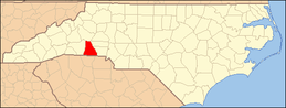 | |
| Towns | ||
| CDP | ||
| Unincorporated communities | ||
| Footnotes | ‡This populated place also has portions in an adjacent county or counties | |