Lattimore, North Carolina
| Lattimore, North Carolina | |
|---|---|
| Town | |
 Location of Lattimore, North Carolina | |
| Coordinates: 35°18′47″N 81°39′25″W / 35.31306°N 81.65694°WCoordinates: 35°18′47″N 81°39′25″W / 35.31306°N 81.65694°W | |
| Country | United States |
| State | North Carolina |
| County | Cleveland |
| Area | |
| • Total | 1.0 sq mi (2.6 km2) |
| • Land | 1.0 sq mi (2.6 km2) |
| • Water | 0.0 sq mi (0.0 km2) |
| Elevation | 951 ft (290 m) |
| Population (2010) | |
| • Total | 488 |
| • Density | 419.9/sq mi (162.1/km2) |
| Time zone | Eastern (EST) (UTC-5) |
| • Summer (DST) | EDT (UTC-4) |
| ZIP code | 28150 |
| Area code(s) | 704 |
| FIPS code | 37-37040[1] |
| GNIS feature ID | 0988164[2] |
Lattimore is a town in Cleveland County, North Carolina, United States. The population was 488 at the 2010 census.
History
A post office called Lattimore has been in operation since 1886.[3] The town was named for an early settler.[4]
Geography
Lattimore is located at 35°18′47″N 81°39′25″W / 35.31306°N 81.65694°W (35.313063, -81.656974).[5]
According to the United States Census Bureau, the town has a total area of 1.0 square mile (2.6 km2), all of it land.
Demographics
| Historical population | |||
|---|---|---|---|
| Census | Pop. | %± | |
| 1900 | 108 | — | |
| 1910 | 297 | 175.0% | |
| 1920 | 262 | −11.8% | |
| 1930 | 270 | 3.1% | |
| 1940 | 342 | 26.7% | |
| 1950 | 286 | −16.4% | |
| 1960 | 257 | −10.1% | |
| 1970 | 257 | 0.0% | |
| 1980 | 237 | −7.8% | |
| 1990 | 183 | −22.8% | |
| 2000 | 419 | 129.0% | |
| 2010 | 488 | 16.5% | |
| Est. 2015 | 484 | [6] | −0.8% |
As of the census[1] of 2000, there were 419 people, 119 households, and 79 families residing in the town. The population density was 419.9 people per square mile (161.8/km²). There were 127 housing units at an average density of 127.3 per square mile (49.0/km²). The racial makeup of the town was 97.14% White, 2.15% African American, 0.24% Asian, 0.24% from other races, and 0.24% from two or more races. Hispanic or Latino of any race were 0.48% of the population.
There were 119 households out of which 31.1% had children under the age of 18 living with them, 53.8% were married couples living together, 7.6% had a female householder with no husband present, and 33.6% were non-families. 32.8% of all households were made up of individuals and 17.6% had someone living alone who was 65 years of age or older. The average household size was 2.38 and the average family size was 3.05.
In the town the population was spread out with 17.9% under the age of 18, 36.0% from 18 to 24, 19.3% from 25 to 44, 16.5% from 45 to 64, and 10.3% who were 65 years of age or older. The median age was 23 years. For every 100 females there were 88.7 males. For every 100 females age 18 and over, there were 93.3 males.
The median income for a household in the town was $29,063, and the median income for a family was $38,500. Males had a median income of $21,875 versus $17,708 for females. The per capita income for the town was $12,302. About 10.8% of families and 11.0% of the population were below the poverty line, including 3.1% of those under age 18 and 18.0% of those age 65 or over.
Education
Lattimore is the home of Ambassador Baptist College, a private Bible college dedicated to training "God's servants for God's service". The college was founded in 1989 by Evangelist Ron Comfort in the nearby city of Shelby, but was moved to Lattimore in 1997.[8]
References
- 1 2 "American FactFinder". United States Census Bureau. Retrieved 2008-01-31.
- ↑ "US Board on Geographic Names". United States Geological Survey. 2007-10-25. Retrieved 2008-01-31.
- ↑ "Cleveland County". Jim Forte Postal History. Retrieved 12 June 2015.
- ↑ Gannett, Henry (1905). The Origin of Certain Place Names in the United States. U.S. Government Printing Office. p. 182.
- ↑ "US Gazetteer files: 2010, 2000, and 1990". United States Census Bureau. 2011-02-12. Retrieved 2011-04-23.
- ↑ "Annual Estimates of the Resident Population for Incorporated Places: April 1, 2010 to July 1, 2015". Retrieved July 2, 2016.
- ↑ "Census of Population and Housing". Census.gov. Retrieved June 4, 2015.
- ↑ "History of Ambassador Baptist College". Ambassador Baptist College. Retrieved 2016-08-24.
Municipalities and communities of Cleveland County, North Carolina, United States | ||
|---|---|---|
| Cities | 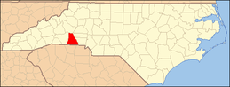 | |
| Towns | ||
| CDP | ||
| Unincorporated communities | ||
| Footnotes | ‡This populated place also has portions in an adjacent county or counties | |