Mont-Alexandre, Quebec
| Mont-Alexandre | |
|---|---|
| Unorganized territory | |
 Location within Le Rocher-Percé RCM. | |
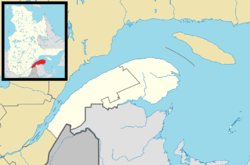 Mont-Alexandre Location in eastern Quebec. | |
| Coordinates: 48°37′N 65°09′W / 48.617°N 65.150°WCoordinates: 48°37′N 65°09′W / 48.617°N 65.150°W[1] | |
| Country |
|
| Province |
|
| Region | Gaspésie–Îles-de-la-Madeleine |
| RCM | Le Rocher-Percé |
| Constituted | January 1, 1986 |
| Government[2] | |
| • Federal riding | Gaspésie—Îles-de-la-Madeleine |
| • Prov. riding | Gaspé |
| Area[2][3] | |
| • Total | 1,791.80 km2 (691.82 sq mi) |
| • Land | 1,802.21 km2 (695.84 sq mi) |
|
There is an apparent contradiction between two authoritative sources | |
| Population (2011)[3] | |
| • Total | 0 |
| • Density | 0.0/km2 (0/sq mi) |
| • Pop 2006-2011 |
|
| • Dwellings | 0 |
| Time zone | EST (UTC-5) |
| • Summer (DST) | EDT (UTC-4) |
| Highways | No major routes |
Mont-Alexandre is an unorganized territory in the Gaspésie–Îles-de-la-Madeleine region of Quebec, Canada.
The eponymous Mount Alexandre is located in the territory 70 kilometres (43 mi) west of Percé. This 760 metres (2,490 ft) peak was named after an Indian trapper, Alexander, who visited the area in the first half of the 19th century.[4]
Demographics
Population
| Historical Census Data - Mont-Alexandre, Quebec[5] | ||||||||||||||||||||||||
|---|---|---|---|---|---|---|---|---|---|---|---|---|---|---|---|---|---|---|---|---|---|---|---|---|
|
|
|
|
| ||||||||||||||||||||
See also
References
- ↑ Reference number 149670 of the Commission de toponymie du Québec (French)
- 1 2 "Mont-Alexandre". Répertoire des municipalités (in French). Ministère des Affaires municipales, des Régions et de l'Occupation du territoire. Retrieved 2011-12-05.
- 1 2 "Mont-Alexandre census profile". 2011 Census data. Statistics Canada. Retrieved 2011-12-05.
- ↑ "Mont Alexandre" (in French). Commission de toponymie du Québec. Retrieved 2011-12-09.
- ↑ Statistics Canada: 1996, 2001, 2006, 2011 census
 |
Rivière-Saint-Jean | Gaspé | | |
| Rivière-Bonaventure | |
Percé | ||
| ||||
| | ||||
| Chandler | Grande-Rivière |
| Cities | |
|---|---|
| Municipalities | |
| Unorganized Territory | |
| |
This article is issued from Wikipedia - version of the 4/11/2014. The text is available under the Creative Commons Attribution/Share Alike but additional terms may apply for the media files.