Minong, Wisconsin
| Minong, Wisconsin | |
|---|---|
| Village | |
 Location of Minong, Wisconsin | |
| Coordinates: 46°6′59″N 91°55′5″W / 46.11639°N 91.91806°WCoordinates: 46°6′59″N 91°55′5″W / 46.11639°N 91.91806°W | |
| Country | United States |
| State | Wisconsin |
| County | Washburn |
| Area[1] | |
| • Total | 1.50 sq mi (3.88 km2) |
| • Land | 1.49 sq mi (3.86 km2) |
| • Water | 0.01 sq mi (0.03 km2) |
| Elevation[2] | 1,056 ft (322 m) |
| Population (2010)[3] | |
| • Total | 527 |
| • Estimate (2012[4]) | 521 |
| • Density | 353.7/sq mi (136.6/km2) |
| Time zone | Central (CST) (UTC-6) |
| • Summer (DST) | CDT (UTC-5) |
| Area code(s) | 715 & 534 |
| FIPS code | 55-53275[5] |
| GNIS feature ID | 1583729[2] |
Minong is a village in Washburn County, Wisconsin, United States. The population was 527 at the 2010 census. The village is located within the Town of Minong.
History
Minong is a name derived from the Ojibwe language, perhaps meaning "good place" or "blueberry place".[6] A post office called Minong has been in operation since 1887.[7] The village was laid out in 1888.[8]
Transportation
U.S. Highway 53 and Wisconsin Highway 77 are two of the main routes in the community.
Geography
Minong is located at 46°5′58″N 91°49′33″W / 46.09944°N 91.82583°W (46.099562, -91.825902).[9]
According to the United States Census Bureau, the village has a total area of 1.50 square miles (3.88 km2), of which, 1.49 square miles (3.86 km2) of it is land and 0.01 square miles (0.03 km2) is water.[1]
Demographics
| Historical population | |||
|---|---|---|---|
| Census | Pop. | %± | |
| 1920 | 230 | — | |
| 1930 | 292 | 27.0% | |
| 1940 | 308 | 5.5% | |
| 1950 | 357 | 15.9% | |
| 1960 | 348 | −2.5% | |
| 1970 | 420 | 20.7% | |
| 1980 | 557 | 32.6% | |
| 1990 | 521 | −6.5% | |
| 2000 | 531 | 1.9% | |
| 2010 | 527 | −0.8% | |
| Est. 2015 | 505 | [10] | −4.2% |
2010 census
As of the census[3] of 2010, there were 527 people, 238 households, and 129 families residing in the village. The population density was 353.7 inhabitants per square mile (136.6/km2). There were 277 housing units at an average density of 185.9 per square mile (71.8/km2). The racial makeup of the village was 93.0% White, 0.4% African American, 0.4% Native American, 0.2% Asian, 4.6% from other races, and 1.5% from two or more races. Hispanic or Latino of any race were 6.1% of the population.
There were 238 households of which 30.3% had children under the age of 18 living with them, 37.4% were married couples living together, 10.1% had a female householder with no husband present, 6.7% had a male householder with no wife present, and 45.8% were non-families. 37.8% of all households were made up of individuals and 21.8% had someone living alone who was 65 years of age or older. The average household size was 2.21 and the average family size was 2.96.
The median age in the village was 41.3 years. 25.2% of residents were under the age of 18; 6.2% were between the ages of 18 and 24; 24.4% were from 25 to 44; 22.5% were from 45 to 64; and 21.8% were 65 years of age or older. The gender makeup of the village was 52.0% male and 48.0% female.
2000 census
As of the census[5] of 2000, there were 531 people, 230 households, and 137 families residing in the village. The population density was 349.6 people per square mile (134.9/km²). There were 247 housing units at an average density of 162.6 per square mile (62.7/km²). The racial makeup of the village was 97.18% White, 1.32% Native American, 0.38% Asian, and 1.13% from two or more races. 0.75% of the population were Hispanic or Latino of any race.
There were 230 households out of which 29.1% had children under the age of 18 living with them, 44.8% were married couples living together, 8.3% had a female householder with no husband present, and 40.4% were non-families. 36.5% of all households were made up of individuals and 19.6% had someone living alone who was 65 years of age or older. The average household size was 2.31 and the average family size was 3.04.
In the village the population was spread out with 26.2% under the age of 18, 7.3% from 18 to 24, 26.2% from 25 to 44, 21.7% from 45 to 64, and 18.6% who were 65 years of age or older. The median age was 38 years. For every 100 females there were 95.9 males. For every 100 females age 18 and over, there were 92.2 males.
The median income for a household in the village was $25,341, and the median income for a family was $35,341. Males had a median income of $27,411 versus $14,844 for females. The per capita income for the village was $13,306. About 15.2% of families and 23.2% of the population were below the poverty line, including 38.2% of those under age 18 and 11.2% of those age 65 or over.
References
- 1 2 "US Gazetteer files 2010". United States Census Bureau. Retrieved 2012-11-18.
- 1 2 "US Board on Geographic Names". United States Geological Survey. 2007-10-25. Retrieved 2008-01-31.
- 1 2 "American FactFinder". United States Census Bureau. Retrieved 2012-11-18.
- ↑ "Population Estimates". United States Census Bureau. Retrieved 2013-06-24.
- 1 2 "American FactFinder". United States Census Bureau. Retrieved 2008-01-31.
- ↑ Vogel, Virgil J. (1991). Indian Names on Wisconsin's Map. Univ of Wisconsin Press. p. 135. ISBN 978-0-299-12984-2.
- ↑ "Washburn County". Jim Forte Postal History. Retrieved 4 April 2015.
- ↑ Chicago and North Western Railway Company (1908). A History of the Origin of the Place Names Connected with the Chicago & North Western and Chicago, St. Paul, Minneapolis & Omaha Railways. p. 184.
- ↑ "US Gazetteer files: 2010, 2000, and 1990". United States Census Bureau. 2011-02-12. Retrieved 2011-04-23.
- ↑ "Annual Estimates of the Resident Population for Incorporated Places: April 1, 2010 to July 1, 2015". Retrieved July 2, 2016.
- ↑ "Census of Population and Housing". Census.gov. Retrieved June 4, 2015.
External links
- Village of Minong, Wisconsin
- Josiah Bond's Memoir of the Settlement of Minong
- Emma M. Smith's Memories of My Childhood in the Old Days at Minong, Wisconsin
Municipalities and communities of Washburn County, Wisconsin, United States | ||
|---|---|---|
| Cities | 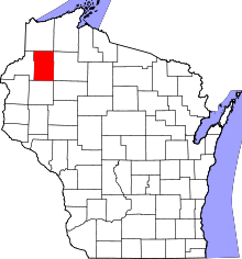 | |
| Villages | ||
| Towns | ||
| CDPs | ||
| Unincorporated communities | ||
| Ghost town | ||
| Indian reservation | ||
| Footnotes | ‡This populated place also has portions in an adjacent county or counties | |