Ministry of Lands, Housing and Urban Development (Uganda)
|
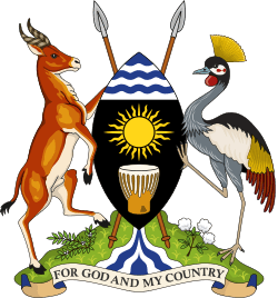
Coat of Arms of Uganda | |
| Ministry overview | |
|---|---|
| Type | Ministry |
| Jurisdiction | Government of Uganda |
| Headquarters |
13-15 Parliament Avenue Kampala, Uganda |
| Ministry executive |
|
| Website |
mlhud |
The Ministry of Lands, Housing and Urban Development (MLHUD), is a cabinet-level government ministry of Uganda. It is responsible for "policy direction, national standards and coordination of all matters concerning lands, housing and urban development".[1] The ministry is headed by a cabinet minister, currently Betty Amongi.[2]
Location
The headquarters of the ministry are located at 13-15 Parliament Avenue, in the Central Division of Kampala, Uganda's capital and largest city.[3] The coordinates of the ministry headquarters are 0°18'51.0"N, 32°35'16.0"E (Latitude:0.314167; Longitude:32.587778).[4]
Subministries
The ministry is divided into three sub-ministries, each headed by a Minister of State.[1] (1) The Minister of State for Lands is Persis Namuganza (2) The Minister of State for Housing is Chris Baryomunsi and (3) The Minister of State for Urban development is Isaac Musumba.
Organisational structure
Administratively, the ministry is divided into the following directorates and departments:[1] (A) Directorate of Land Management (1) Department of Survey and Mapping (2) Department of Land Registration (3) Department of Land Administration (B) Directorate of Physical Planning and Urban Development (1) Department of Physical Planning (2) Department of Urban Development (3) Department of Land Use Regulation and Compliance (C) Directory of Housing (1) Department of Human Settlement (2) Department of Housing Development and Estates Management and (3) Department of Planning and Quality Assurance.
Tasks
Beginning in February 2010, the Government of Uganda, in partnership with Thomson Reuters, with funding from the World Bank, began the implementation if the Land information System (LIS). The system involves the digitization of Uganda's Land registry, beginning with key geographical and administrative areas and then rolling the program out to include the entire country. This has improved the country's rank in the ease of doing business and has shortened turn-around times in processes like obtaining a mortgage, selling and buying land and carrying out of land surveys.[5]
See also
References
- 1 2 3 MLHUD (9 October 2016). "Ministry of Lands, Housing and Urban Development (Uganda): About Us". Kampala: Uganda Ministry of Lands, Housing and Urban Development (MLHUD). Retrieved 9 October 2016.
- ↑ Kwesiga, Paschal (22 June 2016). "Mailo land tenure unfair, says lands minister". New Vision. Kampala. Retrieved 9 October 2016.
- ↑ MLHUD (9 October 2016). "Ministry of Lands, Housing and Urban Development (Uganda): Contact Us". Kampala: Uganda Ministry of Lands, Housing and Urban Development (MLHUD). Retrieved 9 October 2016.
- ↑ Google (9 October 2016). "Location of the Headquarters of Ministry of Lands, Housing and Urban Development (Uganda)" (Map). Google Maps. Google. Retrieved 9 October 2016.
- ↑ Gasant Jacobs (25 March 2014). "Uganda Promotes A New Land Information System". Thomson Reuters. Retrieved 8 November 2016.
External links
Coordinates: 00°18′51″N 32°35′16″E / 0.31417°N 32.58778°E
