Milltown, Wisconsin
| Milltown, Wisconsin | |
|---|---|
| Village | |
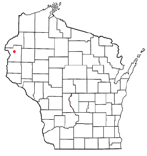 Location of Milltown, Wisconsin | |
| Coordinates: 45°29′35″N 92°27′48″W / 45.49306°N 92.46333°WCoordinates: 45°29′35″N 92°27′48″W / 45.49306°N 92.46333°W | |
| Country | United States |
| State | Wisconsin |
| County | Polk |
| Area[1] | |
| • Total | 1.78 sq mi (4.61 km2) |
| • Land | 1.75 sq mi (4.53 km2) |
| • Water | 0.03 sq mi (0.08 km2) |
| Elevation[2] | 1,198 ft (365 m) |
| Population (2010)[3] | |
| • Total | 917 |
| • Estimate (2012[4]) | 898 |
| • Density | 524.0/sq mi (202.3/km2) |
| Time zone | Central (CST) (UTC-6) |
| • Summer (DST) | CDT (UTC-5) |
| Area code(s) | 715 & 534 |
| FIPS code | 55-52100[5] |
| GNIS feature ID | 1583719[2] |
Milltown is a village in Polk County, Wisconsin, United States. The population was 917 at the 2010 census. The village is located within the Town of Milltown.
Geography
Milltown is located at 45°31′39″N 92°30′19″W / 45.52750°N 92.50528°W (45.527684, -92.505386).[6]
According to the United States Census Bureau, the village has a total area of 1.78 square miles (4.61 km2), of which, 1.75 square miles (4.53 km2) of it is land and 0.03 square miles (0.08 km2) is water.[1]
Demographics
| Historical population | |||
|---|---|---|---|
| Census | Pop. | %± | |
| 1910 | 250 | — | |
| 1920 | 440 | 76.0% | |
| 1930 | 450 | 2.3% | |
| 1940 | 469 | 4.2% | |
| 1950 | 580 | 23.7% | |
| 1960 | 608 | 4.8% | |
| 1970 | 634 | 4.3% | |
| 1980 | 732 | 15.5% | |
| 1990 | 786 | 7.4% | |
| 2000 | 888 | 13.0% | |
| 2010 | 917 | 3.3% | |
| Est. 2015 | 883 | [7] | −3.7% |
2010 census
As of the census[3] of 2010, there were 917 people, 416 households, and 237 families residing in the village. The population density was 524.0 inhabitants per square mile (202.3/km2). There were 473 housing units at an average density of 270.3 per square mile (104.4/km2). The racial makeup of the village was 97.4% White, 0.3% African American, 0.9% Native American, 0.5% from other races, and 0.9% from two or more races. Hispanic or Latino of any race were 1.2% of the population.
There were 416 households of which 31.0% had children under the age of 18 living with them, 36.3% were married couples living together, 13.0% had a female householder with no husband present, 7.7% had a male householder with no wife present, and 43.0% were non-families. 36.3% of all households were made up of individuals and 15.4% had someone living alone who was 65 years of age or older. The average household size was 2.19 and the average family size was 2.79.
The median age in the village was 39.6 years. 24.4% of residents were under the age of 18; 6.5% were between the ages of 18 and 24; 25.6% were from 25 to 44; 27.5% were from 45 to 64; and 16% were 65 years of age or older. The gender makeup of the village was 50.1% male and 49.9% female.
2000 census
As of the census[5] of 2000, there were 888 people, 420 households, and 235 families residing in the village. The population density was 501.8 people per square mile (193.7/km²). There were 437 housing units at an average density of 246.9 per square mile (95.3/km²). The racial makeup of the village was 97.18% White, 1.13% Native American, 0.68% from other races, and 1.01% from two or more races. 0.79% of the population were Hispanic or Latino of any race.
There were 420 households out of which 25.0% had children under the age of 18 living with them, 38.6% were married couples living together, 12.1% had a female householder with no husband present, and 44.0% were non-families. 38.6% of all households were made up of individuals and 21.0% had someone living alone who was 65 years of age or older. The average household size was 2.11 and the average family size was 2.76.
In the village the population was spread out with 22.5% under the age of 18, 7.5% from 18 to 24, 27.3% from 25 to 44, 19.1% from 45 to 64, and 23.5% who were 65 years of age or older. The median age was 40 years. For every 100 females there were 85.0 males. For every 100 females age 18 and over, there were 85.9 males.
The median income for a household in the village was $28,309, and the median income for a family was $36,875. Males had a median income of $30,446 versus $22,031 for females. The per capita income for the village was $17,284. About 5.2% of families and 11.5% of the population were below the poverty line, including 7.6% of those under age 18 and 15.3% of those age 65 or over.
Education
Notable people
- George A. Nelson, Wisconsin State Assemblyman and farmer, born in Milltown.[9]
- Howard I. Nelson, Minnesota state legislator and businessman, born in Milltown.[10]
- Raymond A. Peabody, Wisconsin State Assemblyman and businessman, lived in Milltown; Peabody was a trustee and village president of Milltown.[11]
References
- 1 2 "US Gazetteer files 2010". United States Census Bureau. Retrieved 2012-11-18.
- 1 2 "US Board on Geographic Names". United States Geological Survey. 2007-10-25. Retrieved 2008-01-31.
- 1 2 "American FactFinder". United States Census Bureau. Retrieved 2012-11-18.
- ↑ "Population Estimates". United States Census Bureau. Retrieved 2013-06-24.
- 1 2 "American FactFinder". United States Census Bureau. Retrieved 2008-01-31.
- ↑ "US Gazetteer files: 2010, 2000, and 1990". United States Census Bureau. 2011-02-12. Retrieved 2011-04-23.
- ↑ "Annual Estimates of the Resident Population for Incorporated Places: April 1, 2010 to July 1, 2015". Retrieved July 2, 2016.
- ↑ "Census of Population and Housing". Census.gov. Retrieved June 4, 2015.
- ↑ 'Wisconsin Blue Book 1925,' Biographical Sketch of George A. Nelson, pg. 676
- ↑ Minnesota Legislators Past and Present-Howard I. Nelson
- ↑ 'Wisconsin Blue Book 1956,' Biographical Sketch of Raymond A. Peabody, pg. 37
External links
Municipalities and communities of Polk County, Wisconsin, United States | ||
|---|---|---|
| Cities | 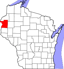 | |
| Villages | ||
| Towns | ||
| CDP | ||
| Unincorporated communities | ||
| Indian reservations | ||
| Footnotes | ‡This populated place also has portions in an adjacent county or counties | |