Amery, Wisconsin
| Amery, Wisconsin | |
|---|---|
| City | |
|
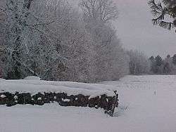
near Amery on a winter morning | |
 Location of Amery, Wisconsin | |
| Coordinates: 45°18′35″N 92°21′46″W / 45.30972°N 92.36278°WCoordinates: 45°18′35″N 92°21′46″W / 45.30972°N 92.36278°W | |
| Country | United States |
| State | Wisconsin |
| County | Polk |
| Area[1] | |
| • Total | 3.61 sq mi (9.35 km2) |
| • Land | 2.96 sq mi (7.67 km2) |
| • Water | 0.65 sq mi (1.68 km2) |
| Elevation[2] | 1,070 ft (326 m) |
| Population (2010)[3] | |
| • Total | 2,902 |
| • Estimate (2012[4]) | 2,875 |
| • Density | 980.4/sq mi (378.5/km2) |
| Time zone | Central (CST) (UTC-6) |
| • Summer (DST) | CDT (UTC-5) |
| Area code(s) | 715 & 534 |
| FIPS code | 55-01725[5] |
| GNIS feature ID | 1560828[2] |
| Website | http://www.amerywisconsin.org |
Amery is a city in Polk County, Wisconsin, United States, along the Apple River. The population was 2,902 at the 2010 census.
Geography
Amery is located at 45°18′35″N 92°21′46″W / 45.30972°N 92.36278°W (45.309747, -92.362782).[6]
According to the United States Census Bureau, the city has a total area of 3.61 square miles (9.35 km2), of which, 2.96 square miles (7.67 km2) is land and 0.65 square miles (1.68 km2) is water.[1]
Demographics
| Historical population | |||
|---|---|---|---|
| Census | Pop. | %± | |
| 1890 | 451 | — | |
| 1900 | 905 | 100.7% | |
| 1910 | 659 | −27.2% | |
| 1920 | 1,203 | 82.5% | |
| 1930 | 1,354 | 12.6% | |
| 1940 | 1,461 | 7.9% | |
| 1950 | 1,625 | 11.2% | |
| 1960 | 1,769 | 8.9% | |
| 1970 | 2,126 | 20.2% | |
| 1980 | 2,404 | 13.1% | |
| 1990 | 2,657 | 10.5% | |
| 2000 | 2,845 | 7.1% | |
| 2010 | 2,902 | 2.0% | |
| Est. 2015 | 2,834 | [7] | −2.3% |
2010 census
As of the census[3] of 2010, there were 2,902 people, 1,286 households, and 705 families residing in the city. The population density was 980.4 inhabitants per square mile (378.5/km2). There were 1,445 housing units at an average density of 488.2 per square mile (188.5/km2). The racial makeup of the city was 97.3% White, 0.1% African American, 0.8% Native American, 0.3% Asian, 0.1% Pacific Islander, 0.4% from other races, and 0.9% from two or more races. Hispanic or Latino of any race were 2.2% of the population.
There were 1,286 households of which 26.4% had children under the age of 18 living with them, 39.4% were married couples living together, 10.5% had a female householder with no husband present, 4.9% had a male householder with no wife present, and 45.2% were non-families. 41.1% of all households were made up of individuals and 25.2% had someone living alone who was 65 years of age or older. The average household size was 2.14 and the average family size was 2.89.
The median age in the city was 45.1 years. 22.9% of residents were under the age of 18; 5.7% were between the ages of 18 and 24; 21.3% were from 25 to 44; 22.6% were from 45 to 64; and 27.6% were 65 years of age or older. The gender makeup of the city was 44.6% male and 55.4% female.
2000 census
As of the census[5] of 2000, there were 2,845 people, 1,231 households, and 725 families residing in the city. The population density was 947.2 people per square mile (366.2/km²). There were 1,311 housing units at an average density of 436.5 per square mile (168.7/km²). The racial makeup of the city was 97.96% White, 0.07% African American, 0.70% Native American, 0.25% Asian, 0.18% Pacific Islander, 0.32% from other races, and 0.53% from two or more races. Hispanic or Latino of any race were 0.95% of the population.
There were 1,231 households out of which 25.7% had children under the age of 18 living with them, 47.0% were married couples living together, 9.0% had a female householder with no husband present, and 41.1% were non-families. 36.6% of all households were made up of individuals and 21.1% had someone living alone who was 65 years of age or older. The average household size was 2.17 and the average family size was 2.83.
In the city the population was spread out with 22.1% under the age of 18, 6.7% from 18 to 24, 21.6% from 25 to 44, 21.9% from 45 to 64, and 27.6% who were 65 years of age or older. The median age was 45 years. For every 100 females there were 77.4 males. For every 100 females age 18 and over, there were 72.5 males.
The median income for a household in the city was $30,710, and the median income for a family was $40,568. Males had a median income of $31,636 versus $20,795 for females. The per capita income for the city was $17,125. About 4.0% of families and 8.5% of the population were below the poverty line, including 10.6% of those under age 18 and 10.1% of those age 65 or over.
Notable people
- Jerry M. Anderson, educator
- Ed Barney, MLB player
- Dougald D. Kennedy, Wisconsin State Assemblyman
- Annie Lobert, anti-human trafficking activist and missionary to the sex industry
- Ethan B. Minier, Wisconsin State Assemblyman and lawyer
- William Nordeen, United States diplomat
- Harvey Stower, Wisconsin State Assemblyman and former Mayor of Amery
Education
Amery is served by the Amery School District.
Transportation
The Amery Municipal Airport (KAHH) is located near Amery.
In popular culture
The film Clear Lake, WI starring Michael Madsen was partially filmed in Amery.
References
- 1 2 "US Gazetteer files 2010". United States Census Bureau. Archived from the original on 2012-01-24. Retrieved 2012-11-18.
- 1 2 "US Board on Geographic Names". United States Geological Survey. 2007-10-25. Retrieved 2008-01-31.
- 1 2 "American FactFinder". United States Census Bureau. Retrieved 2012-11-18.
- ↑ "Population Estimates". United States Census Bureau. Archived from the original on 2013-06-17. Retrieved 2013-06-24.
- 1 2 "American FactFinder". United States Census Bureau. Archived from the original on 2013-09-11. Retrieved 2008-01-31.
- ↑ "US Gazetteer files: 2010, 2000, and 1990". United States Census Bureau. 2011-02-12. Retrieved 2011-04-23.
- ↑ "Annual Estimates of the Resident Population for Incorporated Places: April 1, 2010 to July 1, 2015". Retrieved July 2, 2016.
- ↑ "Census of Population and Housing". Census.gov. Archived from the original on May 11, 2015. Retrieved June 4, 2015.
External links
- Amery, Wisconsin website
- Amery School District
- Amery Centennial Hall
- Amery On The Map. 3D Buildings in Google Earth
- Sanborn fire insurance map: 1911
Municipalities and communities of Polk County, Wisconsin, United States | ||
|---|---|---|
| Cities |  | |
| Villages | ||
| Towns | ||
| CDP | ||
| Unincorporated communities | ||
| Indian reservations | ||
| Footnotes | ‡This populated place also has portions in an adjacent county or counties | |