Mexico, Kentucky
Coordinates: 37°13′30″N 88°05′48″W / 37.22500°N 88.09667°W Mexico is an unincorporated community, in Crittenden County, Kentucky. It lies at an elevation of 495 feet (151 m).
References
Municipalities and communities of Crittenden County, Kentucky, United States | ||
|---|---|---|
| Cities | 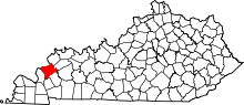 | |
| CDPs | ||
| Other unincorporated communities | ||
This article is issued from Wikipedia - version of the 9/29/2014. The text is available under the Creative Commons Attribution/Share Alike but additional terms may apply for the media files.