Metarfa
| Metarfa المطارفة | |
|---|---|
| Town and commune | |
_location_map.svg.png) Location of Metarfa commune within Adrar Province | |
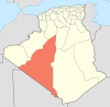
 Metarfa Location of Metarfa in Algeria | |
| Coordinates: 28°35′21″N 0°8′59″W / 28.58917°N 0.14972°WCoordinates: 28°35′21″N 0°8′59″W / 28.58917°N 0.14972°W | |
| Country | Algeria |
| Province | Adrar |
| District | Aougrout |
| Elevation | 258 m (846 ft) |
| Population (2008)[1] | |
| • Total | 8,438 |
| Time zone | CET (UTC+1) |
Metarfa (Arabic: المطارفة) is a town and commune in Aougrout District, Adrar Province, in south-central Algeria. According to the 2008 census it has a population of 8,438,[1] up from 7,061 in 1998,[2] with an annual growth rate of 1.8%.[1]
Geography
The villages in Metarfa commune are built near various scattered oases in the southern part of the Gourara region of northern Adrar Province, about halfway between Timimoun and Adrar. The surrounding areas generally consist of rocky plains interspersed with low sand dunes.
Climate
Metarfa has a hot desert climate (Köppen climate classification BWh), with extremely hot summers and mild winters, and very little precipitation throughout the year.
| Climate data for Metarfa | |||||||||||||
|---|---|---|---|---|---|---|---|---|---|---|---|---|---|
| Month | Jan | Feb | Mar | Apr | May | Jun | Jul | Aug | Sep | Oct | Nov | Dec | Year |
| Average high °C (°F) | 20.0 (68) |
22.7 (72.9) |
27.4 (81.3) |
32.6 (90.7) |
36.5 (97.7) |
42.8 (109) |
45.8 (114.4) |
44.3 (111.7) |
40.2 (104.4) |
33.0 (91.4) |
25.2 (77.4) |
18.1 (64.6) |
32.38 (90.29) |
| Daily mean °C (°F) | 12.2 (54) |
14.8 (58.6) |
19.1 (66.4) |
24.2 (75.6) |
28.1 (82.6) |
34.1 (93.4) |
37.0 (98.6) |
35.8 (96.4) |
32.2 (90) |
25.4 (77.7) |
18.1 (64.6) |
12.0 (53.6) |
24.42 (75.96) |
| Average low °C (°F) | 4.4 (39.9) |
7.0 (44.6) |
10.9 (51.6) |
15.9 (60.6) |
19.8 (67.6) |
25.4 (77.7) |
28.2 (82.8) |
27.3 (81.1) |
24.2 (75.6) |
17.8 (64) |
11.1 (52) |
6.0 (42.8) |
16.5 (61.69) |
| Average precipitation mm (inches) | 1 (0.04) |
2 (0.08) |
3 (0.12) |
1 (0.04) |
1 (0.04) |
0 (0) |
0 (0) |
1 (0.04) |
1 (0.04) |
2 (0.08) |
2 (0.08) |
2 (0.08) |
16 (0.64) |
| Source: climate-data.org[3] | |||||||||||||
Transportation
Roads lead out of Metarfa town to the southwest and northeast. The road to the southeast connects to the N6 highway, while the road to the northeast branches; the branch to the northwest leads to the villages of Ouled Rached and Ouled Ali while the branch to the southeast leads to Ouled Mahmoud and Oufrane, and eventually to Aougrout.
Education
2.8% of the population has a tertiary education, and another 10.5% has completed secondary education.[4] The overall literacy rate is 73.8%, and is 85.8% among males and 61.2% among females.[5]
Localities
As of 1984, the commune was composed of 11 localities:[6]
- Ouled Mahmoud
- Saala
- Metarfa
- Ouled Rached
- Ouled Ali
- Oufrane
References
- 1 2 3 "Population: Wilaya d'Adrar" (PDF) (in French). Office National des Statistiques Algérie. Retrieved 1 July 2013.
- ↑ "Algeria Communes". Statoids. Retrieved 8 March 2013.
- ↑ "Climate data for: Metarfa". climate-data.org. Retrieved 12 July 2013.
- ↑ "Structure relative de la population résidente des ménages ordinaires et collectifs âgée de 6 ans et plus selon le niveau d'instruction et la commune de résidence." (PDF) (in French). Office National des Statistiques Algérie. Retrieved 1 July 2013.
- ↑ "Taux d'analphabétisme et taux d'alphabétisation de la population âgée de 15 ans et plus, selon le sexe et la commune de résidence ." (PDF) (in French). Office National des Statistiques Algérie. Retrieved 1 July 2013.
- ↑ "Décret n° 84-365, fixant la composition, la consistance et les limites territoriale des communes. Wilaya d'Adrar" (PDF) (in French). Journal officiel de la République Algérienne,. 19 December 1984. p. 1473. Archived from the original (PDF) on 2 March 2013 or before. Retrieved 1 July 2013. Check date values in:
|archive-date=(help)
 |
Béchar Ksabi (Béchar) |
El Bayadh Charouine Saala |
Ghardaïa Deldoul Ouled Ali |
|
| Tindouf Bou Bernous (Tindouf) |
|
Aougrout Ouled Mahmoud | ||
| ||||
| | ||||
| Ariane er Râs Tsabit |
Sebaa Adrar |
Kabertene Timokten Tamanrasset |