Reggane
| Reggane رقان | |
|---|---|
| Commune and town | |
.jpg) | |
_location_map.svg.png) Location of Reggane Commune within Adrar Province | |
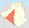
 Reggane Location of Reggane within Algeria | |
| Coordinates: 26°43′13″N 0°10′22″E / 26.72028°N 0.17278°ECoordinates: 26°43′13″N 0°10′22″E / 26.72028°N 0.17278°E | |
| Country |
|
| Province | Adrar Province |
| District | Reggane District |
| Elevation | 217 m (712 ft) |
| Population (2008) | |
| • Total | 20,402 |
| Time zone | CET (UTC+1) |
Reggane (from Berber "Argan"; Arabic: رقان) is a town and commune, and the capital of Reggane District, in Adrar Province, central Algeria. Reggane lies in the Sahara Desert near an oasis. According to the 2008 census it has a population of 20,402,[1] up from 14,179 in 1998,[2] with an annual growth rate of 3.8%.[1] Berber tribes and people live in and around Reggane.
History
To the east of Reggane there was until 1965 a rocket launching site where numerous civilian and military ballistic rockets were launched. France began its nuclear testing program in the vicinity of Reggane, conducting four such tests during the Algerian War in 1960 and 1961, before independence.[3]
Geography
The town of Reggane and its neighbouring villages lie next to the southernmost oasis of the Tuat region, which stretches northward to Adrar. The Tidikelt region, a plain with isolated oases, lies to the east, including towns such as In Salah, In Ghar, Aoulef and Tit. To the west is the sandy Erg Chech desert, while to the south lies the vast barren plain of the Tanezrouft.
Climate
Reggane has a hot desert climate (Köppen climate classification BWh), with long, extremely hot summers and short, very warm winters. The climate is torrid and almost rainless. Daytime temperatures are known to consistently approach 50 °C (122 °F) in summer and nighttime temperatures routinely remain above 30 °C (86 °F). Average annual rainfall is extremely low, with only 10 mm (0.39 in). The sky is always clear throughout the year and the sunshine reigns supreme. The area in the heart of the Algerian Desert bounded by Adrar - Reggane - In Salah is nicknamed the "triangle of fire" by local inhabitants due to the extreme heat that bakes the region from May to September.[4] Reggane is obviously among the hottest spots worldwide.
| Climate data for Reggane | |||||||||||||
|---|---|---|---|---|---|---|---|---|---|---|---|---|---|
| Month | Jan | Feb | Mar | Apr | May | Jun | Jul | Aug | Sep | Oct | Nov | Dec | Year |
| Average high °C (°F) | 22.6 (72.7) |
25.2 (77.4) |
31.9 (89.4) |
36.4 (97.5) |
40.2 (104.4) |
44.1 (111.4) |
46.9 (116.4) |
45.5 (113.9) |
42.3 (108.1) |
35.8 (96.4) |
28.7 (83.7) |
24.9 (76.8) |
35.59 (96.06) |
| Daily mean °C (°F) | 16.0 (60.8) |
18.2 (64.8) |
23.1 (73.6) |
27.9 (82.2) |
32.2 (90) |
36.4 (97.5) |
39.8 (103.6) |
38.4 (101.1) |
35.5 (95.9) |
29.2 (84.6) |
22.0 (71.6) |
17.8 (64) |
28.34 (83.01) |
| Average low °C (°F) | 9.4 (48.9) |
11.3 (52.3) |
15.9 (60.6) |
20.6 (69.1) |
24.8 (76.6) |
29.0 (84.2) |
32.8 (91) |
31.6 (88.9) |
28.7 (83.7) |
22.5 (72.5) |
15.3 (59.5) |
11.2 (52.2) |
21.1 (70) |
| Average precipitation mm (inches) | 1.4 (0.055) |
1.1 (0.043) |
1.2 (0.047) |
1.6 (0.063) |
0.5 (0.02) |
0.1 (0.004) |
0.0 (0) |
0.5 (0.02) |
0.2 (0.008) |
1.2 (0.047) |
0.5 (0.02) |
1.8 (0.071) |
10.1 (0.398) |
| Source: Global climatology for Reggane, Algeria (2000 - 2015)[5] | |||||||||||||
Transportation
Reggane is the last town on the Tanezrouft track heading south across the Sahara Desert to Mali. Customs and police inspection here are mandatory before crossing the Sahara Desert. The Tanezrouft track is the southern part of Algeria's N6 national highway, which connects to Adrar to the north and Bordj Badji Mokhtar to the south. Another highway, the N52, leads through the Tidikelt region to Aoulef and eventually In Salah.
The town is served by Reggane Airport,[6] located about 10 kilometres (6.2 mi) east of the town.
Education
6.0% of the population has a tertiary education, and another 15.6% has completed secondary education.[7] The overall literacy rate is 75.9%, and is 85.0% among males and 66.3% among females.[8]
Localities
As of 1984, the commune was composed of 11 localities:[9]
- Bahou
- El Mestour
- Zaouit Lahchef
- Anzeglouf
- Aït Massaoud
- En Nefis
- Timadanine
- Taarabt
- Tinoufel Djedida
- Tinoufel Elgadima
- Zaouit Reggani
- Taourirt
- Berriche
See also
- Gerboise Bleue - France's first nuclear bomb, tested at Reggane
External links
References
- 1 2 "Population: Wilaya d'Adrar" (PDF) (in French). Office National des Statistiques Algérie. Retrieved 1 July 2013.
- ↑ "Algeria Communes". Statoids. Retrieved 8 March 2013.
- ↑ http://www.johnstonsarchive.net/nuclear/tests/FR-ntests1.html
- ↑ http://www.3emegroupedetransport.com/Regganesouffredechaleur.htm
- ↑ "Global climatology for Reggane, Algeria (2000 - 2015)". Retrieved 31 May 2013.
- ↑ "Reggane Airport". OurAirports. Retrieved 11 October 2013.
- ↑ "Structure relative de la population résidente des ménages ordinaires et collectifs âgée de 6 ans et plus selon le niveau d'instruction et la commune de résidence." (PDF) (in French). Office National des Statistiques Algérie. Retrieved 1 July 2013.
- ↑ "Taux d'analphabétisme et taux d'alphabétisation de la population âgée de 15 ans et plus, selon le sexe et la commune de résidence ." (PDF) (in French). Office National des Statistiques Algérie. Retrieved 1 July 2013.
- ↑ "Décret n° 84-365, fixant la composition, la consistance et les limites territoriale des communes. Wilaya d'Adrar" (PDF) (in French). Journal officiel de la République Algérienne,. 19 December 1984. p. 1472. Archived from the original (PDF) on 2 March 2013 or before. Retrieved 1 July 2013. Check date values in:
|archive-date=(help)
 |
Béchar Sali En Nefis |
Adrar | Ghardaïa El Goléa (Ghardaïa) |
|
| Tindouf Bou Bernous (Tindouf) |
|
Taourirt Aoulef | ||
| ||||
| | ||||
| Taoudenni (Mali) | Bordj Badji Mokhtar | Arak (Tamanrasset Tamanrasset |
| Active spaceports |
| ||||||||||||||||||
|---|---|---|---|---|---|---|---|---|---|---|---|---|---|---|---|---|---|---|---|
| Proposed | |||||||||||||||||||
| Historical | |||||||||||||||||||