Aoulef
| Aoulef وﻟﻒ | |
|---|---|
| Town and commune | |
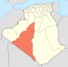
_location_map.svg.png) Location of Aoulef commune within Adrar Province | |
 Aoulef Location of Aoulef in Algeria | |
| Coordinates: 26°58′25″N 1°4′52″E / 26.97361°N 1.08111°ECoordinates: 26°58′25″N 1°4′52″E / 26.97361°N 1.08111°E | |
| Country | Algeria |
| Province | Adrar |
| District | Aoulef |
| Elevation | 288 m (945 ft) |
| Population (2008)[1] | |
| • Total | 21,723 |
| Time zone | CET (UTC+1) |
Aoulef (Arabic: أولف, Awlaf) is a town and commune and capital of Aoulef District, in Adrar Province, south-central Algeria. According to the 2008 census it has a population of 21,723,[1] up from 15,229 in 1998,[2] with an annual growth rate of 3.7%.[1]
Geography
The town of Aoulef lies at an elevation of 288 metres (945 ft) on the eastern side of an oasis. The oasis is a part of the Tidikelt region of the central Sahara that extends from central eastern Adrar Province (where Aoulef is located) to northeast Tamanrasset Province around In Salah. The oases in this region are sparser than in the Tuat and Gourara regions in which most of the population of Adrar Province live, but there are still a number of towns such as Timokten, Akabli, Tit and In Ghar. The nearby land is mostly flat aside from some small hills to the east; however further north the land rises to the Tademaït plateau.
Climate
Aoulef has a hot desert climate (Köppen climate classification BWh), with long, extremely hot summers and short, very warm winters. Daytime temperatures are known to consistently approach 50 °C (122 °F) in summer and nighttime temperatures routinely remain above 30 °C (86 °F). Average annual rainfall is extremely low, with only 10 mm (0.39 in). The sky is nearly always clear throughout the year and cloudy days are extremely rare. Aoulef is often quoted as one of the hottest spots worldwide.
| Climate data for Aoulef (Reggane Station) | |||||||||||||
|---|---|---|---|---|---|---|---|---|---|---|---|---|---|
| Month | Jan | Feb | Mar | Apr | May | Jun | Jul | Aug | Sep | Oct | Nov | Dec | Year |
| Average high °C (°F) | 22.0 (71.6) |
25.8 (78.4) |
29.2 (84.6) |
34.7 (94.5) |
39.7 (103.5) |
44.4 (111.9) |
46.8 (116.2) |
45.7 (114.3) |
42.2 (108) |
35.9 (96.6) |
27.5 (81.5) |
22.5 (72.5) |
34.7 (94.47) |
| Daily mean °C (°F) | 14.9 (58.8) |
18.1 (64.6) |
21.5 (70.7) |
26.7 (80.1) |
31.2 (88.2) |
36.3 (97.3) |
38.6 (101.5) |
37.8 (100) |
34.5 (94.1) |
28.4 (83.1) |
20.4 (68.7) |
15.7 (60.3) |
27.01 (80.62) |
| Average low °C (°F) | 7.8 (46) |
10.3 (50.5) |
13.8 (56.8) |
18.7 (65.7) |
22.6 (72.7) |
28.1 (82.6) |
30.4 (86.7) |
29.9 (85.8) |
26.7 (80.1) |
20.9 (69.6) |
13.3 (55.9) |
8.9 (48) |
19.28 (66.7) |
| Average precipitation mm (inches) | 1.4 (0.055) |
1.1 (0.043) |
1.2 (0.047) |
1.6 (0.063) |
0.5 (0.02) |
0.1 (0.004) |
0.0 (0) |
0.5 (0.02) |
0.2 (0.008) |
1.2 (0.047) |
0.5 (0.02) |
1.8 (0.071) |
10.1 (0.398) |
| Source #1: NOAA (1964-1990)[3] | |||||||||||||
| Source #2: climatebase.ru (humidity)[4] | |||||||||||||
Transportation
Aoulef lies on the N52 national highway, which connects it to Reggane and eventually Adrar to the west and In Salah to the east. A provincial road connects the town to Timokten, located just to the northwest of Aoulef.
Education
11.1% of the population has a tertiary education (the highest rate in the province), and another 22.4% has completed secondary education.[5] The overall literacy rate is 84.6% (second highest in the province), and is 90.9% among males (second highest in the province) and 77.1% among females.[6]
Localities
As of 1984, the commune was composed of eight localities:[7]
- Ouamanat
- Takaraft
- Djedid
- Gasbet Bellal
- Gasbet Maïkhaf
- Roukina
- Zaouit Heinoume
- Habbadat
References
- 1 2 3 "Population: Wilaya d'Adrar" (PDF) (in French). Office National des Statistiques Algérie. Retrieved 1 July 2013.
- ↑ "Algeria Communes". Statoids. Retrieved 8 March 2013.
- ↑ "Climate Normals for In Salah". Retrieved 31 May 2013.
- ↑ "In-Salah, Algeria". Climatebase.ru. Retrieved 31 May 2013.
- ↑ "Structure relative de la population résidente des ménages ordinaires et collectifs âgée de 6 ans et plus selon le niveau d'instruction et la commune de résidence." (PDF) (in French). Office National des Statistiques Algérie. Retrieved 1 July 2013.
- ↑ "Taux d'analphabétisme et taux d'alphabétisation de la population âgée de 15 ans et plus, selon le sexe et la commune de résidence ." (PDF) (in French). Office National des Statistiques Algérie. Retrieved 1 July 2013.
- ↑ "Décret n° 84-365, fixant la composition, la consistance et les limites territoriale des communes. Wilaya d'Adrar" (PDF) (in French). Journal officiel de la République Algérienne,. 19 December 1984. p. 1473. Archived from the original (PDF) on 2 March 2013 or before. Retrieved 1 July 2013. Check date values in:
|archive-date=(help)
 |
Adrar, Algeria Timokten |
El Bayadh Aougrout Zaouiet Moulay Heïba |
Ghardaïa El Goléa (Ghardaïa) |
|
| Reggane | |
Tit | ||
| ||||
| | ||||
| Taoudenni (Mali) | Bordj Badji Mokhtar | Akabli Tamanrasset |