Mermaid Waters, Queensland
| Mermaid Waters Gold Coast, Queensland | |||||||||||||
|---|---|---|---|---|---|---|---|---|---|---|---|---|---|
 Canal and homes, 2015 | |||||||||||||
 Mermaid Waters | |||||||||||||
| Coordinates | 28°2′52″S 153°25′18″E / 28.04778°S 153.42167°ECoordinates: 28°2′52″S 153°25′18″E / 28.04778°S 153.42167°E | ||||||||||||
| Population | 11,789 (2011 census)[1] | ||||||||||||
| Postcode(s) | 4218 | ||||||||||||
| LGA(s) | Gold Coast City | ||||||||||||
| State electorate(s) | Mermaid Beach | ||||||||||||
| Federal Division(s) | Moncrieff | ||||||||||||
| |||||||||||||
Mermaid Waters is a suburb on the Gold Coast in Queensland, Australia. At the 2011 Census, Mermaid Waters had a population of 11,789.[1]
The suburb derives it name from the Mermaid, a cutter ship that brought Australian surveyor John Oxley to the region in 1823.[2] Oxley named the area where he landed "Mermaid Beach". The adjacent area to the west eventually became known as "Mermaid Waters".
Facilities

Mermaid Waters is primarily a residential suburb, featuring many homes built along artificial canals and lakes, including the 17-hectare fresh water Lake Hugh Muntz.[3] Mermaid Waters is serviced by three public transport routes: Surfside Buslines routes 756 Broadbeach South - West Burleigh, 750 Broadbeach South - Robina Railway Station and 757 Broadbeach South - Burleigh Heads.
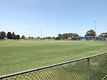
The nearest rail station is there a number of small local shopping centres in the suburb and is a medium-sized shopping centre in the western parts of the suburb called the Q Super Centre., with new retail and commercial developments being established in the adjacent area. Nearby Pacific Fair Shopping Centre in Broadbeach is the second largest shopping centre in the Gold Coast and currently undergoing $670 million development. Albert Waterways Community Hall is at the northern end of the suburb, adjacent to Broadbeach Branch Library. The City of Gold Coast has a branch in Mermaid Waters at this complex. The Miami State School Community Hall is located on the grounds of Miami State Primary School. Two schools are located in Mermaid Waters: Miami State Primary School and Merrimac State High School. Broadbeach Branch Library located next to Pacific Fair Shopping Centre and Albert Waterways Community Hall. Pizzey Park Sports Complex hosts a variety of sports and clubs in the southern Gold Coast. Adjacent to the complex is the Miami Olympic Swimming Pool.
References
- 1 2 Australian Bureau of Statistics (31 October 2012). "Mermaid Waters (State Suburb)". 2011 Census QuickStats. Retrieved 21 September 2014.
- ↑ "Gold Coast Heritage site". Retrieved 2007-04-17.
- ↑ Dunbar, Chantal (2004). Where to live in the Gold Coast. Surfers Paradise, Australia: Where to Live Guides. pp. 174–7.
External links
| Wikimedia Commons has media related to Mermaid Waters, Queensland. |
- University of Queensland: Queensland Places: Mermaid Waters
- Visit Translink for transportation information[1]
- ↑ Roads, TransLink Division, Department of Transport and Main. "translink.com.au". translink.com.au. Retrieved 2015-08-25.