Gilberton, Queensland (Gold Coast)
| Gilberton Gold Coast, Queensland, Queensland | |||||||||||||
|---|---|---|---|---|---|---|---|---|---|---|---|---|---|
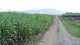 Private road through sugar cane fields, 2014 | |||||||||||||
| Postcode(s) | 4208 | ||||||||||||
| Location | 30 km (19 mi) north of Southport | ||||||||||||
| LGA(s) | City of Gold Coast | ||||||||||||
| State electorate(s) | Coomera | ||||||||||||
| Federal Division(s) | Fadden | ||||||||||||
| |||||||||||||
Gilberton is a rural locality in the northern part of City of Gold Coast, Queensland, Australia.[1]
Environmental issues
Gilberton has acid sulphate soil in naturally water-logged conditions. The lowering of the water table due to drainage work on the Pimpama River allows oxidisation of the iron sulfide to create sulphuric acid which can, in turn, enable the release of iron, aluminium and other heavy metals, doing damage to both the natural and built environment. Application of lime to neutralise low pH levels and the maintenance of broad shallow drains to reduce oxidisation are used to mitigate the problem.[2]
Gold Coast Intra Regional Transport Corridor
The proposed Gold Coast Intra Regional Transport Corridor will connect Gold Coast suburbs from Coomera to Carrara with a multi-modal urban arterial road by 2031. It is proposed to reserve a land corridor from Coomera to Stapylton for future extensions; on current plans, this land corridor will pass through Gilberton near the confluence of Sandy Creek and Halfway Creek.[3][4]
References
- ↑ "Gilberton (entry 46048)". Queensland Place Names. Queensland Government. Retrieved 4 April 2014.
- ↑ Pearson, Leonie; Geoff McDonald; Sarah Park; Ben Harman; Sonja Heyenga; Heidi Horan (July 2007). "Future Use of the Rocky Point Cane Landscapes, Gold Coast" (PDF). CSIRO. Retrieved 7 April 2014.
- ↑ "Gold Coast City Transport Strategy 2031" (PDF). City of Gold Coast Council. March 2013. Retrieved 8 April 2014.
- ↑ "Draft Gold Coast City Transport Strategy 2031" (PDF). City of Gold Coast Council. October 2012. Retrieved 8 April 2014.
Coordinates: 27°44′32″S 153°16′25″E / 27.74222°S 153.27361°E