Menterwolde
| Menterwolde | |||
|---|---|---|---|
| Municipality | |||
| |||
.svg.png) Location in Groningen | |||
| Coordinates: 53°8′N 6°52′E / 53.133°N 6.867°ECoordinates: 53°8′N 6°52′E / 53.133°N 6.867°E | |||
| Country | Netherlands | ||
| Province | Groningen | ||
| Established | 1 January 1990 | ||
| Government[1] | |||
| • Body | Municipal council | ||
| • Mayor | Eduard van Zuijlen (GL) | ||
| Area[2] | |||
| • Total | 81.62 km2 (31.51 sq mi) | ||
| • Land | 80.33 km2 (31.02 sq mi) | ||
| • Water | 1.29 km2 (0.50 sq mi) | ||
| Elevation[3] | 2 m (7 ft) | ||
| Population (May 2014)[4] | |||
| • Total | 12,233 | ||
| • Density | 152/km2 (390/sq mi) | ||
| Time zone | CET (UTC+1) | ||
| • Summer (DST) | CEST (UTC+2) | ||
| Postcode | 9630–9639, 9649–9651 | ||
| Area code | 0598 | ||
| Website |
www | ||


Menterwolde (Dutch pronunciation: [ˌmɛntərˈʋɔldə]) is a municipality with a population of 12,233 in the province of Groningen in the Netherlands.
History
On 1 January 1990, the municipalities of Meeden, Muntendam, and Oosterbroek merged to form Menterwolde.
Geography
Menterwolde is located in the province of Groningen in the northeast of the Netherlands. It is situated in the west of the region of Oldambt.
Menterwolde is bordered by the municipalities of Slochteren in the northwest and north, Oldambt in the east, Pekela in the southeast, Veendam in the south, and Hoogezand-Sappemeer in the southwest and west.
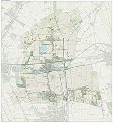
The population centres in Menterwolde are the villages of Borgercompagnie, Meeden, Muntendam, Noordbroek, Tripscompagnie, and Zuidbroek.
The municipality has a total area of 81.62 km2 (31.51 sq mi) of which 80.33 km2 (31.02 sq mi) is land and 1.29 km2 (0.50 sq mi) is water.[2]
Governance
The appointed mayor of Menterwolde is Eduard van Zuijlen of GroenLinks.[1]
Demographics
In 2014, Menterwolde had a population of 12,233 and a population density of 152/km2 (390/sq mi).[4]
Transportation
The Zuidbroek railway station is located on the Harlingen–Nieuweschans railway and the Stadskanaal–Zuidbroek railway.
References
- 1 2 "Samenstelling college" [Board members] (in Dutch). Gemeente Menterwolde. Retrieved 30 January 2014.
- 1 2 "Kerncijfers wijken en buurten" [Key figures for neighbourhoods]. CBS Statline (in Dutch). CBS. 2 July 2013. Retrieved 12 March 2014.
- ↑ "Postcodetool for 9649GR". Actueel Hoogtebestand Nederland (in Dutch). Het Waterschapshuis. Retrieved 30 January 2014.
- 1 2 "Bevolkingsontwikkeling; regio per maand" [Population growth; regions per month]. CBS Statline (in Dutch). CBS. 26 June 2014. Retrieved 24 July 2014.
External links
| Wikimedia Commons has media related to Menterwolde. |
 |
Slochteren | | ||
| |
Oldambt | |||
| ||||
| | ||||
| Hoogezand-Sappemeer | Veendam | Pekela |
Municipalities of Groningen | ||
|---|---|---|
 | ||
| ||