Grootegast
| Grootegast | |||
|---|---|---|---|
| Municipality | |||
|
Wind mill in Sebaldeburen | |||
| |||
.svg.png) Location in Groningen | |||
| Coordinates: 53°13′N 6°17′E / 53.217°N 6.283°ECoordinates: 53°13′N 6°17′E / 53.217°N 6.283°E | |||
| Country | Netherlands | ||
| Province | Groningen | ||
| Government[1] | |||
| • Body | Municipal council | ||
| • Mayor | Kor Dijkstra (CDA) | ||
| Area[2] | |||
| • Total | 87.74 km2 (33.88 sq mi) | ||
| • Land | 86.78 km2 (33.51 sq mi) | ||
| • Water | 0.96 km2 (0.37 sq mi) | ||
| Elevation[3] | 2 m (7 ft) | ||
| Population (May 2014)[4] | |||
| • Total | 12,181 | ||
| • Density | 140/km2 (400/sq mi) | ||
| Time zone | CET (UTC+1) | ||
| • Summer (DST) | CEST (UTC+2) | ||
| Postcode | 9820–9823, 9860–9869 | ||
| Area code | 0594 | ||
| Website |
www | ||


Grootegast (Dutch pronunciation: [ˈɣroːtəˌɣɑst]) is a municipality and a village in the northeastern Netherlands. It is the sister city of Kingston, Tasmania.
Population centres
Doezum, Enumatil, Faan, Grootegast, Kornhorn, Lutjegast, Niekerk, Oldekerk, Opende, Sebaldeburen. In some of these villages they still speak the West Frisian language.
Topography
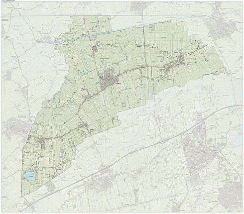
Dutch topographic map of the municipality of Grootegast, June 2015
The village of Grootegast
Grootegast is the main village of the municipality. The name of the village refers to a 'gast' or 'gaast', a higher, sandy ridge in an otherwise swampy area. Groot is Dutch for 'large'.
Grootegast is the birthplace of the theologian Cornelius Van Til.
Lutjegast
Lutjegast is a village in the municipality of Grootegast. In the Groningen dialect of Low German 'Lutje' means small or little.
Lutjegast was the birthplace of the explorer Abel Tasman. Although the house of his birth no longer exists, he is memorialised with a monument, plaque and street name.
Until 1829 a mansion named Rikkerdaborg stood in Lutjegast.
References
- ↑ "College van b en w" [Council of mayor and aldermen] (in Dutch). Gemeente Grootegast. Retrieved 21 January 2014.
- ↑ "Kerncijfers wijken en buurten" [Key figures for neighbourhoods]. CBS Statline (in Dutch). CBS. 2 July 2013. Retrieved 12 March 2014.
- ↑ "Postcodetool for 9861AC". Actueel Hoogtebestand Nederland (in Dutch). Het Waterschapshuis. Retrieved 21 January 2014.
- ↑ "Bevolkingsontwikkeling; regio per maand" [Population growth; regions per month]. CBS Statline (in Dutch). CBS. 26 June 2014. Retrieved 24 July 2014.
External links
- Official website
-
 Media related to Grootegast at Wikimedia Commons
 |
Zuidhorn | | ||
| Achtkarspelen (FR) | |
|||
| ||||
| | ||||
| Smallingerland (FR) | Marum | Leek |
Municipalities of Groningen | ||
|---|---|---|
 | ||
| ||