Melvin Price Locks and Dam
| Melvin Price Locks and Dam | |
|---|---|
 Melvin Price Locks and Dam (Lock and Dam number 26) | |
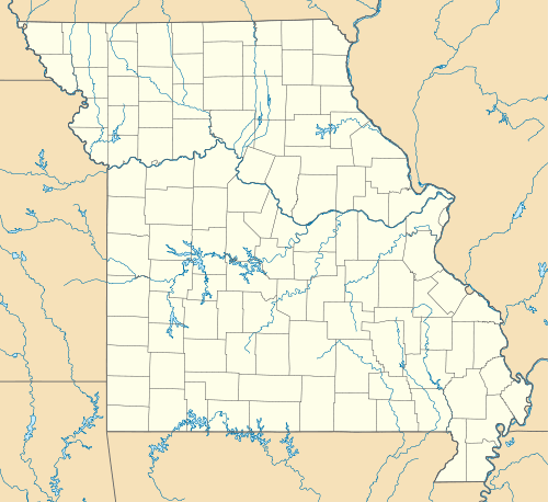 Location of Melvin Price Locks and Dam in USA Missouri | |
| Location | Alton, Illinois / West Alton, Missouri, USA |
| Coordinates | 38°52′09″N 90°09′13″W / 38.86917°N 90.15361°WCoordinates: 38°52′09″N 90°09′13″W / 38.86917°N 90.15361°W |
| Construction began | 1978 |
| Opening date | 1989 |
| Operator(s) | United States Army Corps of Engineers |
| Dam and spillways | |
| Impounds | Upper Mississippi River |
| Length | 1,160 feet (353.6 m) |
| Reservoir | |
| Creates | Pool 26 |
| Total capacity | 238,000 acre·ft (0.294 km3) |
| Catchment area | 171,470 sq mi (444,100 km2) |
Melvin Price Locks and Dam is a dam and two locks at river mile 200.78 on the Upper Mississippi River, about 17 miles (27 km) north of Saint Louis, Missouri. The collocated National Great Rivers Museum, at 1 Lock and Dam Way, East Alton, Illinois, explains the structure and its engineering.
Construction began in 1979, the main lock opened in 1990, and the full structure was completed in 1994. It replaced the earlier Lock and Dam No. 26, demolished in 1990, and is the first replacement structure on the Upper Mississippi River nine-foot navigation project. The main lock is 1,200 feet (370 m) long and 110 feet (34 m) wide; the auxiliary is 600 feet (180 m) long and 110 feet (34 m) wide. The main lock has a vertical lift gate and a miter gate while the aux. lock has two miter gates. The dam is 1,160 feet (350 m) long with 9 tainter gates, each 110 feet (34 m) wide by 42 feet (13 m) high.
It is named after Illinois Congressman Charles Melvin Price.
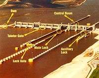 Annotated image of the lock and dam
 Dam and locks from Missouri shore
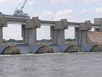 Close-up of the gates on the Melvin Price Lock & Dam
References
External links
- USACE Melvin Price Locks and Dam
- Historic American Engineering Record (HAER) No. IL-32, "Upper Mississippi River 9-foot (2.7 m) Channel Project, Lock & Dam 26R, Alton vicinity, Madison County, IL", 59 photos, 9 data pages, 5 photo caption pages
- Hydroacoustic Identification and Sampling of Fish Aggregations in Tailwater Areas (2005 Monitoring Report – Fish Passage Melvin Price Locks and Dam, Alton, Illinois and Lock and Dam 22, Saverton, Missouri)
| Locks and dams of the Upper Mississippi River | ||
|---|---|---|
| Upstream: Lock and Dam No. 25 |
Downstream: Chain of Rocks Lock | |