Lock and Dam No. 19
| Lock and Dam No. 19 | |
|---|---|
 Mississippi River Lock and Dam number 19 | |
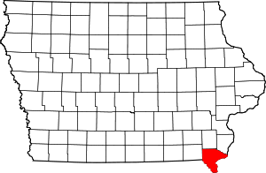
 Location of Lock and Dam No. 19 in Iowa | |
| Location | Hamilton, Illinois / Keokuk, Iowa |
| Coordinates | 40°23′45.46″N 91°22′26.71″W / 40.3959611°N 91.3740861°WCoordinates: 40°23′45.46″N 91°22′26.71″W / 40.3959611°N 91.3740861°W |
| Construction began | 1910 |
| Opening date | 1913 |
| Operator(s) | United States Army Corps of Engineers |
| Dam and spillways | |
| Impounds | Upper Mississippi River |
| Length | 4,620 feet (1,408 m) (movable portion) |
| Reservoir | |
| Creates | Pool 19 / Lake Cooper |
| Total capacity | 292,000 acre·ft (0.360 km3) |
| Catchment area | 119,000 sq mi (310,000 km2) |
|
Lock and Dam No. 19 Historic District | |
|
| |
| Location | 525 N. Water St., Keokuk, Iowa |
| Area | 160.5 acres (65.0 ha) |
| Built | 1870 |
| MPS | Upper Mississippi River 9-Foot Navigation Project MPS |
| NRHP Reference # | 04000179[1] |
| Added to NRHP | March 10, 2004 |
Lock and Dam No. 19 is a lock and dam located on the Upper Mississippi River near Keokuk, Iowa. In 2004, the facility was listed in the National Register of Historic Places as Lock and Dam No. 19 Historic District, #04000179 covering 1,605 acres (650 ha), 7 buildings, 12 structures, 1 object. The lock is owned and operated by the U.S. Army Corps of Engineers. The dam is owned and operated by Ameren Missouri.
The lock and dam obliterated the Des Moines Rapids which had effectively been the northern barrier for traffic on the Mississippi until efforts began in 1837 to address the Mississippi's 2 ft 6 in (76 cm) depth in the rapids.
Locks

The main lock was constructed from 1952 to 1957 and is 1,200 feet (366 m) long and 110 feet (34 m) wide with a lift of just over 38 feet (12 m) and large enough to handle a full-length tow of barges. It was put into operation in 1957 at a cost of 13.5 million dollars. The 1957 lock replaced a 1910-1913 lock. The 1913 lock was a variant of the standardized Panama canal design and was 110 feet (34 m) wide, 358 feet (109 m) long and 57 feet (17 m) tall with a 40 feet (12 m) lift. There was a 130 feet (40 m) wide, 463 feet (141 m) long and 20 feet (6 m) deep dry dock at the site, both the dry dock and 1913 lock were dewatered in 1977 when a sheet pile and cell closure were built blocking the upstream sides of the lock and dry dock.[2]

The lock and dam, as well as the rest of the river, can be viewed from a distance on the Observation Deck of the Keokuk Rail Bridge.
Dam

Construction of the dam began in 1910, and was completed in 1913. The movable portion of the dam is 4,620 feet (1,408 m) long with 119 separate 30 feet (9 m) rectangular, steel-skin plated, sliding gates. The gates are either installed or removed and river flow is controlled by the number of gates installed. They are removed by a gantry crane that travels on the service bridge above the dam. At the time it was completed it was second in length only to the Aswan Low Dam on the Nile River.[2]
Powerhouse

Construction began in 1910 and when completed in 1913 it was the largest capacity, single powerhouse electricity generating plant in the world. The Power House and spillways are owned and operated by Ameren Missouri and has a 134 MW capacity.[3] The powerhouse contains 15 generators, originally designed to produce 25 Hz instead of the 60 Hz alternating current used today. In the 1930s, Union Electric Company purchased this 25 Hz power for Streetcars in St. Louis, Missouri. This 25 Hz power configuration is still used for Amtrak's 25 Hz traction power system in the Northeast Corridor.[2] Lock and Dam No. 1, Lock and Dam No. 2 and the upper St. Anthony Falls dam also produce electricity.
See also

References
- ↑ National Park Service (2010-07-09). "National Register Information System". National Register of Historic Places. National Park Service.
- 1 2 3 4 HAER - Mississippi River 9-Foot Channel, Lock & Dam No. 19, Upper Mississippi River, Keokuk, Lee County, IA
- ↑ https://www.ameren.com/AboutUs/ADC_AU_FactSheet.pdf
Hallwas, John E. (2001) Keokuk and the Great Dam. Arcadia Publishing, Chicago.
Diver, Lorene Curtis, "To Sound Waves," a booklet Mrs. Diver wrote about the sounds heard from her Keokuk, Iowa home as the Dam was being built, 1913. Her husband was James Brice Diver, an engineer and bridge builder.
External links
| Wikimedia Commons has media related to Mississippi River Lock and Dam number 19. |
- HAER - Mississippi River 9-Foot Channel, Lock & Dam No. 19, Upper Mississippi River, Keokuk, Lee County, IA
- Keokuk Area Convention and Tourism Bureau
- Ameren Missouri Fact Sheet
- Hugh L. Cooper speaks to MIT civil engineers Jan. 1915
| Locks and dams of the Upper Mississippi River | ||
|---|---|---|
| Upstream: Lock and Dam No. 18 |
Downstream: Lock and Dam No. 20 | |
| Topics | |
|---|---|
| Lists by states |
|
| Lists by insular areas | |
| Lists by associated states | |
| Other areas | |
| |