Meethari Marwar
| Meethari Marwar मीठड़ी मारवाड़ | |
|---|---|
| Village | |
 Meethari Marwar  Meethari Marwar Meethari Marwar in Rajasthan | |
| Coordinates (Meethari Marwar): 27°34′34″N 74°41′14″E / 27.575975°N 74.687235°ECoordinates: 27°34′34″N 74°41′14″E / 27.575975°N 74.687235°E | |
| Country |
|
| State | Rajasthan |
| District | Nagaur district |
| Tehsil | Ladnun |
| Settled | 900 Years ago |
| Founded by | Unknown |
| Government | |
| • Type | Panchayat |
| • Sarpanch | Nirmla Devi Meghwal |
| Area | |
| • Total | 1,035 ha (2,558 acres) |
| • Rural | 1,035 ha (2,558 acres) |
| Dimensions | |
| • Length | 3 km (2 mi) |
| • Width | 1 km (0.6 mi) |
| Population (census of india 2001) | |
| • Total | 3,236 [1] |
| Time zone | IST (UTC+5:30) |
| PIN | 341303 |
| Telephone code | +91 1581 |
| Website |
meetharimarwar |
Meethari Marwar[2](Hindi: मीठड़ी मारवाड़) is a village in Ladnun tehsil of Nagaur district in the Indian state of Rajasthan.
Location
Geo-Locater Coordinates : Meethari Marwar 27.575975°N 74.687235°E
Meethari Marwar[3](Hindi: मीठड़ी मारवाड़) is situated at a distance of 124 km from Nagaur in the north east direction on Salasar-Didwana state highway no.- 60. Meethari Marwar.[4] a village in Ladnun tehsil of Nagaur district in state of Rajasthan.
History
On historical point of view, we are not aware of the history of the village that when the village was built and who built? The date of establishment and information about founders of the village are unclear, however some evidence and historical accounts indicates that this area became settled in the 'Rajput princely era' about 1100-1150 AD. According to some local evidence and peoples sayings that there was a water pond on the site way before the village was founded. The pond is known as Piparni Nadi or Pipaly Nadi and is regularly replenished with rainwater, so it became a resting point on the this route that was connected two principary Shekhawati and Marwar. Evidence shows that when traders, the army, 'banjare' or others persons traveled from this way, it means they always crossed the borders of two principary states Marwar and Shekhawati. They rested and took shelter here because they always found sweet and clean water for drinking for themselves and their animals, so it soon became called Meethari. This was also the entrance palace to Marwar state, so people started to call it Meethari Marwar[5]
Geography
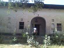
.jpg)
.JPG)
Village are represents traditional Thar regional climate. The main plants and trees are Acacia senegal and Acacia leucophloea, locally the Khejari (Hindi: खेजड़ी) Prosopis cineraria, Kankera, Rohida(Hindi: रोहिड़ा) (State Flower of Rajasthan), Kair, Khair etc. with some big trees like Peepal, Bargad, Neem, Sheesam, Saresh. Despite the large scale forest clearance, a few mammals still remain in village's ecoregion like foxes and jackals. The Forestry part of the village is also home to other wild animals like big cats, mice, gecko, monitor lizard and others reptiles like king cobra, viper, chameleon etc.
Demographics

Total Population : According to Indian census 2001[6] total population of Meethari Marwar village is following :
- Total Population - 3236 Persons
- Total Male Population - 1623 Male
- Total Female Population - 1613 Female
- Scheduled castes population - Persons 1,095
- Scheduled castes population - Male
- Scheduled castes population - Females 544
- Scheduled tribes population - Persons 55
- Scheduled tribes population - Males 28
- Scheduled tribes population - Females 27
Residents of all races live in the village like Agarwal, Brahmins, Jats, RAJPUTS, Meghwal, Goldsmith, Suthar, potters, and Meena etc., these are all followers of Hinduism. Some Muslim religion holds the clans in the village like Kayamkhani.[7] Muslim chhinpa and Muslim maniyars.
Culture
Meethari Marwar.[8] is representative village of the traditional Rajasthani social and cultural rural environment. There are mainlly two communities is lives together with communal harmony and brotherhood. Village's Hindu Muslim communities interconnections is exemplary for humanisn. Almost all Hindu families worships regional folk Gods and goddesses that is practiced in village life of Rajasthan. Gogaji is the most recognized folk God, that is the God of snakes. Like traditional Rajasthani villages has Gogaji dwelling worship palace that is generally calling as Goga Meri. Tejaji, Pabuji, etc. Some of the local deities are also worshiped in village like Durgsa mother, Rajalbai, Shyam Ji, Thakurji, Bhomiaji and Bharavji.
Economy
The village Meethari Marwar have typical ways as economical stage. Almost 60 percent of the village's population depends on agriculture for livelihood. The total land is 1055 ha of which 1035 ha of village land is agricultural land. All fields are village with small holdings. All conditions of agriculture entirely dependent on monsoon rains. The Agarwal representative of the merchant class family in the village were highest caste but they are slowly moving to other areas of the country like Mumbai, Surat, Silwasa, Asam, Bengal, Nagaland and Hyedrabad south. Kayamkhani fraternity's most family members have served in various branches of the Indian Army. Some villagers works in the rural state official and-center government services. Some species, such as goldsmiths, Suthar, potter etc. still working in there traditional works but they are in very small numbers.
Government and politics
The village is a Gram Panchayat (Hindi: ग्राम पंचायत) headquarter under Panchayat Sumitee Ladnun(Hindi: लाडनूं).The Gram Panchayat is divided into 12 wards. After every 5 years the entire panchayat sarpanch elected along with the head of the 12 wards as 12 wardpanchon. . After the last Panchayat Election 2009 Bhgwani Ram Bajari is the village Sarpanch.
Public Facilities


Village has all kinds public facilities as the town level.
- 1. Educational institutions
- Government Senior Secondary School.[9]
- Government Girls Secondary School (Upgraded in AUG. 2013)
- Government Upper Primary School
- Government Primary School No. 1
- Government Primary School No. 2 (Indira colony)
- Madarsa Islamiyan (K.K.Colony)
- Prince School - (Lachhari road,Rajput Colony)
- 2. Hospitals and Clinics
- Government Community Health Center
- Government Veterinary Hospital
- 3. Community Hall and Cultural Center
- Bharech Bhawan
- Meghwal Dharma Shala
- Community Hall, (Didwana Road)
- Bharat Nirman Rajiv Gandhi Sewa Kendra, (Didwana Road)
- Shree Balaji Gau Seva Samiti Trust
- 4. Water distribution and-Management
The level of underground water is very deep almost 300 or 350 feet. Due to more salinity of groundwater is not suitable for neither agricultural activities nor to drinking water. Water supply depends on tubewells system from nearby town Nechhwa.
- 5. Integrated Watershed Management Programme (IWMP)
Village has been linked to Integrated Watershed Management Programme (IWMP) scheme of state and national level. Integrated Watershed Management Programme (IWMP) is a modified programme of erstwhile Drought Prone Areas Programme (DPAP), Desert Development Programme (DDP) and Integrated Wastelands Development Programme (IWDP) of the Department of Land Resources..In last financial year (2011–15) village has been linked to the scheme. The village's total land area (1035 ha) has been added under the IWMP [10] scheme in Meethari Marwar.
References
- ↑ "Population of Meethari Marwar".
- ↑ "Meethari Marwar on Here.com map".
- ↑ "Pin code search option, Meethari Marwar". Archived from the original on May 20, 2012.
- ↑ Falling Rain Genomics, Inc - Meethari Marwar
- ↑ http://www.geonames.org/1258899/rajasthan.html
- ↑ census 2001 Meethari Marwar
- ↑ "Kayamkhani Nabab's of Ftehapur Shekhawati".
- ↑ "Meethari Marwar community page on facebook".
- ↑ "Govt.Ser.Sec.School blog".
- ↑ "IWMP Meethari Marwar".
External links
- Position of Meethari Marwar in Nagaur District Map
- Polling Station in Nagaur District
- IWMP Programming in Meethari Marwar
- Nagaur District Live News
- Population Of Meethari Marwar
- List of elected Surpunch's in Panchayat Election 2010
- The list of all villages of Rajasthan according to their Panchayat Summities
- Meethari Marwar on Stad.com
Village Position
 |
Sujangurh, Bikaner | Salasar, Churu | Ganeri | |
| Jaswant Gurh, Ladnnun | |
Nechhwa | ||
| ||||
| | ||||
| Didwana, Nagaur | Kuchaman City, Ajmer | Sikar |
| Outline | 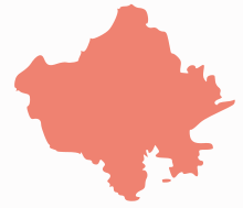 | ||||||||||||||||||||||||||
|---|---|---|---|---|---|---|---|---|---|---|---|---|---|---|---|---|---|---|---|---|---|---|---|---|---|---|---|
| Governance | |||||||||||||||||||||||||||
| Divisions and Districts |
| ||||||||||||||||||||||||||
| Major cities | |||||||||||||||||||||||||||
| Related templates |
| ||||||||||||||||||||||||||