McMullen, Alabama
| McMullen, Alabama | |
|---|---|
| Town | |
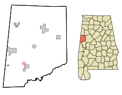 Location in Pickens County and the state of Alabama | |
| Coordinates: 33°8′57″N 88°10′26″W / 33.14917°N 88.17389°W | |
| Country | United States |
| State | Alabama |
| County | Pickens |
| Area | |
| • Total | 0.1 sq mi (0.3 km2) |
| • Land | 0.1 sq mi (0.3 km2) |
| • Water | 0 sq mi (0 km2) |
| Elevation | 197 ft (60 m) |
| Population (2013)[1] | |
| • Total | 10 |
| • Density | 660/sq mi (220/km2) |
| Time zone | Central (CST) (UTC-6) |
| • Summer (DST) | CDT (UTC-5) |
| ZIP code | 35442 |
| Area code(s) | 205 |
| FIPS code | 01-45640 |
| GNIS feature ID | 0135569 |
McMullen is a town in Pickens County, Alabama, United States. The population was 10 at the 2010 census, down from 66 in 2000. It incorporated around 1976.[2] As of 2010, it holds the distinction of being the smallest incorporated town in the state of Alabama.
Geography
McMullen is located at 33°8′57″N 88°10′26″W / 33.14917°N 88.17389°W (33.149131, -88.173919).[3]
According to the United States Census Bureau, the town has a total area of 0.1 square miles (0.26 km2), all land.
Demographics
| Historical population | |||
|---|---|---|---|
| Census | Pop. | %± | |
| 1970 | 73 | — | |
| 1980 | 164 | 124.7% | |
| 1990 | 112 | −31.7% | |
| 2000 | 66 | −41.1% | |
| 2010 | 10 | −84.8% | |
| Est. 2015 | 10 | [4] | 0.0% |
| U.S. Decennial Census[5] 2013 Estimate[6] | |||
As of the 2010 United States Census, there were 10 people residing in the town. 60.0% were African American, 30.0% from some other race and 10.0% White. 30.0% were Hispanic or Latino of any race.
As of the census of 2000, there were 66 people, 31 households, and 19 families residing in the town. The population density was 544.0 people per square mile (212.4/km²). There were 31 housing units at an average density of 255.5 per square mile (99.7/km²). The racial makeup of the town was 100.00% African American.
There were 31 households out of which 16.1% had children under the age of 18 living with them, 32.3% were married couples living together, 29.0% had a female householder with no husband present, and 38.7% were non-families. 38.7% of all households were made up of individuals and 12.9% had someone living alone who was 65 years of age or older. The average household size was 2.13 and the average family size was 2.74.
In the town the population was spread out with 19.7% under the age of 18, 6.1% from 18 to 24, 25.8% from 25 to 44, 22.7% from 45 to 64, and 25.8% who were 65 years of age or older. The median age was 44 years. For every 100 females there were 53.5 males. For every 100 females age 18 and over, there were 51.4 males.
The median income for a household in the town was $30,000, and the median income for a family was $33,500. Males had a median income of $21,250 versus $16,250 for females. The per capita income for the town was $10,458. There were 8.3% of families and 13.4% of the population living below the poverty line, including 10.0% of under eighteens and 4.3% of those over 64.
References
- ↑ "Population Estimates". United States Census Bureau. Retrieved 2014-06-07.
- ↑ https://news.google.com/newspapers?nid=1817&dat=19760421&id=BnwhAAAAIBAJ&sjid=TIoFAAAAIBAJ&pg=6892,4995485&hl=en
- ↑ "US Gazetteer files: 2010, 2000, and 1990". United States Census Bureau. 2011-02-12. Retrieved 2011-04-23.
- ↑ "Annual Estimates of the Resident Population for Incorporated Places: April 1, 2010 to July 1, 2015". Retrieved July 2, 2016.
- ↑ United States Census Bureau. "Census of Population and Housing". Retrieved February 2, 2014.
- ↑ "Annual Estimates of the Resident Population: April 1, 2010 to July 1, 2013". Retrieved June 7, 2014.
Coordinates: 33°08′57″N 88°10′26″W / 33.149131°N 88.173919°W
Municipalities and communities of Pickens County, Alabama, United States | ||
|---|---|---|
| Cities | 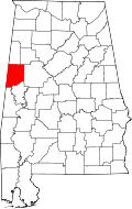 | |
| Towns | ||
| CDP | ||
| Unincorporated communities | ||