McKinney Acres, Texas
This article is about the unincorporated community in west Texas. For the city in the Dallas-Fort Worth Metroplex, see McKinney, Texas.
| McKinney Acres, Texas | |
|---|---|
| Census-designated place | |
 McKinney Acres | |
| Coordinates: 32°17′54″N 102°31′50″W / 32.29833°N 102.53056°WCoordinates: 32°17′54″N 102°31′50″W / 32.29833°N 102.53056°W | |
| Country | United States |
| State | Texas |
| County | Andrews |
| Area | |
| • Total | 1.7 sq mi (4.3 km2) |
| • Land | 1.7 sq mi (4.3 km2) |
| • Water | 0 sq mi (0 km2) |
| Elevation | 3,175 ft (968 m) |
| Population (2010) | |
| • Total | 815 |
| • Density | 487/sq mi (187.9/km2) |
| Time zone | Central (CST) (UTC-6) |
| • Summer (DST) | CDT (UTC-5) |
| Area code(s) | 432 |
| FIPS code | 48-45750 |
| GNIS feature ID | 2034056 |
McKinney Acres is a census-designated place (CDP) in Andrews County, Texas, United States. The population was 815 at the 2010 census.[1]
Geography
McKinney Acres is located along the southern border of Andrews, the county seat. U.S. Route 385 runs along the western edge of the CDP, leading south 32 miles (51 km) to Odessa.
According to the United States Census Bureau, the CDP has a total area of 1.7 square miles (4.3 km2), all of it land.[1]
References
- 1 2 "Geographic Identifiers: 2010 Demographic Profile Data (G001): McKinney Acres CDP, Texas". U.S. Census Bureau, American Factfinder. Retrieved August 9, 2013.
Municipalities and communities of Andrews County, Texas, United States | ||
|---|---|---|
| City | 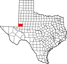 | |
| CDP | ||
| Ghost towns | ||
This article is issued from Wikipedia - version of the 10/2/2014. The text is available under the Creative Commons Attribution/Share Alike but additional terms may apply for the media files.