Mayfield, Canterbury
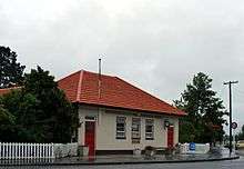

Mayfield is a small farming settlement in Mid Canterbury, in New Zealand's South Island. It is located 35 km from Ashburton[1] on former State Highway 72 at the intersection of the Lismore-Mayfield Road towards the top of the Canterbury Plains. The village has a shop, garage, tavern, local transport company and rural supply store. The population of the Mayfield village is around 200.[2]
Mayfield is within the Ashburton District Council and Canterbury Regional Council boundaries.
The town has a voluntary rural fire brigade staffed by locals. The brigade uses a Bedford tanker and International fire appliance.[3] The fire brigade is particularly useful since the climate and local farms are particularly prone to drought and grass fires during the summer season.[4]
The first post office in Mayfield was established on 1 September 1879 when Mr. John Bowick was appointed Postmaster, he was also the town blacksmith and it was his house on the Mayfield-Klondike road that was the first Post Office. He was later bought out on 1 July 1881 by Mr. James Dellow, who became the local blacksmith.[5] But it was only in mid-1889 that a post office with telegraph office and bureau was opened.[5] The Mayfield post Office was in use from this time until it was downgraded to a volunteer Post office in 1982. Several local ladies held the position of volunteer Postmistress thereafter until the postal services were shifted to the local store.[6]
If any one person could be considered to have founded Mayfield then it was almost certainly James Dellow. It was he who essentially invented the heavier, more robust farming gear needed when it became quite clear that the lightweight harrows and plows previously used could not handle the stony conditions and it was he who lived to see Mayfield grown from one or two houses to a functioning, prosperous settlement.[7]
The local store burnt down in early 2008 but re-opened in early 2009.[8]
The Mayfield Agricultural and Pastoral show takes place on the second Saturday in March each year.[9][1]
In June 2006 Mayfield and the Mid Canterbury region were hit by large snowfalls disrupting power, phone and roads. Power remained cut for hundreds of households more than a week after the event making it one of the worst storms to hit the region in several decades.[10]
A local newsletter the Mayfield Message is issued monthly and sent via the New Zealand Post to households in the local area and published on the Ashburton District Council website.[2]
Communications
Mayfield has a Chorus owned telephone exchange providing Telephone and DSL services to the local area. The exchange is only capable of providing ADSL 1 services and the equipment is limited by the its backhaul capabilities.[11] It is also serviced by the Electricity Ashburton and Vodafone fibre optic networks which pass through the town.[12] Mayfield is also serviced by the Wireless Rural Broadband Initiative and the privately operated Ruralnet.[13]
Education
Mayfield is the location of a primary school that services the township and surrounding community. The school was opened sometime between 1880 and 1887. In 2000 the school was increased in size when the smaller Lismore and Westerfield schools were closed. Students at these schools transferred to Mayfield. Two relocatable classrooms from Lismore were moved to Mayfield to add two additional classrooms while another building was used to extend the library/hall. Mayfield School is a decile 9 co-educational state full primary school (U2 grade) catering for New Entrants to Year 8 students. At the end of 2010 the roll was 71 students.[14]
Secondary education is undertaken at Geraldine High School or Ashburton College, with school buses running from Mayfield to both schools.[15]
References
| Wikimedia Commons has media related to Mayfield, Canterbury. |
- 1 2 Te Ara encyclopedia http://www.teara.govt.nz/en/canterbury-places/17
- 1 2 Council, Ashburton District. "Mayfield Latest News". Ashburton District Council. Retrieved 4 June 2015.
- ↑ McDowell, Robert (1987). Mayfield School and District, 1887-1987. Mayfield School Centennial Committee. p. 89. OCLC 154610001.
- ↑ Mayfield Press 11 April 2010 http://www.mayfield.co.nz/article.php?story=20090310141635947
- 1 2 McDowell, Robert (1987). Mayfield School and District, 1887-1987. Mayfield School Centennial Committee. p. 45. OCLC 154610001.
- ↑ McDowell, Robert (1987). Mayfield School and District, 1887-1987. Mayfield School Centennial Committee. p. 48. OCLC 154610001.
- ↑ McDowell, Robert (1987). Mayfield School and District, 1887-1987. Mayfield School Centennial Committee. p. 10. OCLC 154610001.
- ↑ Mayfield Press 11 February 2009 http://www.mayfield.co.nz/article.php?story=20081123115821322
- ↑ Mayfield A&P Show website http://www.mayfieldshow.com/About_us.html
- ↑ NZs Ministry of Agriculture and Fisheries - The Resilience and Response of Farm Households in the Aftermath of the 2006 Canterbury Snow Storm http://www.maf.govt.nz/mafnet/rural-nz/emergency-management/snow/farm-response-to-2006-canterbury-snow/page-05.htm
- ↑ Chorus. "Broadband Capability Map". Chorus. Retrieved 4 June 2015.
- ↑ Networks, EA. "EA Networks - Fibre Optic Network". Ashburton District Council. Retrieved 4 June 2015.
- ↑ Broadband, Ultimate. "Ruralnet Wireless Broadband network". Ultimate Broadband. Retrieved 4 June 2015.
- ↑ Mayfield, School Board. "Welcome to Mayfield School". Mayfield School Board. Retrieved 12 June 2011.
- ↑ Canterbury School Transport Service, Mid. "About Mid Canterbury School Transport Service". Mid Canterbury School Transport Service. Retrieved 4 June 2015.
Coordinates: 43°49′S 171°25′E / 43.817°S 171.417°E