May 2010 Northern Sumatra earthquake
 | |
| Date | 9 May 2010 05:59 UTC |
|---|---|
| Magnitude | 7.2 MW |
| Depth | 45 kilometres (28 mi) |
| Epicenter | 3°46′30″N 96°03′18″E / 3.775°N 96.055°ECoordinates: 3°46′30″N 96°03′18″E / 3.775°N 96.055°E |
| Areas affected |
Indonesia Malaysia |
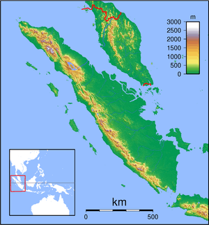
The May 2010 Northern Sumatra earthquake occurred with a moment magnitude of 7.2 on May 9 at 12:59 PM local time (5:59 UTC) in Indonesia. The epicenter was 215 km from Banda Aceh on the northwestern tip of Sumatra. According to USGS, it is likely that this earthquake occurred along the interface of the Indo-Australia Plate and the Sunda Plate. It was one of a sequence of large earthquakes along the Sunda megathrust in 2000s. It was also felt in Laos, Malaysia, Myanmar, Singapore and Thailand.[1] Minor damage was reported in the control tower of an airport near Meulaboh.[2]
See also
References
This article is issued from Wikipedia - version of the 11/26/2016. The text is available under the Creative Commons Attribution/Share Alike but additional terms may apply for the media files.