1996 Biak earthquake
  | |
| Date | February 17, 1996 |
|---|---|
| Origin time | 05:59:30 UTC [1] |
| Magnitude | 8.2 Mw [1] |
| Depth | 20 km (12 mi) [1] |
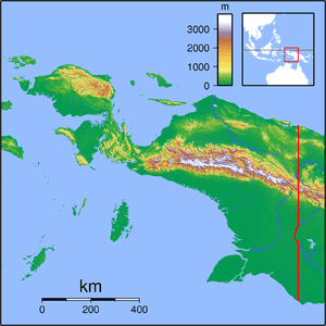
| Epicenter | 0°57′S 136°56′E / .95°S 136.94°ECoordinates: 0°57′S 136°56′E / .95°S 136.94°E [1] |
| Type | Thrust [2] |
| Total damage | $4.2 million [3] |
| Max. intensity | VIII (Severe) |
| Tsunami | 7 m (23 ft) [2] |
| Casualties |
166 dead [3] 423 injured [3] 5,090 displaced [3] |
The 1996 Biak earthquake, or the 1996 Irian Jaya earthquake, occurred on February 17 at 14:59:30 local time near Biak Island, Indonesia. The earthquake had a moment magnitude of 8.2 and a maximum Mercalli intensity of VIII (Severe). The run-up height of the generated tsunami reached 7 meters (23 ft). One-hundred and sixty-six people were reported dead, 423 were injured, and 5,090 were made homeless.
This earthquake was a thrust in a very oblique subduction zone. It ruptured at least 270 km (170 mi) along the New Guinea trench.[4] The slip distribution is very nonuniform. The largest slip was ∼12 m near the hypocentral depth, and the mean slip over a 230 km by 100 km fault area was 4 m.[5]
References
- 1 2 3 4 ISC (2015), ISC-GEM Global Instrumental Earthquake Catalogue (1900–2009), Version 2.0, International Seismological Centre
- 1 2 Okal, E.; Piatanesi, A.; Heinrich, P. (1999), "Tsunami detection by satellite altimetry" (PDF), Journal of Geophysical Research, American Geophysical Union, 104 (B1): 611, doi:10.1029/1998JB000018
- 1 2 3 4 USGS (September 4, 2009), PAGER-CAT Earthquake Catalog, Version 2008_06.1, United States Geological Survey
- ↑ Taylor, M. A. J.; Dmowska, R.; Rice, J. R., Comparison of Coulomb Shear Stress Changes from the Feb. 17, 1996 Biak Mw = 8.2 Event and a Subsequent Seismic Inversion
- ↑ Henry, C.; Das, S., "The Mw 8.2, 17 February 1996 Biak, Indonesia, earthquake: Rupture history, aftershocks, and fault plane properties", Journal of geophysical research, American Geophysical Union, 107 (B11)
External links
This article is issued from Wikipedia - version of the 11/27/2016. The text is available under the Creative Commons Attribution/Share Alike but additional terms may apply for the media files.