Mavis/Chinguacousy Roads
| |||||||
|---|---|---|---|---|---|---|---|
| Peel Regional Road 18 | |||||||
|
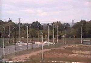
Mavis Rd. within Mississauga | |||||||
| Route information | |||||||
|
Maintained by City of Mississauga (south of Hwy. 407) Region of Peel (north of Hwy. 407) | |||||||
| Length: | 15 km (9 mi) | ||||||
| Major junctions | |||||||
| South end: |
| ||||||
|
Dundas Street Burnhamthorpe Road Eglinton Avenue | |||||||
| North end: |
| ||||||
| Highway system | |||||||
| |||||||


Mavis Road and Chinguacousy Road are a pair of interlined roads in Peel Region, Ontario, Canada, running in the cities of Mississauga, Brampton, and the Town of Caledon. Their combined lengths are approximately 37 kilometres (23 miles).
Mavis Road
Mavis Road begins at the Queensway, as a continuation of Stavebank Road (a residential street), and runs north to Steeles Avenue, where Chinguacousy Road takes over. Between Highway 407 and Steeles Avenue, it is maintained by Peel Region and designated as Peel Regional Road 18.[1]
Unlike most major roads in Peel, and the Greater Toronto Area in general, Mavis Road was largely built in modern times. Only the southernmost portion was part of Peel's original concession road grid, and was named Stavebank Road, parts of which still bear that name (see above). The section north of Queensway was later renamed Mavis Road and was reconstructed as a major thoroughfare when the area became more developed. It was extended north of its original terminus at Eglinton Avenue to Britannia Road. in 1991, and then extended north of Highway 401 (where a new interchange was constructed) in 1999 to its current terminus at Steeles Avenue. To connect with Chinguacousy Rd. at Steeles, the Mavis extension had to veer westwards from its main alignment and displaced Second Line West (which was subsequently either closed or broken up into various local streets) as the primary artery southwards.
The CPR level crossing north of Dundas Street, since replaced by a bridge, was the site of the infamous 1979 Mississauga train derailment.
| |||||||
|---|---|---|---|---|---|---|---|
| Route information | |||||||
|
Maintained by City of Brampton Town of Caledon | |||||||
| Length: | 22 km (14 mi) | ||||||
| Major junctions | |||||||
| South end: |
| ||||||
|
Williams Parkway Sandalwood Parkway | |||||||
| North end: |
Dead ends north of | ||||||
| Highway system | |||||||
| |||||||
Chinguacousy Road
Chinguacousy Road continues Mavis north of Steeles Avenue, following the original Second Line alignment for its entire length. In Brampton, heavy residential subdivision construction is ongoing in the areas along the west side of the road for nearly its entire distance through the city. A short distance north of Steeles it crosses the Orangeville-Brampton Railway tracks, and just south of Bovaird Drive (a downloaded portion of Highway 7, now Peel Regional Road 107), passes over the Canadian National line carrying GO Transit's Kitchener Line. It enters rural Caledon north of Mayfield Road (Peel Regional Road 14), traversing farmlands before entering the scenic Oak Ridges Moraine, near the community of Boston Mills, where it crosses the OBR tracks again. The road jogs at Boston Mills Road at the Credit River, and a short distance north passes the Caledon Trailway,[2] which is a part of the Trans-Canada Trail network. It continues past Old Base Line Road (Peel Regional Road 12) and dead ends after 0.7 km (0.4 mile).
References
| North-South routes |  | |
|---|---|---|
| East-West routes | ||
| Highways and expressways | ||