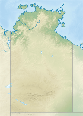
Mary River (Northern Territory)
| Mary | |
| River | |
| Name origin: Mary Chambers | |
| Country | Australia |
|---|---|
| Territory | Northern Territory |
| Source | |
| - elevation | 295 m (968 ft) |
| Mouth | |
| - location | Sampan Creek, Arnhem Land, Australia |
| - elevation | 1.5 m (5 ft) |
| - coordinates | 12°26′9″S 131°42′58″E / 12.43583°S 131.71611°ECoordinates: 12°26′9″S 131°42′58″E / 12.43583°S 131.71611°E |
| Length | 225 km (140 mi) |
| Basin | 8,000 km2 (3,089 sq mi) |
| Discharge | |
| - average | 76.1 m3/s (2,687 cu ft/s) |
 | |
| [1] | |

The Mary River flows in the Northern Territory of Australia and is a site of the Mary River National Park.
Description
The river is approximately 225 kilometres (140 mi) long and rises about 50 kilometres (31 mi) east of Pine Creek.[1] The catchment area is over 8,000 square kilometres (3,089 sq mi) but is ephemeral and only flows in the wet season, during the dry it is a series of pools and billabongs.[2]
The catchment has several small reserve areas forming the Mary River National Park to help protect it. The Arnhem Highway crosses the river near one of the park areas.[3] It also supports multiple land uses including pastoralism, fishing, mining, defence force, tourism, conservation and horticulture. Pastoralism, particularly cattle grazing is the dominant use taking up 63% of the catchment area.[2]
The river has a total of ten tributaries including the Little Mary River, MacKinlay River, Bowerbird Creek, Mingloo Cree and Douglas Creek. It has a mean annual outflow of 2,400 gigalitres (3.139×10⁹ cu yd),[4]
Its lower reaches form part of the Adelaide and Mary River Floodplains Important Bird Area. The river is noted for its population of saltwater crocodiles, and is breeding area for the Barramundi, the traget fish species for recreational anglers in the area.[2] It is one of eight rivers in the Northern Territory with a large floodplain system in their catchment area.[3] The wetlands occupy an area of approximately 1,300 square kilometres (502 sq mi) and are predominantly freshwater, although they suffer from saltwater intrusion. The wetlands provide a mosaic of habitats and are listed in the Directory of Important Wetlands.[5] It is almost unique for an Australian river in that it has had no major tidal estuary as a river outlet for at least the last 2,000 years.[5]
Flora and Fauna
.jpg)
The Fogg Dam Conservation Reserve is another protected area along the river and forms a vital habitat in the dry season for some 250 species of birds including Jabiru, jacana, brolga and pygmy geese.[6]
Four threatened plants are found along the river including Goodenia quadrifida, Schoutenia ovata and the endangered Cycas armstrongii and Helicteres macrothrix.[7]
The riparian vegetation found on the upper catchment includes mixed woodlands of Pandanus, Wattle, Paperbark and freshwater mangroves with an understorey of grass and sedges. Weeds are becoming problematic with shrub horehound, spiny head sida and wild passion fruit vine featuring.[2]
34 species of fish are found in the river including; the Macleay's Glassfish, Barred Grunter, Sooty Grunter, Fly-specked Hardyhead, Toothless catfish, Flathead Goby, Spangled Perch, Barramundi, Oxeye Herring, Rainbowfish, Black-banded Rainbowfish, Northern Trout Gudgeon, Bony Bream, Catfish, Hyrtl's Tandan, Freshwater Longtom, Seven-spot Archerfish and the Sleepy Cod.[8]
Two threatened goanna species; Varanus mertensi and Varanus panoptes are found along the river as is the vulnerable yellow-snouted gecko (Lucasium occultum).[7]
History
The traditional owners of the area are the Wulwulam peoples.[9]
The river was named by John McDouall Stuart in 1862. He wrote in his diary Country burning all round. Lat 13°38'24". This branch I have named the Mary, in honour of Miss Mary Chambers. Stuart always believed that the Mary was a branch of the Adelaide river and always referred to it as The Mary, Adelaide river.[10]
See also
References
- 1 2 "Map of Mary River, NT". Bonzle Digital Atlas of Australia. Retrieved 19 May 2015.
- 1 2 3 4 Christine Bach and Jane Hosking (1 September 2002). "Wetland monitoring for the Mary River Catchment, Northern Territory" (PDF). Natural Heritage Trust. Retrieved 27 April 2015.
- 1 2 "Mary River National Park". Parks and Wildlife Commission. Retrieved 27 April 2015.
- ↑ "Mary River" (PDF). TRaCK. 2009. Retrieved 12 May 2015.
- 1 2 "Mary River Salt Water Intrusion". Northern Territory Government. Retrieved 27 April 2015.
- ↑ "Mary River". Explore Australia's Outback. Retrieved 27 April 2015.
- 1 2 "Mary River National Park - Draft Joint Management Plan" (PDF). July 2014. Retrieved 19 May 2015.
- ↑ "Mary River catchment". Fish Atlas of North Australia. Retrieved 19 May 2015.
- ↑ "Wulwulam". AusAnthrop Australian Aboriginal tribal database. Retrieved 19 May 2015.
- ↑ "Place Names Register Extract - Mary River". NT Place Names Register. Northern Territory Government. Retrieved 27 April 2015.
External links
| Wikimedia Commons has media related to Mary River (Northern Territory). |
River systems and rivers of the Northern Territory, Australia | |
|---|---|
| Floodplains | |
| Rivers |
|
| |