Blyth River (Northern Territory)
| Blyth | |
| River | |
| Name origin: Arthur Blyth[1] | |
| Country | Australia |
|---|---|
| Territory | Northern Territory |
| Region | Arnhem Land |
| Tributaries | |
| - left | Shadforth Creek, Saddlers Creek, Immibar Creek, Cadell River |
| - right | Guyuyu Creek, Rangaburu Creek |
| Source | |
| - elevation | 194 m (636 ft) |
| Mouth | |
| - location | Boucaut Bay, Timor Sea, Australia |
| - elevation | 0 m (0 ft) |
| - coordinates | 12°8′45″S 134°35′20″E / 12.14583°S 134.58889°ECoordinates: 12°8′45″S 134°35′20″E / 12.14583°S 134.58889°E |
| Length | 175 km (109 mi) |
| Basin | 9,219 km2 (3,559 sq mi) |
| Discharge | |
| - average | 58.9 m3/s (2,080 cu ft/s) |
 | |
| [2] | |
The Blyth River is a river in the Northern Territory, Australia.
Course and features
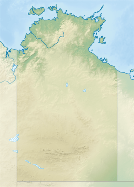
The headwaters rise east of Shadforth Hills and flows in a northerly direction through mostly uninhabited country, past the small community of Gamardi before discharging into Boucaut Bay.[2]
The catchment occupies an area of 9,219 square kilometres (3,559 sq mi) and is situated between the Liverpool River catchment to the west, the Goyder River catchment to the east and the Roper River catchment to the south.[3] It has a mean annual outflow of 1,860 gigalitres (2.433×10⁹ cu yd),[4]
The Cadell and Blyth Floodplains are located at the lower reaches of the river and occupy an area of 432 square kilometres (167 sq mi).
The estuary formed at the river mouth is tidal in nature and in near pristine condition.[5]
History
The river was named by Francis Cadell in 1867 after the Premier of South Australia, Arthur Blyth.[1]
David Lindsay charted the river in 1883 during his expedition of Arnhem Land.
Fauna
Many species of fish are found in the river including Sailfin Glassfish, Macleay's Glassfish, Barred Grunter, Fly-specked Hardyhead and Pennyfish, Goby, Flathead Goby, Empire Gudgeon, Giant Gudgeon, Empire Gudgeon, Threadfin Rainbowfish, Barramundi, Diamond Mullet, Rainbowfish, Western Rainbowfish, Black-banded Rainbowfish, Chequered Rainbowfish, Bony Bream, Black Catfish, Rendahl's Catfish, Seven-spot Archerfish.[6]
See also
References
- 1 2 "Place Names Register Extract - Blyth River". NT Place Names Register. Northern Territory Government. Retrieved 2 May 2015.
- 1 2 "Map of Blyth River, NT". Bonzle Digital Atlas of Australia. Retrieved 3 May 2015.
- ↑ "Drainage Divisions" (PDF). Commonwealth of Australia. 2005. Retrieved 3 May 2015.
- ↑ "BlythRiver" (PDF). TRaCK. 2009. Retrieved 12 May 2015.
- ↑ "Australian Catchment, River and Estuary Assessment" (PDF). Natural Heritage Trust. 2002. Retrieved 3 May 2015.
- ↑ "Blyth River catchment". Fish Atlas of North Australia. Retrieved 4 May 2015.
River systems and rivers of the Northern Territory, Australia | |
|---|---|
| Floodplains | |
| Rivers |
|
| |