Marquette Street Archaeological District
|
Marquette Street Archaeological District | |
|
Region of archaeological district | |
  | |
| Location | Near the St. Ignace Mission, St. Ignace, Michigan[1] |
|---|---|
| Coordinates | 45°52′0″N 84°44′0″W / 45.86667°N 84.73333°WCoordinates: 45°52′0″N 84°44′0″W / 45.86667°N 84.73333°W |
| Area | 6 acres (2.4 ha) |
| NRHP Reference # | 82000541[2] |
| Added to NRHP | October 29, 1982 |
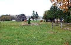
The Marquette Street Archaeological District is an archaeological site in St. Ignace, Michigan near the St. Ignace Mission. It covers 6 acres (2.4 ha) and includes one building, a village site, and a cemetery;[2] archaeological designations are 20MK82 and 20MK99. It was listed on the National Register of Historic Places in 1982.[2]
Early history

The Petun people originally lived east of Georgian Bay, but were driven by the Iroquois into what is now Wisconsin.[3] In the 1660s, the Petun were again displaced by the Sioux, and settled in what is now St. Ignace around 1670.[4] By this time, the reduction in numbers of Petun, due to disease and war, was so severe that some experts believe they were no longer culturally viable.[5]
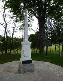
Père Jacques Marquette established his mission near the village a few years later.[4][6] The village was home to 500-800 people.[4] The Petun remained in this location until 1701, when Antoine de la Mothe Cadillac persuaded them to move south when he founded Detroit.[5]
Excavations
The site of the Petun village in St. Ignace was excavated in the 1970s,[3] and again in 1983-86, 1996–97, and 2001.[4] Excavations have shown evidence of Petun longhouses and hearths, and acculturation from exposure to nearby European settlers.[4] In particular, the Petun reused European glass and metal fragments to fashion weapons and ornaments,[4] and incorporated elements of Christian worship into their own rituals.[5] However, the Petun cultural identity remained despite their repeated displacement, reduction in numbers, and exposure to European culture and goods.[5]
References
- ↑ The NRIS gives the location of the Marquette Street Archaeological District as "Address Restricted"; however, multiple sources indicate the Petun village was near the St. Ignace Mission on the (three-block-long) Marquette Street. The geo-coordinates given are approximate.
- 1 2 3 National Park Service (2010-07-09). "National Register Information System". National Register of Historic Places. National Park Service.
- 1 2 Timothy Pauketat (2012), The Oxford Handbook of North American Archaeology Oxford Handbooks, Oxford University Press, pp. 424–425, ISBN 0195380118
- 1 2 3 4 5 6 Charles E. Orser (2002), Encyclopedia of Historical Archaeology, Psychology Press, pp. 373–364, ISBN 0415215447
- 1 2 3 4 Francis P. McManamon; Linda S. Cordell; Kent G. Lightfoot; George R. Milner (2009), Archaeology in America: Northeast and Southeast, ABC-CLIO, pp. 53–54, ISBN 0313331855
- ↑ "MICHIGAN - Dickinson County (NRIS database access)". NationalRegisterOfHistoricPlaces.com. Retrieved May 20, 2012.
Further reading
- Susan M Branstner, "Tionontate Huron Occupation at the Marquette Mission", Calumet Fleur-de-Lys: Archaeology of Indian and French Contact in the Mid-continent, Smithsonian Press: 177–201
| Topics | |
|---|---|
| Lists by states |
|
| Lists by insular areas | |
| Lists by associated states | |
| Other areas | |
| |