Manzanita, Oregon
| Manzanita, Oregon | |
|---|---|
| City | |
|
View of Manzanita and Nehalem Bay from Neahkahnie Mountain. | |
 Location in Oregon | |
| Coordinates: 45°43′9″N 123°56′9″W / 45.71917°N 123.93583°WCoordinates: 45°43′9″N 123°56′9″W / 45.71917°N 123.93583°W | |
| Country | United States |
| State | Oregon |
| County | Tillamook |
| Incorporated | 1946 |
| Government | |
| • Mayor | Garry Bullard |
| Area[1] | |
| • Total | 0.82 sq mi (2.12 km2) |
| • Land | 0.82 sq mi (2.12 km2) |
| • Water | 0 sq mi (0 km2) |
| Elevation | 78 ft (23.8 m) |
| Population (2010)[2] | |
| • Total | 598 |
| • Estimate (2012[3]) | 605 |
| • Density | 729.3/sq mi (281.6/km2) |
| Time zone | Pacific (UTC-8) |
| • Summer (DST) | Pacific (UTC-7) |
| ZIP code | 97130 |
| Area code(s) | 503 Exchange: 368 |
| FIPS code | 41-45700[4] |
| GNIS feature ID | 1123738[5] |
| Website | www.ci.manzanita.or.us |

Manzanita /ˌmænzəˈniːtə/ is a coastal city in Tillamook County, Oregon, United States. It is located on U.S. Route 101 about 25 miles (40 km) south of Seaside and 25 miles (40 km) north of Tillamook. The population was 598 at the 2010 census.
History
Manzanita was platted as a beach resort in 1912.[6] Manzanita post office was established in 1914 and named for the manzanita (Arctostaphylos sp.) plants that grow in the area.[6] Manzanita means "little apple" in Spanish.[6]
Tornado

On the morning of October 14, 2016, an EF2 tornado,[7] which had begun as a waterspout, hit Manzanita. Many buildings in the town were damaged, but no injuries were reported.[8][9] The mayor of Manzanita declared a state of emergency in response.[10]
Geography
According to the United States Census Bureau, the city has a total area of 0.82 square miles (2.12 km2), all of it land.[1]
Demographics
| Historical population | |||
|---|---|---|---|
| Census | Pop. | %± | |
| 1950 | 339 | — | |
| 1960 | 363 | 7.1% | |
| 1970 | 365 | 0.6% | |
| 1980 | 443 | 21.4% | |
| 1990 | 513 | 15.8% | |
| 2000 | 564 | 9.9% | |
| 2010 | 598 | 6.0% | |
| Est. 2015 | 622 | [11] | 4.0% |
2010 census
As of the census[2] of 2010, there were 598 people, 315 households, and 176 families residing in the city. The population density was 729.3 inhabitants per square mile (281.6/km2). There were 1,285 housing units at an average density of 1,567.1 per square mile (605.1/km2). The racial makeup of the city was 91.6% White, 1.2% African American, 0.2% Native American, 1.8% Asian, 1.2% from other races, and 4.0% from two or more races. Hispanic or Latino of any race were 6.2% of the population.
There were 315 households of which 10.8% had children under the age of 18 living with them, 50.8% were married couples living together, 3.5% had a female householder with no husband present, 1.6% had a male householder with no wife present, and 44.1% were non-families. 37.5% of all households were made up of individuals and 17.7% had someone living alone who was 65 years of age or older. The average household size was 1.89 and the average family size was 2.40.
The median age in the city was 59.9 years. 10% of residents were under the age of 18; 2.2% were between the ages of 18 and 24; 14.4% were from 25 to 44; 36.5% were from 45 to 64; and 37% were 65 years of age or older. The gender makeup of the city was 48.2% male and 51.8% female.
2000 census
As of the census[4] of 2000, there were 564 people, 307 households, and 177 families residing in the city. The population density was 759.1 people per square mile (294.3/km²). There were 1,078 housing units at an average density of 1,450.9 per square mile (562.5/km²). The racial makeup of the city was 96.45% White, 0.53% Native American, 0.89% from other races, and 2.13% from two or more races. Hispanic or Latino of any race were 1.60% of the population.
There were 307 households out of which 9.4% had children under the age of 18 living with them, 51.1% were married couples living together, 4.6% had a female householder with no husband present, and 42.3% were non-families. 38.8% of all households were made up of individuals and 18.6% had someone living alone who was 65 years of age or older. The average household size was 1.84 and the average family size was 2.33.
In the city the population was spread out with 10.8% under the age of 18, 4.3% from 18 to 24, 14.4% from 25 to 44, 36.0% from 45 to 64, and 34.6% who were 65 years of age or older. The median age was 57 years. For every 100 females there were 84.9 males. For every 100 females age 18 and over, there were 83.6 males.
The median income for a household in the city was $38,750, and the median income for a family was $43,958. Males had a median income of $30,000 versus $25,833 for females. The per capita income for the city was $26,428. About 4.9% of families and 7.2% of the population were below the poverty line, including 22.4% of those under age 18 and 4.7% of those age 65 or over.
Recreation
North County Recreation District, organizes the annual "Manzanita Beach Walk & Run". Since 1990 the event, which is used as a fundraiser for the local fitness center located in Nehalem, has been run on the beach at the foot of Neahkahnie Mountain.
Points of interest
Transportation
Notable people
- Dennis Awtrey, retired National Basketball Association player[13]
References
- 1 2 "US Gazetteer files 2010". United States Census Bureau. Retrieved 2012-12-21.
- 1 2 "American FactFinder". United States Census Bureau. Retrieved 2012-12-21.
- ↑ "Population Estimates". United States Census Bureau. Retrieved 2013-06-02.
- 1 2 "American FactFinder". United States Census Bureau. Retrieved 2008-01-31.
- ↑ "US Board on Geographic Names". United States Geological Survey. 2007-10-25. Retrieved 2008-01-31.
- 1 2 3 McArthur, Lewis A.; McArthur, Lewis L. (2003) [1928]. Oregon Geographic Names (7th ed.). Portland, Oregon: Oregon Historical Society Press. p. 608. ISBN 978-0875952772.
- ↑ Njus, Elliot (October 14, 2016). "Manzanita twister confirmed as EF2 tornado". The Oregonian. Retrieved October 15, 2016.
- ↑ Chaney, Eric (October 14, 2016). "Tornado Reported, Thousands Without Power as Storm Slams Pacific Northwest". Weather.com. Retrieved October 14, 2016.
- ↑ "Video shows waterspout off Oregon Coast". Cox Media Group/KIRO 7. October 14, 2016. Retrieved October 14, 2016.
- ↑ "The Latest: Mayor Declares Emergency After Oregon Tornado". The Associated Press/ABC News. October 14, 2016. Retrieved October 14, 2016.
- ↑ "Annual Estimates of the Resident Population for Incorporated Places: April 1, 2010 to July 1, 2015". Retrieved July 2, 2016.
- ↑ "Census of Population and Housing". Census.gov. Retrieved June 4, 2015.
- ↑ Schoenfeld, Bruce (June–July 2014). "In Praise of the American Beach Town". National Geographic Traveller.
External links
| Wikimedia Commons has media related to Manzanita, Oregon. |
Municipalities and communities of Tillamook County, Oregon, United States | ||
|---|---|---|
| Cities | 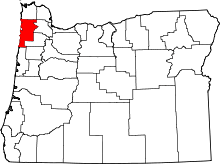 | |
| CDPs |
| |
| Unincorporated communities | ||