Malta, Montana
| Malta, Montana | |
|---|---|
| City | |
|
| |
 Location of Malta, Montana | |
| Coordinates: 48°21′20″N 107°52′17″W / 48.35556°N 107.87139°WCoordinates: 48°21′20″N 107°52′17″W / 48.35556°N 107.87139°W | |
| Country | United States |
| State | Montana |
| County | Phillips |
| Area[1] | |
| • Total | 1.06 sq mi (2.75 km2) |
| • Land | 1.06 sq mi (2.75 km2) |
| • Water | 0 sq mi (0 km2) |
| Elevation | 2,254 ft (687 m) |
| Population (2010)[2] | |
| • Total | 1,997 |
| • Estimate (2015)[3] | 1,963 |
| • Density | 1,884.0/sq mi (727.4/km2) |
| Time zone | Mountain (MST) (UTC-7) |
| • Summer (DST) | MDT (UTC-6) |
| ZIP code | 59538 |
| Area code(s) | 406 |
| FIPS code | 30-47425 |
| GNIS feature ID | 0773850 |

Malta (![]() i/ˈmɒltə/ MAL-tə) is a city in, and the county seat of, Phillips County, Montana, United States,[4] located at the intersection of U.S. Routes 2 and 191. The population was 1,997 at the 2010 census.
i/ˈmɒltə/ MAL-tə) is a city in, and the county seat of, Phillips County, Montana, United States,[4] located at the intersection of U.S. Routes 2 and 191. The population was 1,997 at the 2010 census.
History
After James Hill and his partners built the St Paul, Minneapolis, and Manitoba railway (which in 1890 became the Great Northern Railway) across Montana's "High Line" in 1887,[5] Malta evolved from rail siding number 54. What came to be Saco, Montana, to the east and Dodson, Montana, to the west grew from other nearby sidings. A post office was established in Malta in 1890. Its name is said to have been determined by a spin of the globe by a Great Northern official whose finger came to rest on the island of Malta in the Mediterranean Sea.[6]
On July 3, 1901, Kid Curry (Harvey Logan), as part of Butch Cassidy's Wild Bunch, robbed a train just west of Malta, near Wagner, Montana,[7] making off with about $40,000.[8]
One of the best preserved dinosaurs ever discovered and one of only four that were mummified is a 77-million-year-old Brachylophosaurus nicknamed Leonardo, unearthed north of Malta in 2000.[9][10] Leonardo,[11] together with brachylophosaurs Elvis[12] (1994), Roberta[13] (2003) and Peanut[14] (2002), is on display at The Great Plains Dinosaur Museum.
Two stops on The Montana Dinosaur Trail[15] are located in Malta.
- The Great Plains Dinosaur Museum and Field Station (home to the Judith River Dinosaur Institute[16])
- The Phillips County Museum and the H.G. Robinson House and Gardens[17]
Geography
Malta is located at 48°21′20″N 107°52′17″W / 48.355496°N 107.871361°W (48.355496, -107.871361).[18]
Malta is on the High Plains of Montana. The Little Rocky Mountains are located south of the town. The city's water source is the Milk River, which originates in Glacier National Park.
According to the United States Census Bureau, the city has a total area of 1.06 square miles (2.75 km2), all of it land.[1]
Malta experiences a semi-arid climate (Köppen BSk) with long, cold, dry winters and hot, wetter summers.
| Climate data for Malta, Montana | |||||||||||||
|---|---|---|---|---|---|---|---|---|---|---|---|---|---|
| Month | Jan | Feb | Mar | Apr | May | Jun | Jul | Aug | Sep | Oct | Nov | Dec | Year |
| Record high °F (°C) | 62 (17) |
74 (23) |
82 (28) |
94 (34) |
101 (38) |
106 (41) |
107 (42) |
108 (42) |
103 (39) |
90 (32) |
79 (26) |
63 (17) |
108 (42) |
| Average high °F (°C) | 22.1 (−5.5) |
31.3 (−0.4) |
44.1 (6.7) |
59.0 (15) |
69.4 (20.8) |
78.4 (25.8) |
84.6 (29.2) |
84.2 (29) |
72.2 (22.3) |
59.9 (15.5) |
39.3 (4.1) |
27.1 (−2.7) |
55.97 (13.32) |
| Daily mean °F (°C) | 10.0 (−12.2) |
18.3 (−7.6) |
30.6 (−0.8) |
44.3 (6.8) |
54.9 (12.7) |
63.9 (17.7) |
68.9 (20.5) |
67.7 (19.8) |
55.6 (13.1) |
44.2 (6.8) |
26.5 (−3.1) |
14.9 (−9.5) |
41.65 (5.35) |
| Average low °F (°C) | −2.1 (−18.9) |
5.2 (−14.9) |
17.0 (−8.3) |
29.6 (−1.3) |
40.3 (4.6) |
49.3 (9.6) |
53.2 (11.8) |
51.2 (10.7) |
39.0 (3.9) |
28.5 (−1.9) |
13.6 (−10.2) |
2.6 (−16.3) |
27.28 (−2.6) |
| Record low °F (°C) | −42 (−41) |
−44 (−42) |
−32 (−36) |
−4 (−20) |
21 (−6) |
29 (−2) |
37 (3) |
31 (−1) |
11 (−12) |
−11 (−24) |
−36 (−38) |
−45 (−43) |
−45 (−43) |
| Average precipitation inches (mm) | 0.38 (9.7) |
0.29 (7.4) |
0.59 (15) |
0.90 (22.9) |
2.24 (56.9) |
2.57 (65.3) |
1.81 (46) |
1.22 (31) |
1.19 (30.2) |
0.77 (19.6) |
0.51 (13) |
0.41 (10.4) |
12.88 (327.4) |
| Source #1: NOAA (normals, 1971–2000) [19] | |||||||||||||
| Source #2: The Weather Channel (Records) [20] | |||||||||||||
Demographics
| Historical population | |||
|---|---|---|---|
| Census | Pop. | %± | |
| 1910 | 433 | — | |
| 1920 | 1,427 | 229.6% | |
| 1930 | 1,342 | −6.0% | |
| 1940 | 2,215 | 65.1% | |
| 1950 | 2,095 | −5.4% | |
| 1960 | 2,339 | 11.6% | |
| 1970 | 2,195 | −6.2% | |
| 1980 | 2,367 | 7.8% | |
| 1990 | 2,340 | −1.1% | |
| 2000 | 2,120 | −9.4% | |
| 2010 | 1,997 | −5.8% | |
| Est. 2015 | 1,963 | [21] | −1.7% |
| U.S. Decennial Census[22][23] 2015 Estimate[3] | |||
2010 census
As of the census[2] of 2010, there were 1,997 people, 902 households, and 539 families residing in the city. The population density was 1,884.0 inhabitants per square mile (727.4/km2). There were 1,006 housing units at an average density of 949.1 per square mile (366.4/km2). The racial makeup of the city was 88.2% White, 0.1% African American, 5.5% Native American, 0.4% Asian, 0.3% from other races, and 5.7% from two or more races. Hispanic or Latino of any race were 2.0% of the population.
There were 902 households of which 26.6% had children under the age of 18 living with them, 46.8% were married couples living together, 10.0% had a female householder with no husband present, 3.0% had a male householder with no wife present, and 40.2% were non-families. 36.6% of all households were made up of individuals and 17.6% had someone living alone who was 65 years of age or older. The average household size was 2.16 and the average family size was 2.81.
The median age in the city was 46.8 years. 23.1% of residents were under the age of 18; 5.8% were between the ages of 18 and 24; 18.6% were from 25 to 44; 29.5% were from 45 to 64; and 23.2% were 65 years of age or older. The gender makeup of the city was 46.7% male and 53.3% female.
2000 census
As of the census[24] of 2000, there were 2,120 people, 907 households, and 565 families residing in the city. The population density was 2,006.1 people per square mile (772.2/km2). There were 1,067 housing units at an average density of 1,009.7 per square mile (388.7/km2). The racial makeup of the city was 92.83% White, 0.05% African American, 4.67% Native American, 0.24% Asian, 0.05% Pacific Islander, 0.19% from other races, and 1.98% from two or more races. Hispanic or Latino of any race were 1.04% of the population.
There were 907 households out of which 28.3% had children under the age of 18 living with them, 49.9% were married couples living together, 9.7% had a female householder with no husband present, and 37.6% were non-families. 33.7% of all households were made up of individuals and 18.1% had someone living alone who was 65 years of age or older. The average household size was 2.27 and the average family size was 2.90.
In the city the population was spread out with 24.7% under the age of 18, 5.8% from 18 to 24, 23.1% from 25 to 44, 24.3% from 45 to 64, and 22.1% who were 65 years of age or older. The median age was 43 years. For every 100 females there were 93.1 males. For every 100 females age 18 and over, there were 87.0 males.
The median income for a household in the city was $31,212, and the median income for a family was $41,422. Males had a median income of $30,117 versus $18,636 for females. The per capita income for the city was $16,405. About 8.8% of families and 13.1% of the population were below the poverty line, including 14.4% of those under age 18 and 8.8% of those age 65 or over.
Transportation

Media
- KMMR FM 100.1 (Country Music)
See also
References
- 1 2 "US Gazetteer files 2010". United States Census Bureau. Retrieved 2012-12-18.
- 1 2 "American FactFinder". United States Census Bureau. Retrieved 2012-12-18.
- 1 2 "Population Estimates". United States Census Bureau. Retrieved July 20, 2016.
- ↑ "Find a County". National Association of Counties. Retrieved 2011-06-07.
- ↑ Malone, Michael P.; Richard B. Roeder (1976). Montana: A History of Two Centuries, page 135. University of Washington Press. p. 352. ISBN 0-295-95520-1.
- ↑ Malta Montana Information
- ↑ Kid Curry
- ↑ Aarstad, Rich, Ellie Arguimbau, Ellen Baumler, Charlene Porsild, and Brian Shovers. Montana Place Names from Alzada to Zortman. Montana Historical Society Press.
- ↑ "Mummified" Dinosaur Discovered In Montana
- ↑ Dear Mummy: Rare fossil reveals common dinosaur's soft tissue: Science News Online, Oct. 19, 2002
- ↑ Montana Leonardo dinosaur discovery: Brachylophosaurus - Judith River Dinosaur Institute
- ↑ Brachylophosaurus Dinosaur discovery: Judith River Dinosaur Institute
- ↑ Brachylophosaurus Dinosaur - Roberta discovery: Judith River Dinosaur Institute
- ↑ Brachylophosaurus Dinosaur - Peanut discovery: Judith River Dinosaur Institute
- ↑ Follow The Montana Dinosaur Trail For Adventure
- ↑ Montana Dinosaurs - dinosaur digs: Judith River Dinosaur Institute of Montana
- ↑ Phillips County Museum and H.G. Robinson House and Gardens
- ↑ "US Gazetteer files: 2010, 2000, and 1990". United States Census Bureau. 2011-02-12. Retrieved 2011-04-23.
- ↑ "Climatography of the United States NO.81" (PDF). National Oceanic and Atmospheric Administration. Retrieved January 15, 2011.
- ↑ "Monthly Averages for Malta, MT". The Weather Channel. Retrieved January 15, 2011.
- ↑ "Annual Estimates of the Resident Population for Incorporated Places: April 1, 2010 to July 1, 2015". Retrieved July 2, 2016.
- ↑ "Census of Population and Housing". Census.gov. Retrieved June 4, 2015.
- ↑ "Census & Economic Information Center". Retrieved July 3, 2015.
- ↑ "American FactFinder". United States Census Bureau. Retrieved 2008-01-31.
Further reading
- Malone, Michael P.; Richard B. Roeder (1976). Montana: A History of Two Centuries. University of Washington Press. p. 352. ISBN 0-295-95520-1.
- Murphy, N.L., D. Trexler, and M. Thompson. 2002. Exceptional soft-tissue preservation in a mummified ornithopod dinosaur from the Campanian Lower Judith River Formation. Society of Vertebrate Paleontology meeting. Oct. 9-12. Norman, Okla.
Municipalities and communities of Phillips County, Montana, United States | ||
|---|---|---|
| City | 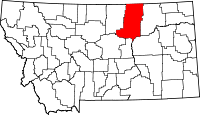 | |
| Towns | ||
| CDPs | ||
| Other unincorporated communities | ||
| Indian reservations | ||
| Footnotes | ‡This populated place also has portions in an adjacent county or counties | |