Luweero District
| Luweero District | |
|---|---|
| District | |
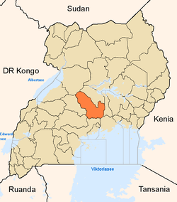 District location in Uganda | |
| Coordinates: 00°50′N 32°30′E / 0.833°N 32.500°ECoordinates: 00°50′N 32°30′E / 0.833°N 32.500°E | |
| Country |
|
| Region | Central Region of Uganda |
| Capital | Luweero |
| Area | |
| • Land | 2,217.6 km2 (856.2 sq mi) |
| Population (2014 Census) | |
| • Total | 458,158 |
| • Density | 206.6/km2 (535/sq mi) |
| Time zone | EAT (UTC+3) |
| Website |
www |
Luweero District (sometimes spelled Luwero) is a district in the Central Region of Uganda. Luweero is the site of the district headquarters.
Location
Luweero District is bordered by Nakasongola District to the north, Kayunga District to the east, Mukono District to the southeast, Wakiso District to the south, and Nakaseke District to the west. The district headquarters at Luweero are approximately 75 kilometres (47 mi), by road, north of Kampala, Uganda's capital and largest city.[1] The coordinates of the district are 00 50N, 32 30E (Latitude:0.8333; Longitude:32.500).
Overview
Luweero District was the site of a fierce insurgency by the rebel group National Resistance Army and a brutal counter-insurgency by the government of Milton Obote, known as the Luweero War or the "Bush War", that left many thousands of civilians dead during the early to mid-1980s. The area affected by the war has come to be known as the Luweero Triangle. In 2005, Nakaseke County was split from Luweero District to form Nakaseke District. Luweero District is administered by the Luweero District Administration, with headquarters at Luweero. There are several town councils within the district, each with its own urban town council:
Population
The 1991 national census estimated the population of the district at 255,400. The national census conducted in 2002 estimated the population at 341,300. In 2012, the population was estimated at 440,200.[2] The August 2014 national population census enumerated the population at 458,158.[3]
Economic activities
Agriculture is the mainstay of the district economy. It has been estimated that 85 percent of the district population are engaged in agriculture.[4]
Points of interest
The following additional points of interest are located in Luweero District:
- Main Campus of Bugema University
- Main Campus of Ndejje University
- a branch Campus of Kampala University
- Bamunanika Palace, one of the palaces of the Kabaka of Buganda, located at Bamunanika
- headquarters of the Uganda Land Forces, a unit of the Uganda People's Defence Force, located at Bombo
- Bombo Military Hospital, one of the two military hospitals in Uganda, the other being Mbuya Military Hospital
References
- ↑ "Road Distance Between Kampala and Luweero With Map". Globefeed.com. Retrieved 1 May 2014.
- ↑ "Estimated Population of Luweero District In 1991, 2002 & 2012". Cityppulation.de. Retrieved 1 May 2014.
- ↑ UBOS (27 August 2014). "The population of the regions and districts of Uganda: Luweero District". Citypopulation.de Quoting Uganda Bureau of Statistics (UBOS). Retrieved 28 August 2015.
- ↑ "The Economy of Luweero District". Uganda Travel Guide. Retrieved 1 May 2014.