Lund, Nevada
| Lund, Nevada | |
|---|---|
| Census-designated place | |
|
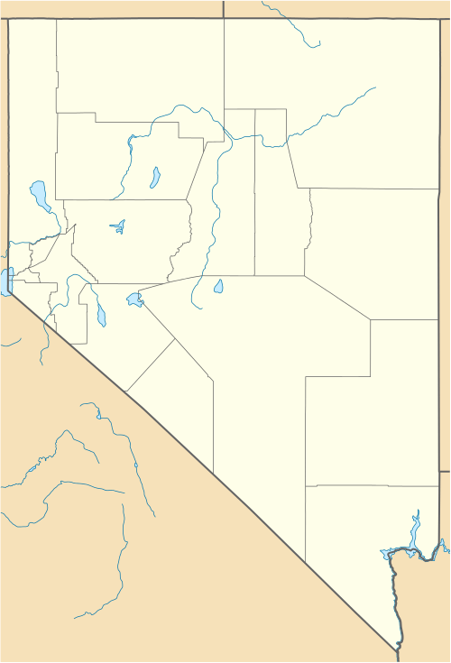
Lund from northbound Nevada State Route 318 | |
 Lund Location within the state of Nevada | |
| Coordinates: 38°51′22″N 115°0′22″W / 38.85611°N 115.00611°WCoordinates: 38°51′22″N 115°0′22″W / 38.85611°N 115.00611°W | |
| Country | United States |
| State | Nevada |
| County | White Pine |
| Area | |
| • Total | 1.7 sq mi (4.4 km2) |
| • Land | 1.7 sq mi (4.4 km2) |
| • Water | 0 sq mi (0 km2) |
| Elevation | 5,580 ft (1,700 m) |
| Population (2010) | |
| • Total | 282 |
| • Density | 170/sq mi (64/km2) |
| Time zone | Pacific (PST) (UTC-8) |
| • Summer (DST) | PDT (UTC-7) |
| ZIP codes | 89317 |
| Area code(s) | 775 |
| FIPS code | 32-43400 |
| GNIS feature ID | 0845548 |
Lund is a small town and census-designated place in White Pine County, Nevada, United States. Lund was named for Anthon H. Lund.[1] Lund was settled in 1898 on land that the United States government had given The Church of Jesus Christ of Latter-day Saints (Mormons) in lieu of land that had been confiscated under the Edmunds–Tucker Act. The first settlers were Mormons,[2] and the LDS Church still has a ward in Lund. The population of Lund as of 2010 was 282.[3]

Pioneer Joseph Smith Leavitt and family in Lund, ca. 1902
Climate
| Climate data for Lund, Nevada (Elevation 5,580ft) | |||||||||||||
|---|---|---|---|---|---|---|---|---|---|---|---|---|---|
| Month | Jan | Feb | Mar | Apr | May | Jun | Jul | Aug | Sep | Oct | Nov | Dec | Year |
| Record high °F (°C) | 68 (20) |
75 (24) |
81 (27) |
83 (28) |
94 (34) |
99 (37) |
104 (40) |
101 (38) |
95 (35) |
90 (32) |
78 (26) |
69 (21) |
104 (40) |
| Average high °F (°C) | 43.0 (6.1) |
47.1 (8.4) |
53.9 (12.2) |
61.4 (16.3) |
71.1 (21.7) |
81.3 (27.4) |
88.9 (31.6) |
86.9 (30.5) |
79.3 (26.3) |
67.7 (19.8) |
53.2 (11.8) |
44.3 (6.8) |
64.8 (18.2) |
| Average low °F (°C) | 14.6 (−9.7) |
19.2 (−7.1) |
23.7 (−4.6) |
28.9 (−1.7) |
36.5 (2.5) |
43.7 (6.5) |
50.3 (10.2) |
48.7 (9.3) |
40.9 (4.9) |
31.7 (−0.2) |
21.9 (−5.6) |
15.0 (−9.4) |
31.2 (−0.4) |
| Record low °F (°C) | −20 (−29) |
−12 (−24) |
−2 (−19) |
−3 (−19) |
13 (−11) |
23 (−5) |
33 (1) |
32 (0) |
19 (−7) |
5 (−15) |
−11 (−24) |
−18 (−28) |
−20 (−29) |
| Average precipitation inches (mm) | 0.78 (19.8) |
0.85 (21.6) |
1.00 (25.4) |
0.98 (24.9) |
0.95 (24.1) |
0.82 (20.8) |
0.69 (17.5) |
0.87 (22.1) |
0.77 (19.6) |
0.92 (23.4) |
0.69 (17.5) |
0.73 (18.5) |
10.04 (255) |
| Average snowfall inches (cm) | 3.6 (9.1) |
4.2 (10.7) |
3.8 (9.7) |
2.2 (5.6) |
0.5 (1.3) |
0 (0) |
0 (0) |
0 (0) |
0 (0) |
0.1 (0.3) |
1.6 (4.1) |
3.9 (9.9) |
19.9 (50.5) |
| Source: The Western Regional Climate Center[4] | |||||||||||||
See also
References
- ↑ Jenson, Andrew. Encyclopedic History of the Church of Jesus Christ of Latter-day Saints. (Salt Lake City: Deseret News Press, 1941) p. 452
- ↑ Hall, Shawn (1994). Romancing Nevada's Past: Ghost Towns and Historic Sites of Eureka, Lander, and White Pine Counties. Reno NV: University of Nevada Press. p. 160. ISBN 9780874172287. Retrieved 30 September 2014.
- ↑ "Geographic Identifiers: 2010 Demographic Profile Data (G001): Lund CDP, Nevada". U.S. Census Bureau, American Factfinder. Retrieved January 28, 2013.
- ↑ "Seasonal Temperature and Precipitation Information". Western Regional Climate Center. Retrieved April 6, 2013.
External links
| Wikimedia Commons has media related to Lund, Nevada. |
Municipalities and communities of White Pine County, Nevada, United States | ||
|---|---|---|
| City | 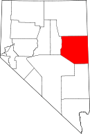 | |
| CDPs | ||
| Other unincorporated communities |
| |
| Indian reservation | ||
| Ghost towns | ||
This article is issued from Wikipedia - version of the 11/19/2016. The text is available under the Creative Commons Attribution/Share Alike but additional terms may apply for the media files.