Lučivná
| Lučivná | ||
| Municipality | ||
|
||
| Country | Slovakia | |
|---|---|---|
| Region | Prešov | |
| District | Poprad | |
| Elevation | 771 m (2,530 ft) | |
| Coordinates | 49°03′08″N 20°08′34″E / 49.05222°N 20.14278°ECoordinates: 49°03′08″N 20°08′34″E / 49.05222°N 20.14278°E | |
| Area | 18.765568 km2 (7 sq mi) | |
| Population | 978 (31 December 2010) | |
| Density | 52/km2 (135/sq mi) | |
| Postal code | 059 31 | |
| Area code | +421-52 | |
| Car plate | PP | |
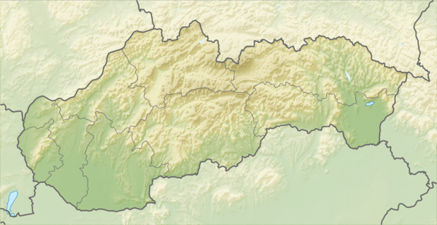 Location of Lučivná in Slovakia | ||
| Wikimedia Commons: Lučivná | ||
| Statistics: | ||
| Website: www.lucivna.sk | ||
Lučivná is a village and municipality in Poprad District in the Prešov Region of northern Slovakia.[1] It lies on the foothills oh High Tatras. It is a small spa village.
Geography
The municipality lies at an elevation of 767 metres (2,516 ft) and covers an area of 18.766 km² (7.246 mi²). It has a population of about 975 people.
History
In historical records the village was first mentioned in 1321.
Infrastructure and economy
Part of the village municipality is Lopušná dolina with a lot of recreational and sporting facilities. In the village are classical evangelical and Roman Catholic churches and a manor house.
References
- ↑ "Statistical Office of the Slovak Republic" (PDF). Výsledky SODB 2011. Štatistický úrad SR. Retrieved 9 August 2012.
External links
- http://lucivna.e-obce.sk
- http://www.tkl.sk/ Spa information for children
- http://www.vodnesvety.sk/kupele-lucivna Spa Lučivná information
- http://slovakiainn.sk/sk/index.php?page=h_uvod&hotel=3 Slovakia Inn
- http://www.kastiellucivna.sk/ Manor house homepage
Municipalities of Poprad District | ||
|---|---|---|
This article is issued from Wikipedia - version of the 7/7/2016. The text is available under the Creative Commons Attribution/Share Alike but additional terms may apply for the media files.