Long Reach, West Virginia
| Long Reach, West Virginia | |
|---|---|
| Unincorporated community | |
 Long Reach, West Virginia  Long Reach, West Virginia | |
| Coordinates: 39°29′03″N 81°05′33″W / 39.48417°N 81.09250°WCoordinates: 39°29′03″N 81°05′33″W / 39.48417°N 81.09250°W | |
| Country | United States |
| State | West Virginia |
| County | Tyler |
| Elevation | 646 ft (197 m) |
| Time zone | Eastern (EST) (UTC-5) |
| • Summer (DST) | EDT (UTC-4) |
| Area code(s) | 304 & 681 |
| GNIS feature ID | 1549794[1] |
Long Reach is an unincorporated community in Tyler County, West Virginia, United States. Long Reach is located along the Ohio River and West Virginia Route 2 2.8 miles (4.5 km) southwest of Friendly.[2]
Long Reach is located along a 17-mile (27 km) relatively straight portion stretch of the Ohio River. This is the longest and straightest stretch of the entire river.[3]
References
- ↑ "Long Reach". Geographic Names Information System. United States Geological Survey.
- ↑ Tyler County, West Virginia General Highway Map (PDF) (Map). West Virginia Department of Transportation. 2011. p. 1. Retrieved February 22, 2012.
- ↑ Hay, Jerry M. (2008). Ohio River Guidebook. Inland Waterways Books. p. 28. Retrieved 22 November 2013.
Municipalities and communities of Tyler County, West Virginia, United States | ||
|---|---|---|
| Cities | 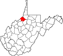 | |
| Towns | ||
| Unincorporated communities | ||
| Footnotes | ‡This populated place also has portions in an adjacent county or counties | |
This article is issued from Wikipedia - version of the 10/4/2016. The text is available under the Creative Commons Attribution/Share Alike but additional terms may apply for the media files.