List of Category A listed buildings in the Scottish Borders
This is a list of Category A listed buildings in the Scottish Borders council area in south-east Scotland.
In Scotland, the term listed building refers to a building or other structure officially designated as being of "special architectural or historic interest".[1] Category A structures are those considered to be "buildings of national or international importance, either architectural or historic, or fine little-altered examples of some particular period, style or building type."[2] Listing was begun by a provision in the Town and Country Planning (Scotland) Act 1947, and the current legislative basis for listing is the Planning (Listed Buildings and Conservation Areas) (Scotland) Act 1997.[3] The authority for listing rests with Historic Scotland, an executive agency of the Scottish Government, which inherited this role from the Scottish Development Department in 1991. Once listed, severe restrictions are imposed on the modifications allowed to a building's structure or its fittings. Listed building consent must be obtained from local authorities prior to any alteration to such a structure.[3] There are approximately 47,400 listed buildings in Scotland, of which around 8% (some 3,800) are Category A.[4]
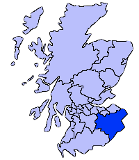
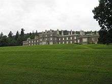
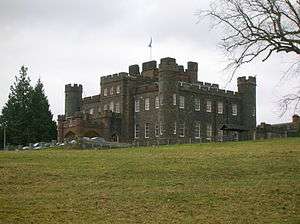
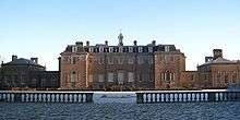
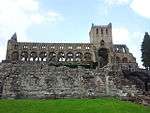
The council area of the Scottish Borders covers 4,732 square kilometres (1,827 sq mi), and has a population of around 112,400. There are 182 Category A listed buildings in the area.
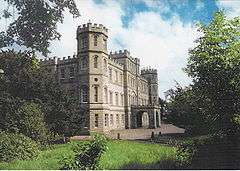
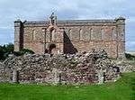
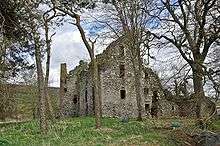
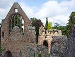
Listed buildings


Notes
- ↑ Sometimes known as OSGB36, the grid reference (where provided) is based on the British national grid reference system used by the Ordnance Survey.
• "Guide to National Grid". Ordnance Survey. Retrieved 2007-12-12.
• "Get-a-map". Ordnance Survey. Retrieved 2007-12-17. - ↑ The "HB Number" is a unique number assigned to each listed building by Historic Scotland.
- ↑ Also in England, listed at grade II*,
- ↑ Also in England, listed at grade II*,
- ↑ Also in England, listed at grade I,
- ↑ Also in England, listed at grade I,
- ↑ Also in England, listed at grade I,
References
- ↑ Guide to the Protection of Scotland’s Listed Buildings (PDF). Historic Scotland. 2009. p. 4. ISBN 978-1-84917-013-0. Retrieved 2010-05-05.
- ↑ "What is Listing?". Historic Scotland. Retrieved 2010-05-05.
- 1 2 Scottish Historic Environment Policy (PDF). Historic Scotland. October 2008. pp. 24–25. ISBN 978-1-84917-002-4. Retrieved 2010-05-05.
- ↑ Guide to the Protection of Scotland’s Listed Buildings, p. 17.
- ↑ "Torwoodlee: Listed Building Report". Historic Scotland.
- ↑ "Cranshaws Church (Church Of Scotland) Including Graveyard, Gatepiers And Gates: Listed Building Report". Historic Scotland.
- ↑ "Hermitage Castle: Listed Building Report". Historic Scotland.
- ↑ "Old Ancrum Bridge: Listed Building Report". Historic Scotland.
- ↑ "Parish Church Of St Cuthbert & Churchyard, Channelkirk: Listed Building Report". Historic Scotland.
- ↑ "Yair House: Listed Building Report". Historic Scotland.
- ↑ "Yair Bridge: Listed Building Report". Historic Scotland.
- ↑ "Ashiesteel: Listed Building Report". Historic Scotland.
- ↑ "Ashiesteel Bridge: Listed Building Report". Historic Scotland.
- ↑ "Peel Hospital: Listed Building Report". Historic Scotland.
- ↑ "Bowden Church And Graveyard: Listed Building Report". Historic Scotland.
- ↑ "The Retreat Including The Retreat Cottage, Walled Garden, Outbuilding And Sundial: Listed Building Report". Historic Scotland.
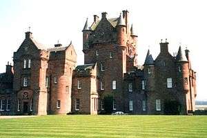
- ↑ "Ayton Castle Including Service Courtyard, Courtyard Walls And Garden Rampart Walls: Listed Building Report". Historic Scotland.
- ↑ "Ayton Castle, Dovecot: Listed Building Report". Historic Scotland.
- ↑ "Portmore: Listed Building Report". Historic Scotland.
- ↑ "Westgate Hall: Listed Building Report". Historic Scotland.
- ↑ "Crailing House: Listed Building Report". Historic Scotland.
- ↑ "Cowdenknowes: Listed Building Report". Historic Scotland.
- ↑ "Mellerstain House: Listed Building Report". Historic Scotland.
- ↑ "Stables And Cottage Block, Mellerstain: Listed Building Report". Historic Scotland.
- ↑ "Edrom, Parish Church With Graveyeard And Monuments: Listed Building Report". Historic Scotland.
- ↑ "Nisbet House, Including Walled Garden And Gardener's Cottage, Vault: Listed Building Report". Historic Scotland.
- ↑ "Nisbet Dovecot: Listed Building Report". Historic Scotland.
- ↑ "Cessford Castle: Listed Building Report". Historic Scotland.
- ↑ "Kalemouth Suspension Bridge, Over River Teviot: Listed Building Report". Historic Scotland.
- ↑ "Wedderburn Castle, Lion Gate And Boundary Walls: Listed Building Report". Historic Scotland.
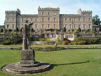
- ↑ "Manderston Including Service Court And Motor House: Listed Building Report". Historic Scotland.
- ↑ "Manderston, Stables: Listed Building Report". Historic Scotland.
- ↑ "Old Manor House (Sparrow Castle): Listed Building Report". Historic Scotland.
- ↑ "Market Cross Cockburnspath: Listed Building Report". Historic Scotland.
- ↑ "St Helen's Kirk And Kirkyard: Listed Building Report". Historic Scotland.
- ↑ "Pease Bridge: Listed Building Report". Historic Scotland.
- ↑ "Coldingham, Coldingham Priory (Church Of Scotland) Including Transept Arch, Former Hearse House And Gravedigger's Store, Graveyard, Boundary Walls, Gatepiers And Gates: Listed Building Report". Historic Scotland.
- ↑ "Lennel House: Listed Building Report". Historic Scotland.
- ↑ "The Hirsel: Listed Building Report". Historic Scotland.
- ↑ "Coldstream Bridge: Listed Building Report". Historic Scotland.
- ↑ "Cranshaws Castle Including Sundial, Covered Well And Garden Walls: Listed Building Report". Historic Scotland.
- ↑ "Coldingham, School Road, Market Cross: Listed Building Report". Historic Scotland.
- ↑ "Renton House Including Pavilions, Sundial, Quadrant Walls And Boundary Walls: Listed Building Report". Historic Scotland.
- ↑ "Duns Castle, With Screen Walls And Sundial: Listed Building Report". Historic Scotland.
- ↑ "Bughtrig House: Listed Building Report". Historic Scotland.
- ↑ "Kames House Including Cobbled Courtyard: Listed Building Report". Historic Scotland.
- ↑ "Preston Bridge: Listed Building Report". Historic Scotland.
- ↑ "Bunkle Old Kirk In Bonkyl Church Graveyard, Including Railings: Listed Building Report". Historic Scotland.
- ↑ "Ninewells Dovecot: Listed Building Report". Historic Scotland.
- ↑ "Cockburnspath Church And Graveyard: Listed Building Report". Historic Scotland.
- ↑ "Chesters House: Listed Building Report". Historic Scotland.
- ↑ "Dovecot, Knowesouth: Listed Building Report". Historic Scotland.
- ↑ "Chapel, Hermitage: Listed Building Report". Historic Scotland.
- ↑ "Chirnside, Chirnside Primary School Including Playsheds, Boundary Walls, Quadrant Walls, Gates And Gatepiers: Listed Building Report". Historic Scotland.
- ↑ "Kirkhope Tower: Listed Building Report". Historic Scotland.
- ↑ "Greenlaw, Market Cross: Listed Building Report". Historic Scotland.
- ↑ "Thirlestane Castle: Listed Building Report". Historic Scotland.
- ↑ "Walkerburn, The Kirna: Listed Building Report". Historic Scotland.
- ↑ "Walkerburn, Prefabricated Cast - Iron Urinal: Listed Building Report". Historic Scotland.
- ↑ "Longformacus House Including Ancillary Structures, Courtyard Gatepiers, Quadrant Walls, Railings, Gatepiers And Gates: Listed Building Report". Historic Scotland.
- ↑ "Longformacus House, Dovecot: Listed Building Report". Historic Scotland.
- ↑ "St Mary's Church Ladykirk: Listed Building Report". Historic Scotland.
- ↑ "West Lodge Ladykirk: Listed Building Report". Historic Scotland.
- ↑ "Tentyfoot Tower: Listed Building Report". Historic Scotland.
- ↑ "Floors Castle: Listed Building Report". Historic Scotland.
- ↑ "Hume Castle: Listed Building Report". Historic Scotland.
- ↑ "Greenlaw Church: Listed Building Report". Historic Scotland.
- ↑ "Old Market Cross In Churchyard: Listed Building Report". Historic Scotland.
- ↑ "Court House Greenlaw: Listed Building Report". Historic Scotland.
- ↑ "Castle Inn And Supporting Coach House Wings Forming Courtyard: Listed Building Report". Historic Scotland.
- ↑ "Paxton House Estate, Paxton House: Listed Building Report". Historic Scotland.
- ↑ "Foulden Tithe Barn Including Cobbled Yard And Boundary Walls: Listed Building Report". Historic Scotland.
- ↑ "Fogo Kirk, Church Of Scotland, Including Inner And Outer Graveyards, Boundary Walls And Lych Gate: Listed Building Report". Historic Scotland.
- ↑ "Fogo Bridge: Listed Building Report". Historic Scotland.
- ↑ "West Linton, Main Street, Gifford Stones House: Listed Building Report". Historic Scotland.
- ↑ "Glenmayne House,Near Galashiels: Listed Building Report". Historic Scotland.
- ↑ "Walkerburn, Galashiels Road, Stoneyhill House, Stables And Boundary Walls: Listed Building Report". Historic Scotland.
- ↑ "Springwood Estate (Springwood Caravan Park), Scott-Douglas Mausoleum: Listed Building Report". Historic Scotland.
- ↑ "Greenknowe Tower: Listed Building Report". Historic Scotland.
- ↑ "Edgerston House With Gatepiers, Terraces And Wall Garden, Birdpool, And Entrance Gates: Listed Building Report". Historic Scotland.
- ↑ "Ferniehurst Castle With Arched Gateway, Garden Walls And Outbuildings: Listed Building Report". Historic Scotland.
- ↑ "Ferniehurst Castle Visitor Centre (Former Chapel): Listed Building Report". Historic Scotland.
- ↑ "Glenburn Hall With Walled Garden, Outbuildings, Gatepiers And Railings: Listed Building Report". Historic Scotland.
- ↑ "Leithen Lodge With Lochend Arch, Outbuildings And Sundial: Listed Building Report". Historic Scotland.
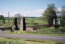
- ↑ "Union Suspension Bridge Including Pylons, Piers And Walls: Listed Building Report". Historic Scotland.
- ↑ "Eagle Lodge: Listed Building Report". Historic Scotland.
- ↑ "Branxholme Castle: Listed Building Report". Historic Scotland.
- ↑ "Swinton House, Dovecot: Listed Building Report". Historic Scotland.
- ↑ "Neidpath Castle Including Courtyard Buildings, Gateway, Former Walled Garden And Boundary Wall: Listed Building Report". Historic Scotland.
- ↑ "Drochil Castle: Listed Building Report". Historic Scotland.
- ↑ "Smailholm Tower And Barmkin: Listed Building Report". Historic Scotland.
- ↑ "Pele-House, Mervinslaw: Listed Building Report". Historic Scotland.
- ↑ "Harden: Listed Building Report". Historic Scotland.
- ↑ "Railway Viaduct, Roxburgh: Listed Building Report". Historic Scotland.
- ↑ "Abbotsford Including House, Walled Gardens And Courtyards, Conservatory, Bothies, Game Larder, Ice House, Terraces, Gate Lodge, Boundary Walls, Gardener's Cottage, Stable Block, Garden Statuary And All Other Ancillary Structures: Listed Building Report". Historic Scotland.
- ↑ "Drygrange Bridge: Listed Building Report". Historic Scotland.
- ↑ "Mertoun House: Listed Building Report". Historic Scotland.
- ↑ "Dovecote, Mertoun: Listed Building Report". Historic Scotland.
- ↑ "Dryburgh Abbey: Listed Building Report". Historic Scotland.
- ↑ "Bemersyde House: Listed Building Report". Historic Scotland.
- ↑ "Leaderfoot Viaduct (Also St Boswell's, Drygrange), British Rail Bridge Number 401/61: Listed Building Report". Historic Scotland.
- ↑ "Sundial, Lamancha: Listed Building Report". Historic Scotland.
- ↑ "The Haining, Including Railed Screen Wall And Terrace Statues: Listed Building Report". Historic Scotland.
- ↑ "The Stables, Haining: Listed Building Report". Historic Scotland.
- ↑ "Aikwood Tower: Listed Building Report". Historic Scotland.
- ↑ "Bowhill: Listed Building Report". Historic Scotland.
- ↑ "Newark Castle: Listed Building Report". Historic Scotland.
- ↑ "Neidpath Railway Viaduct (Near Neidpath Castle): Listed Building Report". Historic Scotland.
- ↑ "Newton Don: Listed Building Report". Historic Scotland.
- ↑ "Swinton House: Listed Building Report". Historic Scotland.
- ↑ "Barns Stables: Listed Building Report". Historic Scotland.
- ↑ "Stobo Castle: Listed Building Report". Historic Scotland.
- ↑ "Polwarth Church, Church Of Scotland, Including Graveyard, Boundary Walls And Gates: Listed Building Report". Historic Scotland.
- ↑ "Marchmont Estate, Marchmont House Including Garden Walls, Stairs And Sundial: Listed Building Report". Historic Scotland.
- ↑ "Marchmont Estate, Dovecot: Listed Building Report". Historic Scotland.
- ↑ "Traquair House Including Wings, Terraces, Pavilions, Courtyard Screen Walls, Gatepiers, Railings And Gates: Listed Building Report". Historic Scotland.
- ↑ "Traquair House Policies, Bear Gates And Avenue Head Cottages (4 Dwellings): Listed Building Report". Historic Scotland.
- ↑ "Kailzie, Dovecote: Listed Building Report". Historic Scotland.
- ↑ "Lessudden House: Listed Building Report". Historic Scotland.
- ↑ "Hoselaw Chapel (Church Of Scotland) Including Boundary Walls And Gate: Listed Building Report". Historic Scotland.
- ↑ "Minto House And Garden Terraces: Listed Building Report". Historic Scotland.
- ↑ "Traquair House Policies, Summerhouse: Listed Building Report". Historic Scotland.
- ↑ "The Studio (Former Bernat Klein Studio) High Sunderland: Listed Building Report". Historic Scotland.
- ↑ "Buckholm Tower: Listed Building Report". Historic Scotland.
- ↑ "Court Of Offices, Whim House: Listed Building Report". Historic Scotland.
- ↑ "Wedderlie House: Listed Building Report". Historic Scotland.
- ↑ "The Glen, House And Service Wing: Listed Building Report". Historic Scotland.
- ↑ "11 Church Street, Chester House: Listed Building Report". Historic Scotland.
- ↑ "Gunsgreen House And Terrace Retaining Wall. (Eyemouth Golf Club And Border Sailing Club): Listed Building Report". Historic Scotland.
- ↑ "Old Gala House: Listed Building Report". Historic Scotland.
- ↑ "Selkirk Road, Kingsknowes, House And Conservatory: Listed Building Report". Historic Scotland.
- ↑ "Windyknowe Road, Woodlands: Listed Building Report". Historic Scotland.
- ↑ "Tower Mill, Kirkstile: Listed Building Report". Historic Scotland.
- ↑ "Equestrian Statue, High Street: Listed Building Report". Historic Scotland.
- ↑ "Abbey Place, Newgate With Attached Wall, External Stair And Railings: Listed Building Report". Historic Scotland.
- ↑ "Canongate Bridge: Listed Building Report". Historic Scotland.
- ↑ "Castlegate, Jedburgh Castle Old Jail With Exercise Yard Walls, Fortifications, Portcullis Gates, Entrance Gates And Outer Embankment Wall: Listed Building Report". Historic Scotland.
- ↑ "Castlegate, Sheriff Court (Old County Buildings) With Front Wall And Railings: Listed Building Report". Historic Scotland.
- ↑ "3-5 (Odd Nos) Exchange Street: Listed Building Report". Historic Scotland.
- ↑ "11 Exchange Street: Listed Building Report". Historic Scotland.
- ↑ "Newcastle Road (And Oxnam Road), Old Parish Church With Gatepiers And Boundary Wall, (Church Of Scotland): Listed Building Report". Historic Scotland.
- ↑ "Pleasance, St John's Episcopal Church With Lych Gate And Boundary Wall: Listed Building Report". Historic Scotland.
- ↑ "Queen Street, Queen Mary's House With Outbuildings, Boundary Wall And Railings: Listed Building Report". Historic Scotland.
- ↑ "Abbey Row Kelso Old Parish Church: Listed Building Report". Historic Scotland.
- ↑ "Bridge Street, Ednam House Hotel: Listed Building Report". Historic Scotland.
- ↑ "Bridge Street Bridge-End Cottage: Listed Building Report". Historic Scotland.
- ↑ "Bridge Street Kelso Abbey: Listed Building Report". Historic Scotland.
- ↑ "Kelso Bridge: Listed Building Report". Historic Scotland.
- ↑ "Roxburgh Street St John's Edenside And Ednam Church Of Scotland: Listed Building Report". Historic Scotland.
- ↑ "Roxburgh Street Walton Hall, And Stable Wing: Listed Building Report". Historic Scotland.
- ↑ "Roxburgh Street Walton Hall, Entrance Gateways And Wall: Listed Building Report". Historic Scotland.
- ↑ "Roxburgh Street Floors Castle Gates And Gate Lodges: Listed Building Report". Historic Scotland.
- ↑ "Springwood Park, Gateway And Gates: Listed Building Report". Historic Scotland.
- ↑ "Teviot Bridge: Listed Building Report". Historic Scotland.
- ↑ "East High Street, Lauder Church (Church Of Scotland), Including Entrance Gates And Churchyard Wall: Listed Building Report". Historic Scotland.
- ↑ "Melrose Abbey: Listed Building Report". Historic Scotland.
- ↑ "Darnick Village Tower Road Darnick Tower: Listed Building Report". Historic Scotland.
- ↑ "Market Square, Market Cross: Listed Building Report". Historic Scotland.
- ↑ "Melrose Railway Station: Listed Building Report". Historic Scotland.
- ↑ "Waverley Road, St Helen's: Listed Building Report". Historic Scotland.
- ↑ "Cross Road, Remains Of The Cross Kirk With Boundary Walls: Listed Building Report". Historic Scotland.
- ↑ "High Street, Chambers Institution: Listed Building Report". Historic Scotland.
- ↑ "High Street, Town House: Listed Building Report". Historic Scotland.
- ↑ "Tweed Bridge: Listed Building Report". Historic Scotland.
- ↑ "Market Place, Town House, Old Sheriff Court And Boundary Walls: Listed Building Report". Historic Scotland.
- ↑ "Dunsdale Road, Ettrick Mill: Listed Building Report". Historic Scotland.
- ↑ "Ettrick Terrace, War Memorial: Listed Building Report". Historic Scotland.
- ↑ "Manderston, Boat House And Gateway: Listed Building Report". Historic Scotland.
- ↑ "Manderston, Buxley, Dairy Court: Listed Building Report". Historic Scotland.
- ↑ "Manderston, Buxley, Dairy Tower With Unicorn Stair: Listed Building Report". Historic Scotland.
- ↑ "Manderston, Buxley, Engineer's House With Gatepiers And Garden Walls: Listed Building Report". Historic Scotland.
- ↑ "Manderston, Buxley, Fire Station And Engine House With Stalk And Gatepiers: Listed Building Report". Historic Scotland.
- ↑ "Manderston, Buxley, Head Gardener's House With Outbuildings, Boundary Walls And Gateways: Listed Building Report". Historic Scotland.
- ↑ "Manderston, Pheasantry Wood, Gamekeeper's Cottage With Dovecot: Listed Building Report". Historic Scotland.
- ↑ "Manderston, Terraces To South And East, Including Ram's Horn Stair, Urns, Mercury Statue And Griffin Gate: Listed Building Report". Historic Scotland.
- ↑ "Wedderburn Castle: Listed Building Report". Historic Scotland.
- ↑ "Nisbet House, Stable And Coach House: Listed Building Report". Historic Scotland.
- ↑ "Ayton Parish Church, Church Of Scotland, Including Boundary Walls, Railings, Gatepiers, Gates And War Memorial: Listed Building Report". Historic Scotland.
- ↑ "Paxton House Estate, The Dower House (Former Factor's House): Listed Building Report". Historic Scotland.
- ↑ "Walkerburn, Galashiels Road, Stoneyhill Cottage (Former Stoneyhill Lodge) Including Boundary Wall And Gatepier: Listed Building Report". Historic Scotland.
- ↑ "Walkerburn, Galashiels Road, Sunnybrae Lodge Including Gatepiers, Stables And Boundary Walls: Listed Building Report". Historic Scotland.
- ↑ "The Glen, Lion Gateway, Garden Features And Terraces: Listed Building Report". Historic Scotland.
- ↑ "The Glen, Stable Courtyard: Listed Building Report". Historic Scotland.
- ↑ "The Glen, The Temple: Listed Building Report". Historic Scotland.
- ↑ "High Sunderland: Listed Building Report". Historic Scotland.
- ↑ "Kelso Racecourse, Grandstand: Listed Building Report". Historic Scotland.
External links
![]() Media related to Category A listed buildings in the Scottish Borders at Wikimedia Commons
Media related to Category A listed buildings in the Scottish Borders at Wikimedia Commons