Lily, Wisconsin
| Lily, Wisconsin | |
|---|---|
| Unincorporated community | |
|
| |
 Lily, Wisconsin  Lily, Wisconsin | |
| Coordinates: 45°18′25″N 88°51′14″W / 45.307°N 88.854°WCoordinates: 45°18′25″N 88°51′14″W / 45.307°N 88.854°W | |
| Country | United States |
| State | Wisconsin |
| County | Langlade |
| Elevation | 1,440 ft (440 m) |
| Time zone | Central (CST) (UTC-6) |
| • Summer (DST) | CDT (UTC-5) |
| ZIP code | 54491 |
| Area code(s) | 715 & 534 |
| GNIS feature ID | 1579653[1] |

Lily is an unincorporated community in Langlade County, Wisconsin, United States, located within the town of Langlade. Lily is at the intersection of Wisconsin State Highway 52 and Wisconsin State Highway 55.
The Town of Langlade Town Hall and Fire Department are located in Lily.
Lily is also a junction for many area snowmobile and ATV trails. The Lily Sno-Birds Clubhouse is located on Turtle Lake Road, and there is also a small racetrack located there where snowmobiles and ATVs have raced in the past. The track is currently dormant.
Images
 Looking north at the sign for Lily
 Town of Langlade town hall and fire station
References
Municipalities and communities of Langlade County, Wisconsin, United States | ||
|---|---|---|
| City | 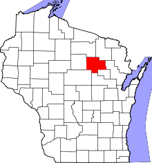 | |
| Village | ||
| Towns | ||
| CDPs | ||
| Unincorporated communities | ||
| Ghost towns |
| |
This article is issued from Wikipedia - version of the 7/29/2016. The text is available under the Creative Commons Attribution/Share Alike but additional terms may apply for the media files.