Elcho, Wisconsin
| Elcho, Wisconsin | |
|---|---|
| Town | |
|
Downtown in unincorporated Elcho | |
 Location of Elcho, Wisconsin | |
| Coordinates: 45°26′19″N 89°10′6″W / 45.43861°N 89.16833°W | |
| Country | United States |
| State | Wisconsin |
| County | Langlade |
| Area | |
| • Total | 75.2 sq mi (194.9 km2) |
| • Land | 71.4 sq mi (184.8 km2) |
| • Water | 3.9 sq mi (10.0 km2) |
| Elevation[1] | 1,608 ft (490 m) |
| Population (2000) | |
| • Total | 1,317 |
| • Density | 18.5/sq mi (7.1/km2) |
| Time zone | Central (CST) (UTC-6) |
| • Summer (DST) | CDT (UTC-5) |
| Zipcode | 54428 |
| Area code(s) | 715 & 534 |
| FIPS code | 55-23050[2] |
| GNIS feature ID | 1583142[1] |

Elcho is a town in Langlade County, Wisconsin, United States. The population was 1,317 at the 2000 census. The census-designated places of Elcho and Post Lake are located in the town.
History
A post office called Elcho has been in operation since 1887.[3] Elcho was named after a place in Scotland.[4]
Geography
According to the United States Census Bureau, the town has a total area of 75.2 square miles (194.9 km²), of which, 71.4 square miles (184.8 km²) of it is land and 3.9 square miles (10.0 km²) of it (5.16%) is water. The town is located in the geographical region of Wisconsin known as the Northern Highland.
Demographics
As of the census[2] of 2000, there were 1,317 people, 613 households, and 397 families residing in the town. The population density was 18.5 people per square mile (7.1/km²). There were 1,370 housing units at an average density of 19.2 per square mile (7.4/km²). The racial makeup of the town was 98.71% White, 0.08% African American, 0.08% Native American, 0.15% Asian, and 0.99% from two or more races. Hispanic or Latino of any race were 0.23% of the population.
There were 613 households out of which 17.5% had children under the age of 18 living with them, 56.3% were married couples living together, 5.1% had a female householder with no husband present, and 35.1% were non-families. 30.2% of all households were made up of individuals and 15.0% had someone living alone who was 65 years of age or older. The average household size was 2.15 and the average family size was 2.64.
In the town the population was spread out with 18.0% under the age of 18, 4.3% from 18 to 24, 20.5% from 25 to 44, 30.5% from 45 to 64, and 26.7% who were 65 years of age or older. The median age was 51 years. For every 100 females there were 101.7 males. For every 100 females age 18 and over, there were 100.7 males.
The median income for a household in the town was $29,010, and the median income for a family was $36,000. Males had a median income of $27,262 versus $19,327 for females. The per capita income for the town was $17,016. About 7.5% of families and 9.0% of the population were below the poverty line, including 5.7% of those under age 18 and 6.0% of those age 65 or over.
Coordinates: 45°26′09″N 89°11′00″W / 45.43583°N 89.18333°W
References
- 1 2 "US Board on Geographic Names". United States Geological Survey. 2007-10-25. Retrieved 2008-01-31.
- 1 2 "American FactFinder". United States Census Bureau. Retrieved 2008-01-31.
- ↑ "Langlade County". Jim Forte Postal History. Retrieved 17 March 2015.
- ↑ Chicago and North Western Railway Company (1908). A History of the Origin of the Place Names Connected with the Chicago & North Western and Chicago, St. Paul, Minneapolis & Omaha Railways. p. 67.
External links
- Elcho School District
- Sanborn fire insurance map: 1920
Municipalities and communities of Langlade County, Wisconsin, United States | ||
|---|---|---|
| City | 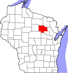 | |
| Village | ||
| Towns | ||
| CDPs | ||
| Unincorporated communities | ||
| Ghost towns |
| |