Licking, Missouri
| Licking, Missouri | |
|---|---|
| City | |
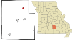 Location of Licking, Missouri | |
| Coordinates: 37°29′48″N 91°51′27″W / 37.49667°N 91.85750°WCoordinates: 37°29′48″N 91°51′27″W / 37.49667°N 91.85750°W | |
| Country | United States |
| State | Missouri |
| County | Texas |
| Area[1] | |
| • Total | 2.14 sq mi (5.54 km2) |
| • Land | 2.13 sq mi (5.52 km2) |
| • Water | 0.01 sq mi (0.03 km2) |
| Elevation | 1,263 ft (385 m) |
| Population (2010)[2] | |
| • Total | 3,124 |
| • Estimate (2012[3]) | 3,077 |
| • Density | 1,466.7/sq mi (566.3/km2) |
| Time zone | Central (CST) (UTC-6) |
| • Summer (DST) | CDT (UTC-5) |
| ZIP code | 65542 |
| Area code(s) | 573 |
| FIPS code | 29-42464[4] |
| GNIS feature ID | 0735692[5] |
Licking is a city located in Texas County, Missouri, United States. The population was 3,124 at the 2010 census.
Geography
Licking is located at 37°29′48″N 91°51′27″W / 37.49667°N 91.85750°W (37.496775, -91.857629).[6] According to the United States Census Bureau, the city has a total area of 2.14 square miles (5.54 km2), of which, 2.13 square miles (5.52 km2) is land and 0.01 square miles (0.03 km2) is water.[1]
Brief History of "The Lick"
Licking (or "Buffalo Lick," as it was originally known)[7] takes its name from a salt lick, which was alive with deer until 1835. The earliest settlers came in 1826. During the American Civil War, Licking was sometimes manned by units of the 5th Missouri State Militia.[8] During that war, the countryside was scourged by armies of both sides, and when the war was over, few homes were left standing. In 1880 a tornado nearly destroyed the town and the homes of the people living there, but by 1889 Licking was once again a thriving little town. At this time, the Licking Academy was thought to be one of the best institutions of higher learning in this part of the state.
Early in the 20th century, fires destroyed a church and several businesses. Three people died in a fire that destroyed the Collier Hotel in 1905. Around this time, Licking was the site of one of the largest stock shows in the state, with as many as 200 wagons lining the streets for this event.
The telephone became available to Licking in 1906, with long distance service not coming until 1926. The first automobile arrived in Licking in July 1911. On April 28, 1938, the first section of line was completed and energized and Licking had electricity.
Licking High School has historically been known for its skilled baseball club. The team had eight final-four appearances from 1980 to 2003, seven of which were teams coached by Byron Hagler, who is currently an assistant coach at Drury University.
Demographics
| Historical population | |||
|---|---|---|---|
| Census | Pop. | %± | |
| 1880 | 163 | — | |
| 1900 | 193 | — | |
| 1910 | 351 | 81.9% | |
| 1920 | 411 | 17.1% | |
| 1930 | 435 | 5.8% | |
| 1940 | 598 | 37.5% | |
| 1950 | 733 | 22.6% | |
| 1960 | 954 | 30.2% | |
| 1970 | 1,002 | 5.0% | |
| 1980 | 1,272 | 26.9% | |
| 1990 | 1,328 | 4.4% | |
| 2000 | 1,471 | 10.8% | |
| 2010 | 3,124 | 112.4% | |
| Est. 2015 | 3,115 | [9] | −0.3% |
2010 census
As of the census[2] of 2010, there were 3,124 people, 634 households, and 397 families residing in the city. The population density was 1,466.7 inhabitants per square mile (566.3/km2). There were 742 housing units at an average density of 348.4 per square mile (134.5/km2). The racial makeup of the city was 73.1% White, 25.6% African American, 0.6% Native American, 0.2% Asian, 0.1% from other races, and 0.4% from two or more races. Hispanic or Latino of any race were 2.2% of the population.
There were 634 households of which 31.2% had children under the age of 18 living with them, 45.1% were married couples living together, 13.4% had a female householder with no husband present, 4.1% had a male householder with no wife present, and 37.4% were non-families. 34.2% of all households were made up of individuals and 18% had someone living alone who was 65 years of age or older. The average household size was 2.33 and the average family size was 2.97.
The median age in the city was 35 years. 12.9% of residents were under the age of 18; 16.2% were between the ages of 18 and 24; 36.8% were from 25 to 44; 23.2% were from 45 to 64; and 10.8% were 65 years of age or older. The gender makeup of the city was 73.3% male and 26.7% female.
2000 census
The 2000 census[4] found that there were 1,471 people, 647 households, and 390 families residing in the city. The population density was 847.8 people per square mile (326.4/km²). There were 744 housing units at an average density of 428.8 per square mile (165.1/km²). The demographics of the city were 97.35% White, 1.70% Hispanic, 1.09% Native American, 0.07% Asian, and 0.34% from other races as stated by census.
There were 647 households within the city. 26.6% had children under the age of 18 living with them, 42.8% were married couples living together, single-mother households account for 13.6%, and 39.7% were non-families. Single-person households make up 37.1%. Citizens over the age of 65 years make up 23.5% of households. The average household size was 2.19, and the average family size was 2.85.
Census found that 22.7% of the city population were children. Adult population represented: 8.8% from 18 to 24, 22.4% from 25 to 44, 20.1% from 45 to 64, and 26.0% who were 65 years of age or older. The average median age was 41 years. For every 1 adult female, there were 17 male adults.
At the time of the 2000 census, Texas County was one of the poorer counties in the state. The median income for a household in the city was $17,576, and the median income for a family was $25,625. Males had a median income of $24,643 versus $17,153 for females. The per capita income for the city was $12,802. About 20.1% of families and 25.5% of the population were below the poverty line, including 33.4% of those under age 18 and 23.4% of those age 65 or over.
Notable residents
- Miyoshi Umeki (1929–2007), the Oscar-winning Japanese-born actress, died in Licking, where she lived with her only son.
References
- 1 2 "US Gazetteer files 2010". United States Census Bureau. Archived from the original on January 24, 2012. Retrieved 2012-07-08.
- 1 2 "American FactFinder". United States Census Bureau. Retrieved 2012-07-08.
- ↑ "Population Estimates". United States Census Bureau. Archived from the original on June 17, 2013. Retrieved 2013-05-30.
- 1 2 "American FactFinder". United States Census Bureau. Archived from the original on September 11, 2013. Retrieved 2008-01-31.
- ↑ "US Board on Geographic Names". United States Geological Survey. 2007-10-25. Retrieved 2008-01-31.
- ↑ "US Gazetteer files: 2010, 2000, and 1990". United States Census Bureau. 2011-02-12. Retrieved 2011-04-23.
- ↑ Eaton, David Wolfe (1918). How Missouri Counties, Towns and Streams Were Named. The State Historical Society of Missouri. p. 368.
- ↑ Hewett, J. (1994). Supplement to the Official records of the Union and Confederate Armies. Wilmington, NC: Broadfoot Pub. Co. , Volume 35, p. 136
- ↑ "Annual Estimates of the Resident Population for Incorporated Places: April 1, 2010 to July 1, 2015". Retrieved July 2, 2016.
- ↑ "Census of Population and Housing". Census.gov. Archived from the original on May 11, 2015. Retrieved June 4, 2015.
Municipalities and communities of Texas County, Missouri, United States | ||
|---|---|---|
| Cities | 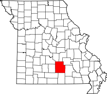 | |
| Villages | ||
| Townships |
| |
| Unincorporated communities | ||
| Footnotes | ‡This populated place also has portions in an adjacent county or counties | |