Lezerea
| Lezerea | |
| Cornish: Lysgre | |
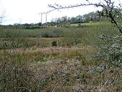 Scrub land north of Porkellis (Lezerea Farm in the background) |
|
 Lezerea |
|
| OS grid reference | SW683333 |
|---|---|
| Civil parish | Wendron |
| Unitary authority | Cornwall |
| Ceremonial county | Cornwall |
| Region | South West |
| Country | England |
| Sovereign state | United Kingdom |
| EU Parliament | South West England |
Coordinates: 50°09′14″N 5°14′42″W / 50.154°N 5.245°W
Lezerea (Cornish: Lysgre, meaning herd's ruin) is a farmstead near Wendron in Cornwall, England, UK.[1] Lezerea is in the civil parish of Wendron, situated approximately 7 miles (11 km) west of Falmouth.[1]
See also
References
Cornwall Portal | |
| Unitary authorities | |
| Major settlements |
|
| Rivers | |
| Topics | |
This article is issued from Wikipedia - version of the 1/29/2016. The text is available under the Creative Commons Attribution/Share Alike but additional terms may apply for the media files.