River Lynher
Coordinates: 50°22′44″N 4°15′50″W / 50.379°N 4.264°W
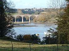

The River Lynher (Cornish: Linar)[1] (or St Germans River downstream from its confluence with the Tiddy) flows through east Cornwall, England, and enters the River Tamar at the Hamoaze, which in turn flows into Plymouth Sound.
Navigation
The normal tidal limit is a weir upstream of Notter Bridge.[2] St Germans is a historic fishing village situated on the River Tiddy just upstream of its confluence with the Lynher. The Quay Sailing Club are based at St Germans Quay. The Queen's Harbour Master for Plymouth[3] is responsible for managing navigation on the tidal Lynher and its tributaries (up to the normal tidal limits).[4]
Geography
The river is about 21 miles (34 km long), rising at a height of about 920 feet (280m) on Bodmin Moor and flowing into the Tamar Estuary near Plymouth. It has four main tributaries, the largest of which is the River Tiddy. The smaller tributaries include Deans Brook, Withey Brook, Marke Valley and Darleyford streams and Kelly Brook.[5][6]
Biology
The Lynher and its tributaries are largely used for rod and line fishing, particularly for brown trout and Atlantic salmon.
Its estuary is a designated Site of Special Scientific Interest[7] and also a Special Protection Area. Many species of animals can be found here, including the kingfisher, otter, dipper, avocet, and black-tailed godwit; the triangular club-rush (scirpus) also grows on the banks. The estuary, along with the Tamar–Tavy Estuary system and St John's Lake, form the Tamar Estuaries Complex Special Protection Area (SPA),[8] as well as forming part of the Plymouth Sound and Estuaries Special Area of Conservation (SAC).[9]
Park Wood, in the Lyhner valley 2 miles (3.2 km) south-west of Callington off the A390 road, is also designated an SSSI for its biological interest.[10]
See also
References
| Wikimedia Commons has media related to River Lynher. |
- ↑ Place-names in the Standard Written Form (SWF) : List of place-names agreed by the MAGA Signage Panel. Cornish Language Partnership.
- ↑ Ordnance Survey mapping
- ↑ Queen's Harbour Master Plymouth
- ↑ The Dockyard Port of Plymouth Order 1999
- ↑ Ordnance Survey: Landranger map sheet 201 Plymouth & Launceston ISBN 978-0-319-23146-3
- ↑ "River Catchments - LYNHER and TIDDY". Cornwall Rivers Project. Retrieved 8 November 2011.
- ↑ "Lynher Estuary" (PDF). Natural England. 1987. Retrieved 30 September 2011.
- ↑ "Tamar Estuaries Complex". Joint Nature Conservation Committee. 2001. Retrieved 11 November 2011.
- ↑ "Plymouth Sound and Estuaries". Joint Nature Conservation Committee. Retrieved 11 November 2011.
- ↑ "Park Wood" (PDF). Natural England. 1988. Retrieved 8 November 2011.
Cornwall Portal | |
| Unitary authorities | |
| Major settlements |
|
| Rivers | |
| Topics | |