Lexa, Arkansas
| Lexa, Arkansas | |
|---|---|
| Town | |
 Location in Phillips County and the state of Arkansas | |
| Coordinates: 34°35′51″N 90°45′2″W / 34.59750°N 90.75056°WCoordinates: 34°35′51″N 90°45′2″W / 34.59750°N 90.75056°W | |
| Country | United States |
| State | Arkansas |
| County | Phillips |
| Area | |
| • Total | 0.4 sq mi (1 km2) |
| • Land | 0.4 sq mi (1 km2) |
| • Water | 0 sq mi (0 km2) |
| Elevation | 213 ft (65 m) |
| Population (2010) | |
| • Total | 286 |
| • Density | 715/sq mi (286/km2) |
| Time zone | Central (CST) (UTC-6) |
| • Summer (DST) | CDT (UTC-5) |
| ZIP code | 72355 |
| Area code(s) | 870 |
| FIPS code | 05-39670 |
| GNIS feature ID | 0058063 |
Lexa is a town[1] in Phillips County, Arkansas, United States. The population was 286 at the 2010 census.
Geography
Lexa is located at 34°35′51″N 90°45′2″W / 34.59750°N 90.75056°W (34.597528, -90.750430).[2]
According to the United States Census Bureau, the city has a total area of 0.4 square miles (1.0 km2), all land.
Demographics
| Historical population | |||
|---|---|---|---|
| Census | Pop. | %± | |
| 1990 | 295 | — | |
| 2000 | 331 | 12.2% | |
| 2010 | 286 | −13.6% | |
| Est. 2015 | 255 | [3] | −10.8% |
As of the census[5] of 2000, there were 331 people, 132 households, and 97 families residing in the city. The population density was 879.8 people per square mile (336.3/km²). There were 139 housing units at an average density of 369.5/sq mi (141.2/km²). The racial makeup of the city was 71.90% White, 26.28% Black or African American, 0.60% Native American, and 1.21% from two or more races.
There were 132 households out of which 34.1% had children under the age of 18 living with them, 53.0% were married couples living together, 17.4% had a female householder with no husband present, and 26.5% were non-families. 25.8% of all households were made up of individuals and 17.4% had someone living alone who was 65 years of age or older. The average household size was 2.51 and the average family size was 2.98.
In the city the population was spread out with 26.6% under the age of 18, 5.4% from 18 to 24, 28.1% from 25 to 44, 22.4% from 45 to 64, and 17.5% who were 65 years of age or older. The median age was 40 years. For every 100 females there were 89.1 males. For every 100 females age 18 and over, there were 78.7 males.
The median income for a household in the city was $30,446, and the median income for a family was $31,339. Males had a median income of $27,361 versus $20,417 for females. The per capita income for the city was $12,168. About 13.3% of families and 17.7% of the population were below the poverty line, including 19.5% of those under age 18 and 31.4% of those age 65 or over.
Education
The Barton–Lexa School District provides early childhood, elementary and secondary education to more than 800 students in prekindergarten through grade 12 at is two schools. Students complete their studies at Barton High School.
Notable people
- Gene Bearden, born in Lexa, major league baseball player[6]
- Maudie Hopkins: last documented widow of a Confederate soldier.[7]
Climate
The climate in this area is characterized by hot, humid summers and generally mild to cool winters. According to the Köppen Climate Classification system, Lexa has a humid subtropical climate, abbreviated "Cfa" on climate maps.[8]
References
- ↑ Local.Arkansas.gov - Lexa, retrieved September 3, 2012
- ↑ "US Gazetteer files: 2010, 2000, and 1990". United States Census Bureau. 2011-02-12. Retrieved 2011-04-23.
- ↑ "Annual Estimates of the Resident Population for Incorporated Places: April 1, 2010 to July 1, 2015". Retrieved July 2, 2016.
- ↑ "Census of Population and Housing". Census.gov. Archived from the original on May 11, 2015. Retrieved June 4, 2015.
- ↑ "American FactFinder". United States Census Bureau. Archived from the original on September 11, 2013. Retrieved 2008-01-31.
- ↑ Reichler, Joseph L., ed. (1979) [1969]. The Baseball Encyclopedia (4th ed.). New York: Macmillan Publishing. ISBN 0-02-578970-8.
- ↑ Schlueter , Roger. Civil War soldier's widow lives Belleville News-Democrat August 3, 2008
- ↑ Climate Summary for Lexa, Arkansas
Municipalities and communities of Phillips County, Arkansas, United States | ||
|---|---|---|
| Cities | 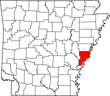 | |
| Town | ||
| Townships |
| |
| Unincorporated communities | ||