Elaine, Arkansas
| Elaine, Arkansas | |
|---|---|
| City | |
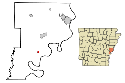 Location in Phillips County and the state of Arkansas | |
| Coordinates: 34°18′31″N 90°51′15″W / 34.30861°N 90.85417°WCoordinates: 34°18′31″N 90°51′15″W / 34.30861°N 90.85417°W | |
| Country | United States |
| State | Arkansas |
| County | Phillips |
| Area | |
| • Total | 0.5 sq mi (1.3 km2) |
| • Land | 0.5 sq mi (1.3 km2) |
| • Water | 0 sq mi (0 km2) |
| Elevation | 167 ft (51 m) |
| Population (2000) | |
| • Total | 865 |
| • Density | 1,730/sq mi (665.4/km2) |
| Time zone | Central (CST) (UTC-6) |
| • Summer (DST) | CDT (UTC-5) |
| ZIP code | 72333 |
| Area code(s) | 870 |
| FIPS code | 05-20950 |
| GNIS feature ID | 0048832 |
Elaine is a city in Phillips County, Arkansas, United States. The population was 865 at the 2000 census.
It is best known as the location of the Elaine massacre of 1919, in which an estimated 237 blacks were killed in the rural county by rampaging white mobs. This was one of the worst incidents of racial violence in American history.[1]
History
In 1919, two whites tried to break up a meeting of black sharecroppers who were trying organize a farmers' union to get better conditions of payment and accounting from white landowners of cotton plantations. After a white man was killed, hundreds of other whites poured into the area, attacking blacks. Governor Charles Hillman Brough requested federal troops to stop what was called the Elaine Race Riot. White mobs spread throughout the county, and an estimated 237 blacks were killed, and five whites. The governor accompanied the troops to the scene; their use had been approved by U.S. President Woodrow Wilson. Sharecroppers generally remained at a disadvantage in dealing with white landowners.
At 6:15 PM, April 26, 2011, a tornado – part of the April 25–28, 2011 tornado outbreak – hit the Elaine area.[2] The tornado was classified as an EF-0, with estimated wind speeds of 75 miles per hour (121 km/h; 65 kn).[2] The tornado's path of destruction was 200 yards (180 m) wide and the tornado travelled a path of 21.5 miles (34.6 km) along Highway 61 and across the Mississippi state line, ending near Lula, Mississippi.[2] Most of the tornado's damage was concentrated in Friars Point and Coahoma, Mississippi.[2]
Geography
Elaine is located at 34°18′31″N 90°51′15″W / 34.30861°N 90.85417°W (34.308595, −90.854201).[3]
According to the United States Census Bureau, the city has a total area of 0.5 square miles (1.3 km2), all land.
Demographics
| Historical population | |||
|---|---|---|---|
| Census | Pop. | %± | |
| 1920 | 377 | — | |
| 1930 | 511 | 35.5% | |
| 1940 | 634 | 24.1% | |
| 1950 | 744 | 17.4% | |
| 1960 | 898 | 20.7% | |
| 1970 | 1,210 | 34.7% | |
| 1980 | 991 | −18.1% | |
| 1990 | 846 | −14.6% | |
| 2000 | 865 | 2.2% | |
| 2010 | 636 | −26.5% | |
| Est. 2015 | 556 | [4] | −12.6% |
2014 Estimate[6] | |||
As of the census[7] of 2000, there were 865 people, 330 households, and 222 families residing in the city. The population density was 1,725.8 people per square mile (668.0/km²). There were 356 housing units at an average density of 710.3 per square mile (274.9/km²). The racial makeup of the city was 39.08% White, 58.15% Black or African American, 0.92% from other races, and 1.85% from two or more races. 6.01% of the population were Hispanic or Latino of any race. Agriculture by rice production brought in seasonal migrant laborers from Mexico and Latin America in the town, nearby Lake View and the Helena area.
There were 330 households out of which 31.8% had children under the age of 18 living with them, 34.2% were married couples living together, 30.3% had a female householder with no husband present, and 32.7% were non-families. 31.2% of all households were made up of individuals and 18.5% had someone living alone who was 65 years of age or older. The average household size was 2.62 and the average family size was 3.31.
In the city the population was spread out with 31.8% under the age of 18, 10.8% from 18 to 24, 19.5% from 25 to 44, 21.2% from 45 to 64, and 16.8% who were 65 years of age or older. The median age was 32 years. For every 100 females there were 80.2 males. For every 100 females age 18 and over, there were 73.5 males.
The median income for a household in the city was $19,479, and the median income for a family was $22,813. Males had a median income of $22,386 versus $18,056 for females. The per capita income for the city was $12,640. About 33.5% of families and 41.1% of the population were below the poverty line, including 59.1% of those under age 18 and 26.5% of those age 65 or over.
Notable people
- John Hughey, country musician
- Levon Helm, musician
- Barry Williamson, Texas politician was reared in Elaine.
Education
The Marvell–Elaine School District serves the community. Marvell Primary School and Marvell High School in Marvell serve Elaine.[8]
Previously the Elaine School District served the community. On July 1, 2006, the Elaine district merged into the Marvell district.[9] When the district existed, it operated Lucilia Wood Elementary School and Elaine High School.[10][11]
References
- ↑ "US Map of 73 years of lynching", New York Times, 10 February 2015
- 1 2 3 4 NWS Memphis Office Report
- ↑ "US Gazetteer files: 2010, 2000, and 1990". United States Census Bureau. 2011-02-12. Retrieved 2011-04-23.
- ↑ "Annual Estimates of the Resident Population for Incorporated Places: April 1, 2010 to July 1, 2015". Retrieved July 2, 2016.
- ↑ "Census of Population and Housing". Census.gov. Retrieved June 4, 2015.
- ↑ "Annual Estimates of the Resident Population for Incorporated Places: April 1, 2010 to July 1, 2014". Retrieved June 4, 2015.
- ↑ "American FactFinder". United States Census Bureau. Retrieved 2008-01-31.
- ↑ "Schools." Marvell-Elaine School District. Retrieved on March 2, 2011.
- ↑ "Consolidation/Annexations of LEA's (1983–2010)." Arkansas Department of Education. Retrieved on March 2, 2011.
- ↑ "Lucilia Wood Elementary School." Information Network of Arkansas (State of Arkansas). Retrieved on March 2, 2011. "100 College St. Elaine, AR 72333"
- ↑ "Elaine high School." Information Network of Arkansas (State of Arkansas). Retrieved on March 2, 2011. "100 College St. Elaine, AR 72333"
Municipalities and communities of Phillips County, Arkansas, United States | ||
|---|---|---|
| Cities | 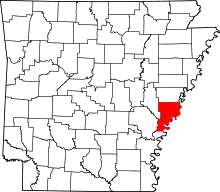 | |
| Town | ||
| Townships |
| |
| Unincorporated communities | ||