Leslie, Michigan
| Leslie, Michigan | |
|---|---|
| City | |
 Location of Leslie, Michigan | |
| Coordinates: 42°27′8″N 84°25′53″W / 42.45222°N 84.43139°W | |
| Country | United States |
| State | Michigan |
| County | Ingham |
| Area[1] | |
| • Total | 1.29 sq mi (3.34 km2) |
| • Land | 1.29 sq mi (3.34 km2) |
| • Water | 0 sq mi (0 km2) |
| Elevation | 935 ft (285 m) |
| Population (2010)[2] | |
| • Total | 1,851 |
| • Estimate (2014[3]) | 1,857 |
| • Density | 1,434.9/sq mi (554.0/km2) |
| Time zone | Eastern (EST) (UTC-5) |
| • Summer (DST) | EDT (UTC-4) |
| ZIP code | 49251 |
| Area code(s) | 517 |
| FIPS code | 26-47180[4] |
| GNIS feature ID | 0630326[5] |
Leslie is a city in Ingham County in the U.S. state of Michigan. The population was 1,851 at the 2010 census. The city is surrounded by Leslie Township, but is politically autonomous.
Geography
The city of Leslie lies just east of US 127 in Ingham County on gently rolling hills. The city is located 28 miles (45 km) directly south of Lansing, and 17 miles (27 km) directly north of Jackson. Leslie is also the home of the Meridian-Baseline State Park There are numerous creeks that flow through the city. Huntoon Creek, draining out from Huntoon Lake off of East Kinneville carves its way through downtown Leslie and by the City Little League Baseball fields.
According to the United States Census Bureau, the city has a total area of 1.29 square miles (3.34 km2), all land.[1]
History
Leslie was first settled by Elijah Woodworth in 1836, who built the first log cabin in the city. It was originally named Meekerville after a famous pioneer to the area, Benjamin Meeker. Jerry G. Cornell named the town after a prominent Leslie family in eastern New York, his home state. The name Leslie was adopted officially when a post office was assigned to the area in 1841. Leslie was later incorporated as a village in 1869, and as a city nearly 100 years later in 1968.[6]
Famous Residents
- Voltairine de Cleyre, anarchist, writer, and feminist, was born in Leslie.
- Holling Clancy Holling, children's author and illustrator of "Paddle to the Sea" and "Pagoo", graduated from Leslie High School in 1917.
- Arthur J. Tuttle, former U.S. District Judge, was born in Leslie.
- Frank L. White, who is believed to be the model for the chef on Cream of Wheat boxes, is buried in Leslie at Woodlawn Cemetery.[7]
Sports
Varsity sports offered at Leslie include: Basketball, baseball, football, golf, tennis, cross country, track, soccer and wrestling for the boys and basketball, softball, cheerleading, golf, tennis, cross country, track, soccer and volleyball for the girls.
In 2008 The Leslie Blackhawks football team played for the Division VI state championship at Ford Field, but fell short to the Montague Wildcats, 41-20. Distance running has been prominent in Leslie. An annual road race is held mid August during the annual Blackhawk Festival at the high school that runs through the outskirts of the city and finishes on the track. Leslie High School Men's cross country running teams have won 14 consecutive conference championships (1990–2003) and one Class C state championship (1993).
Education
The Leslie Public School District is a small, rural district that educates nearly 1,400 students. The new Leslie High School was built in 1996 at 4141 Hull Road which upgraded the middle school into the old high school building. The old middle school (also Leslie Public Schools on Woodworth street (which was also a high school back in the day) is now abandoned, which was about 100 years old. The school district's mascot is the Leslie Blackhawk and the school colors are orange and black. Leslie's one public school has an average sized graduating class, that ranges between 100 and 130 students.
Also located in Leslie is White Pine Academy, a public school academy that is charted by Saginaw Valley State University . White Pine Academy was founded in 1999 by a group of local parents looking for a back to the basics curriculum and small class sizes. In 2005, White Pine Academy built a new facility at 510 Russell St.
Demographics
| Historical population | |||
|---|---|---|---|
| Census | Pop. | %± | |
| 1880 | 1,113 | — | |
| 1890 | 1,058 | −4.9% | |
| 1900 | 1,114 | 5.3% | |
| 1910 | 1,032 | −7.4% | |
| 1920 | 1,089 | 5.5% | |
| 1930 | 1,105 | 1.5% | |
| 1940 | 1,281 | 15.9% | |
| 1950 | 1,543 | 20.5% | |
| 1960 | 1,807 | 17.1% | |
| 1970 | 1,894 | 4.8% | |
| 1980 | 2,110 | 11.4% | |
| 1990 | 1,872 | −11.3% | |
| 2000 | 2,044 | 9.2% | |
| 2010 | 1,851 | −9.4% | |
| Est. 2015 | 1,866 | [8] | 0.8% |
2010 census
As of the census[2] of 2010, there were 1,851 people, 690 households, and 490 families residing in the city. The population density was 1,434.9 inhabitants per square mile (554.0/km2). There were 803 housing units at an average density of 622.5 per square mile (240.3/km2). The racial makeup of the city was 96.5% White, 0.9% African American, 0.3% Native American, 0.5% Asian, 0.2% from other races, and 1.5% from two or more races. Hispanic or Latino of any race were 2.6% of the population.
There were 690 households of which 38.1% had children under the age of 18 living with them, 50.3% were married couples living together, 13.5% had a female householder with no husband present, 7.2% had a male householder with no wife present, and 29.0% were non-families. 23.3% of all households were made up of individuals and 7.7% had someone living alone who was 65 years of age or older. The average household size was 2.64 and the average family size was 3.08.
The median age in the city was 35.7 years. 28.5% of residents were under the age of 18; 7% were between the ages of 18 and 24; 28.8% were from 25 to 44; 26.1% were from 45 to 64; and 9.7% were 65 years of age or older. The gender makeup of the city was 49.3% male and 50.7% female.
2000 census
As of the census[4] of 2000, there were 2,044 people, 734 households, and 518 families residing in the city. The population density was 1,535.6 per square mile (593.4/km²). There were 783 housing units at an average density of 588.3 per square mile (227.3/km²). The racial makeup of the city was 96.04% White, 0.39% African American, 0.29% Native American, 0.68% Asian, 0.05% Pacific Islander, 0.98% from other races, and 1.57% from two or more races. Hispanic or Latino of any race were 3.38% of the population.
There were 734 households out of which 39.8% had children under the age of 18 living with them, 52.3% were married couples living together, 12.9% had a female householder with no husband present, and 29.4% were non-families. 24.5% of all households were made up of individuals and 9.8% had someone living alone who was 65 years of age or older. The average household size was 2.76 and the average family size was 3.31.
In the city the population was spread out with 31.4% under the age of 18, 9.1% from 18 to 24, 31.4% from 25 to 44, 19.4% from 45 to 64, and 8.6% who were 65 years of age or older. The median age was 32 years. For every 100 females there were 94.1 males. For every 100 females age 18 and over, there were 93.4 males.
The median income for a household in the city was $42,700, and the median income for a family was $48,162. Males had a median income of $36,771 versus $22,600 for females. The per capita income for the city was $18,124. About 4.9% of families and 7.5% of the population were below the poverty line, including 8.7% of those under age 18 and 4.9% of those age 65 or over.
Notable person
- Arthur J. Tuttle, former U.S. District Judge
- Voltairine de Cleyre, anarchist
References
- 1 2 "US Gazetteer files 2010". United States Census Bureau. Archived from the original on January 24, 2012. Retrieved 2012-11-25.
- 1 2 "American FactFinder". United States Census Bureau. Retrieved 2012-11-25.
- ↑ "Population Estimates". United States Census Bureau. Retrieved 2015-05-22.
- 1 2 "American FactFinder". United States Census Bureau. Archived from the original on September 11, 2013. Retrieved 2008-01-31.
- ↑ "US Board on Geographic Names". United States Geological Survey. 2007-10-25. Retrieved 2008-01-31.
- ↑ Rolly Olney, Leslie City Manager, information received January 8, 2006.
- ↑ "'Cream of Wheat' man finally gets a tombstone". Associated Press. 2007-06-15. Retrieved 2008-12-11.
- ↑ "Annual Estimates of the Resident Population for Incorporated Places: April 1, 2010 to July 1, 2015". Retrieved July 2, 2016.
- ↑ "Census of Population and Housing". Census.gov. Archived from the original on May 11, 2015. Retrieved June 4, 2015.
External links
Municipalities and communities of Ingham County, Michigan, United States | ||
|---|---|---|
| Cities | 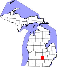 | |
| Villages | ||
| Charter townships | ||
| General law townships | ||
| CDPs | ||
| Other unincorporated communities | ||
| Footnotes | ‡This populated place also has portions in an adjacent county or counties | |
Coordinates: 42°27′05″N 84°25′57″W / 42.45139°N 84.43250°W