Leitersburg, Maryland
| Leitersburg, Maryland | |
|---|---|
| CDP | |
 | |
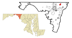 Location of Leitersburg, Maryland | |
| Coordinates: 39°41′40″N 77°37′16″W / 39.69444°N 77.62111°WCoordinates: 39°41′40″N 77°37′16″W / 39.69444°N 77.62111°W | |
| Country | United States |
| State | Maryland |
| County | Washington |
| Area | |
| • Total | 1.8 sq mi (4.6 km2) |
| • Land | 1.8 sq mi (4.6 km2) |
| • Water | 0.0 sq mi (0.0 km2) |
| Elevation | 594 ft (181 m) |
| Population (2000) | |
| • Total | 523 |
| • Density | 297.3/sq mi (114.8/km2) |
| Time zone | Eastern (EST) (UTC-5) |
| • Summer (DST) | EDT (UTC-4) |
| FIPS code | 24-46400 |
| GNIS feature ID | 0590653 |
Leitersburg is a census-designated place (CDP) in Washington County, Maryland, United States. The population was 523 at the 2000 census.
History
Bell-Varner House, Huckleberry Hall, and Leitersburg Historic District are listed on the National Register of Historic Places.[1]
Geography
Leitersburg is located at 39°41′40″N 77°37′16″W / 39.69444°N 77.62111°W (39.694309, -77.621063).[2]
According to the United States Census Bureau, the CDP has a total area of 1.8 square miles (4.7 km2), all of it land.
Demographics
As of the census[3] of 2000, there were 523 people, 218 households, and 163 families residing in the CDP. The population density was 297.3 people per square mile (114.7/km²). There were 226 housing units at an average density of 128.5/sq mi (49.6/km²). The racial makeup of the CDP was 97.13% White, 0.96% African American, 0.19% Asian, 1.34% from other races, and 0.38% from two or more races. Hispanic or Latino of any race were 1.72% of the population.
There were 218 households out of which 27.5% had children under the age of 18 living with them, 63.8% were married couples living together, 5.0% had a female householder with no husband present, and 24.8% were non-families. 21.1% of all households were made up of individuals and 8.7% had someone living alone who was 65 years of age or older. The average household size was 2.38 and the average family size was 2.70.
In the CDP the population was spread out with 20.5% under the age of 18, 5.4% from 18 to 24, 28.7% from 25 to 44, 28.1% from 45 to 64, and 17.4% who were 65 years of age or older. The median age was 42 years. For every 100 females there were 100.4 males. For every 100 females age 18 and over, there were 99.0 males.
The median income for a household in the CDP was $44,135, and the median income for a family was $43,929. Males had a median income of $30,735 versus $19,800 for females. The per capita income for the CDP was $22,662. None of the families and 5.8% of the population were living below the poverty line, including no under eighteens and 9.6% of those over 64.
References
- ↑ National Park Service (2010-07-09). "National Register Information System". National Register of Historic Places. National Park Service.
- ↑ "US Gazetteer files: 2010, 2000, and 1990". United States Census Bureau. 2011-02-12. Retrieved 2011-04-23.
- ↑ "American FactFinder". United States Census Bureau. Retrieved 2008-01-31.
Municipalities and communities of Washington County, Maryland, United States | ||
|---|---|---|
| City | 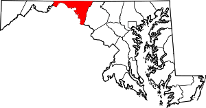 | |
| Towns | ||
| CDPs |
| |
| Other communities | ||