Latham, Kansas
| Latham, Kansas | |
|---|---|
| City | |
|
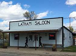
Latham saloon and restaurant, Latham, Kansas | |
 Location within Butler County and Kansas | |
 KDOT map of Butler County (legend) | |
| Coordinates: 37°32′7″N 96°38′30″W / 37.53528°N 96.64167°WCoordinates: 37°32′7″N 96°38′30″W / 37.53528°N 96.64167°W | |
| Country | United States |
| State | Kansas |
| County | Butler |
| Area[1] | |
| • Total | 0.25 sq mi (0.65 km2) |
| • Land | 0.25 sq mi (0.65 km2) |
| • Water | 0 sq mi (0 km2) |
| Elevation | 1,473 ft (449 m) |
| Population (2010)[2] | |
| • Total | 139 |
| • Estimate (2015)[3] | 138 |
| • Density | 560/sq mi (210/km2) |
| Time zone | Central (CST) (UTC-6) |
| • Summer (DST) | CDT (UTC-5) |
| ZIP code | 67072 |
| Area code | 620 |
| FIPS code | 20-38775 [4] |
| GNIS feature ID | 0485486 [5] |
Latham is a city in Butler County, Kansas, United States. As of the 2010 census, the city population was 139.[6]
History
Latham was laid out in 1885.[7] It may have been named for Latham Young, a railroad official.[8]
A post office was opened in Bodock (an extinct town) in 1883, but it was moved to Latham in 1885.[9]
The first newspaper in Latham was founded in 1901.[10]
Geography
Latham is located at 37°32′7″N 96°38′30″W / 37.53528°N 96.64167°W (37.535363, -96.641781).[11] According to the United States Census Bureau, the city has a total area of 0.25 square miles (0.65 km2), all of it land.[1]
Demographics
| Historical population | |||
|---|---|---|---|
| Census | Pop. | %± | |
| 1890 | 268 | — | |
| 1910 | 364 | — | |
| 1920 | 334 | −8.2% | |
| 1930 | 291 | −12.9% | |
| 1940 | 307 | 5.5% | |
| 1950 | 218 | −29.0% | |
| 1960 | 203 | −6.9% | |
| 1970 | 156 | −23.2% | |
| 1980 | 148 | −5.1% | |
| 1990 | 160 | 8.1% | |
| 2000 | 164 | 2.5% | |
| 2010 | 139 | −15.2% | |
| Est. 2015 | 138 | [3] | −0.7% |
| U.S. Decennial Census | |||
2010 census
As of the census[2] of 2010, there were 139 people, 61 households, and 36 families residing in the city. The population density was 556.0 inhabitants per square mile (214.7/km2). There were 82 housing units at an average density of 328.0 per square mile (126.6/km2). The racial makeup of the city was 96.4% White, 1.4% Native American, and 2.2% from two or more races. Hispanic or Latino of any race were 2.2% of the population.
There were 61 households of which 31.1% had children under the age of 18 living with them, 42.6% were married couples living together, 9.8% had a female householder with no husband present, 6.6% had a male householder with no wife present, and 41.0% were non-families. 37.7% of all households were made up of individuals and 6.5% had someone living alone who was 65 years of age or older. The average household size was 2.28 and the average family size was 2.86.
The median age in the city was 43.3 years. 26.6% of residents were under the age of 18; 4.4% were between the ages of 18 and 24; 20.9% were from 25 to 44; 35.3% were from 45 to 64; and 12.9% were 65 years of age or older. The gender makeup of the city was 51.1% male and 48.9% female.
2000 census
As of the census[4] of 2000, there were 164 people, 65 households, and 41 families residing in the city. The population density was 682.8 people per square mile (263.8/km²). There were 81 housing units at an average density of 337.2 per square mile (130.3/km²). The racial makeup of the city was 93.90% White, 0.61% Native American, and 5.49% from two or more races. Hispanic or Latino of any race were 0.61% of the population.
There were 65 households out of which 33.8% had children under the age of 18 living with them, 52.3% were married couples living together, 7.7% had a female householder with no husband present, and 35.4% were non-families. 32.3% of all households were made up of individuals and 10.8% had someone living alone who was 65 years of age or older. The average household size was 2.52 and the average family size was 3.17.
In the city the population was spread out with 34.1% under the age of 18, 6.1% from 18 to 24, 30.5% from 25 to 44, 20.1% from 45 to 64, and 9.1% who were 65 years of age or older. The median age was 32 years. For every 100 females there were 105.0 males. For every 100 females age 18 and over, there were 116.0 males.
The median income for a household in the city was $35,417, and the median income for a family was $42,292. Males had a median income of $33,750 versus $25,536 for females. The per capita income for the city was $13,385. About 12.8% of families and 21.7% of the population were below the poverty line, including 33.3% of those under the age of eighteen and 66.7% of those sixty five or over.
Further reading
References
- 1 2 "US Gazetteer files 2010". United States Census Bureau. Retrieved 2012-07-06.
- 1 2 "American FactFinder". United States Census Bureau. Retrieved 2012-07-06.
- 1 2 "Annual Estimates of the Resident Population for Incorporated Places: April 1, 2010 to July 1, 2015". Retrieved July 2, 2016.
- 1 2 "American FactFinder". United States Census Bureau. Retrieved 2008-01-31.
- ↑ "US Board on Geographic Names". United States Geological Survey. 2007-10-25. Retrieved 2008-01-31.
- ↑ "2010 City Population and Housing Occupancy Status". U.S. Census Bureau. Retrieved March 6, 2011.
- ↑ Mooney, Vol. P. (1916). History of Butler County Kansas. Standard Publishing Company. p. 225.
- ↑ "Profile for Latham, Kansas". ePodunk. Retrieved 5 June 2014.
- ↑ "Kansas Post Offices, 1828-1961 (archived)". Kansas Historical Society. Archived from the original on October 9, 2013. Retrieved 5 June 2014.
- ↑ Kansas State Historical Society (1916). Biennial Report of the Board of Directors of the Kansas State Historical Society. Kansas State Printing Plant. p. 152.
- ↑ "US Gazetteer files: 2010, 2000, and 1990". United States Census Bureau. 2011-02-12. Retrieved 2011-04-23.
External links
| Wikimedia Commons has media related to Latham, Kansas. |
- City
- Schools
- USD 205, local school district
- Maps
- Latham City Map, KDOT
Municipalities and communities of Butler County, Kansas, United States | ||
|---|---|---|
| Cities |  | |
| CDP | ||
| Unincorporated communities | ||
| Ghost towns | ||
| Townships | ||
| Footnotes | ‡This populated place also has portions in an adjacent county or counties | |