Lac-Nilgaut, Quebec
| Lac-Nilgaut | |
|---|---|
| Unorganized territory | |
 Location within Pontiac RCM. | |
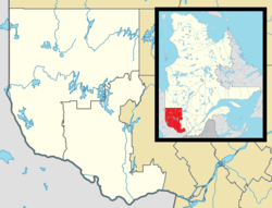 Lac-Nilgaut Location in western Quebec. | |
| Coordinates: 46°36′N 77°15′W / 46.600°N 77.250°WCoordinates: 46°36′N 77°15′W / 46.600°N 77.250°W[1] | |
| Country |
|
| Province |
|
| Region | Outaouais |
| RCM | Pontiac |
| Constituted | January 1, 1986 |
| Government[2] | |
| • Federal riding | Pontiac |
| • Prov. riding | Pontiac |
| Area[2][3] | |
| • Total | 9,851.50 km2 (3,803.69 sq mi) |
| • Land | 9,070.65 km2 (3,502.20 sq mi) |
| Population (2011)[3] | |
| • Total | 0 |
| • Density | 0.0/km2 (0/sq mi) |
| • Pop (2006–11) |
|
| • Dwellings | 1 |
| Time zone | EST (UTC−5) |
| • Summer (DST) | EDT (UTC−4) |
| Postal Code | J0X |
Lac-Nilgaut is a vast unorganized territory in the Outaouais region, Quebec, Canada. With a surface area of 9,851 square kilometres (3,803 sq mi), it takes up over 70% of the northern portion of the Pontiac Regional County Municipality.
Demographics
| Historical Census Data - Lac-Nilgaut, Quebec[4] | ||||||||||||||||||||||||||
|---|---|---|---|---|---|---|---|---|---|---|---|---|---|---|---|---|---|---|---|---|---|---|---|---|---|---|
|
|
| ||||||||||||||||||||||||
See also
References
- ↑ Reference number 149853 of the Commission de toponymie du Québec (French)
- 1 2 "Lac-Nilgaut". Répertoire des municipalités (in French). Ministère des Affaires municipales, des Régions et de l'Occupation du territoire. Retrieved 2012-04-02.
- 1 2 "Lac-Nilgaut census profile". 2011 Census of Population. Statistics Canada. Retrieved 2012-04-02.
- ↑ Statistics Canada: 1996, 2001, 2006, 2011 census
 |
Réservoir-Dozois | | ||
| Les Lacs-du-Témiscamingue | |
Lac-Pythonga | ||
| ||||
| | ||||
| Rapides-des-Joachims | Sheenboro, Chichester, Waltham, Mansfield-et-Pontefract, Otter Lake | Cayamant, Alleyn-et-Cawood |
| Municipalities | |
|---|---|
| Townships | |
| Villages | |
| Unorganized territories | |
| |
This article is issued from Wikipedia - version of the 1/7/2015. The text is available under the Creative Commons Attribution/Share Alike but additional terms may apply for the media files.