Križevci, Croatia
| Križevci | |
|---|---|
| Town | |
|
Križevci Greek Catholic Cathedral | |
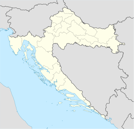 Križevci Location of Križevci in Croatia | |
| Coordinates: 46°01′33″N 16°32′33″E / 46.02583°N 16.54250°ECoordinates: 46°01′33″N 16°32′33″E / 46.02583°N 16.54250°E | |
| Country |
|
| County |
|
| Government | |
| • Mayor | Branko Hrg (HSS) |
| Area | |
| • Town | 263.72 km2 (101.82 sq mi) |
| Elevation | 140 m (460 ft) |
| Population (2011)[1] | |
| • Town | 21,122 |
| • Density | 80/km2 (210/sq mi) |
| • Urban | 11,231 |
| Time zone | CET (UTC+1) |
| • Summer (DST) | CEST (UTC+2) |
| Postal code | 48260 |
| Area code(s) | 048 |
| Vehicle registration | KŽ |
| Website | http://www.krizevci.hr/ |

Križevci (Croatian pronunciation: [krǐːʒeːʋt͡si]; Latin: Crisium, Hungarian: Kőrös [ˈkøːrøʃ], German: Kreutz [kʁɔʏ̯t͡s]) is a town in central Croatia with a total population of 21,122 and with 11,231 in the city itself (2011),[1] the oldest town in its county, the Koprivnica-Križevci County.
History
.JPG)

The first mention of the so-called Upper Križevac was from 1193 by Béla III, obtaining the status of Royal Borough[2] in 1252 by the ban Stephan which was confirmed by King Béla IV a year later. The so-called Lower Križevac developed somewhat slower than its twin town: it became a free royal town in 1405, thanks to king Sigismund.
Bloody Sabor of Križevci (Croatian: Krvavi Sabor u Križevcima) was organised killing of the Croatian ban Stjepan Lacković and his followers by king Holy Roman Emperor Sigismund, on 27 February 1397.[3]
Križevac was the birthplace of a Catholic priest Marko who died at the hand of Calvinists in Košice in 1619, and was subsequently canonized because of his martyrdom. This event is commemorated every September 7 in Križevci.
After centuries of division, empress Maria Theresa of Austria united the Lower and Upper Križevac into Križevci in 1752 (the word Križevci is plural of Križevac). The town was also hit by the wars with the Turks, but it regained importance in 1871 when the railway was built through it on the way from Budapest to Rijeka.
In the late 19th century and early 20th century, Križevci was a district capital in the Bjelovar-Križevci County of the Kingdom of Croatia-Slavonia.
These days the town is pretty much oriented towards mass entrepreneurship, but it still enjoys the greatest number of valuable and oldest monuments in the county (both in the town and its surroundings).
Križevci has nine churches (seven Catholic, a Serbian Orthodox and a Greek Catholic), some of them built in the Middle Ages. In the oldest Gothic Church of Saint Cross in Križevci, there are important Baroque pictures and a marble altar dating from the 18th century (by Francesco Robba). Also interesting is the parish church of St. Anne from the 17th century.
Of particular note is the Greek Catholic Cathedral of the Holy Trinity, the seat of the Eparchy of Križevci since 1789. The cathedral building was worked on by some of Zagreb's finest architects: its facade was rebuilt by Bartol Felbinger in 1817 while an internal reconstruction was performed in the Gothic revival style by Hermann Bolle in 1892-97. The iconostasis and the pictures on the walls are works of famous Croatian painters including Ivan Tišov, Celestin Medović and Bela Čikoš-Sesija.
Križevci Synagogue was built in 1895 and today serves as a youth center. The city museum exhibits a rich archeological, ethnographic and cultural-historical collection.
The main town manifestation is called Križevačko veliko spravišče, commemorated yearly, when the local cultural traditions are displayed during a fiesta that lasts throughout the first full weekend of July. According to legend, this feast originates from a 14th-century feast of reconciliation between the previously hostile communities of merchants from the towns of Križevac and the nobility from the nearby Kalnik hillside.
Geography
Križevci is a city in Koprivnica-Križevci County. Because of its nearness to Zagreb (57 km), Križevci is developing like a satellite city. It has a good position because it's close to all regional centers: Koprivnica (31 km), Bjelovar (33 km) and Varaždin (48 km). Very important fact for establishing the city was its macro traffical position. This place was known already in antics and Middle Ages because that was where the main caravan roads crossed, and there was a famous king's Coloman road that was going through Križevci. That road was connecting Pannonia and Dalmatia. In its closer past, many roads and other types of traffic connections were built: Many macadamic roads that connects Posavina, region around Kalnik and Podravina (there were all already finished in the 18th century), the railroad from Hungary to Zagreb, that goes through Koprivnica and Križevci (1870.), and to Bjelovar (1894). Today, city is still important because it connects Bjelovar and Koprivnica, big regional centers, and because it's the place where many regional roads starts from direction of Bjelovar, Gornja Rijeka and Sudovec, valley of the river Bednja, zelinsko prigorje over Čanjevo and from Rasinja over Apatovec. Križevci lies on 140 m above the level of the sea, where the southern part of Kalnik begins.
Topographically, it lies on pleistocene surface, between swamped alluvial valleys of the brook Vrtlin from the east and the brook Koruska from the west. Relief, geological-petrografical structure, convenient climate and abundance of water, all these were elements of economical and demographic development of the city. Modern demographic-economical transformation has changed relations in space and structure of population, and it's seeable through processes of deagrarization, industrialization and deruralization. This effected with abandonning agricultural production, abandonning villages and moving to Križevci.
Climate
| Climate data for Križevci, Croatia (1971–2000, extremes 1961–2014) | |||||||||||||
|---|---|---|---|---|---|---|---|---|---|---|---|---|---|
| Month | Jan | Feb | Mar | Apr | May | Jun | Jul | Aug | Sep | Oct | Nov | Dec | Year |
| Record high °C (°F) | 16.8 (62.2) |
21.7 (71.1) |
25.2 (77.4) |
29.6 (85.3) |
32.7 (90.9) |
35.1 (95.2) |
37.6 (99.7) |
38.5 (101.3) |
33.5 (92.3) |
27.9 (82.2) |
23.9 (75) |
21.6 (70.9) |
38.5 (101.3) |
| Average high °C (°F) | 2.9 (37.2) |
6.0 (42.8) |
11.2 (52.2) |
15.7 (60.3) |
20.8 (69.4) |
23.8 (74.8) |
25.9 (78.6) |
25.7 (78.3) |
21.5 (70.7) |
15.4 (59.7) |
8.3 (46.9) |
3.9 (39) |
15.1 (59.2) |
| Daily mean °C (°F) | −0.3 (31.5) |
1.7 (35.1) |
6.0 (42.8) |
10.2 (50.4) |
15.0 (59) |
18.1 (64.6) |
19.9 (67.8) |
19.2 (66.6) |
15.1 (59.2) |
9.8 (49.6) |
4.4 (39.9) |
0.8 (33.4) |
10.0 (50) |
| Average low °C (°F) | −3.6 (25.5) |
−2.5 (27.5) |
0.9 (33.6) |
4.5 (40.1) |
9.0 (48.2) |
12.3 (54.1) |
13.8 (56.8) |
13.4 (56.1) |
9.8 (49.6) |
5.2 (41.4) |
0.8 (33.4) |
−2.3 (27.9) |
5.1 (41.2) |
| Record low °C (°F) | −25.5 (−13.9) |
−22.6 (−8.7) |
−18.7 (−1.7) |
−5 (23) |
−3 (27) |
0.5 (32.9) |
4.0 (39.2) |
2.4 (36.3) |
−2.0 (28.4) |
−7 (19) |
−17.2 (1) |
−21 (−6) |
−25.5 (−13.9) |
| Average precipitation mm (inches) | 39.1 (1.539) |
40.1 (1.579) |
46.3 (1.823) |
57.5 (2.264) |
75.2 (2.961) |
90.4 (3.559) |
76.0 (2.992) |
70.5 (2.776) |
75.5 (2.972) |
75.5 (2.972) |
79.0 (3.11) |
60.9 (2.398) |
785.9 (30.941) |
| Average precipitation days (≥ 0.1 mm) | 9.0 | 8.6 | 9.9 | 12.2 | 12.2 | 13.3 | 10.6 | 9.8 | 10.4 | 11.0 | 11.2 | 10.6 | 128.9 |
| Average snowy days (≥ 1.0 cm) | 11.2 | 8.9 | 2.7 | 0.1 | 0.0 | 0.0 | 0.0 | 0.0 | 0.0 | 0.0 | 3.0 | 7.1 | 33.0 |
| Average relative humidity (%) | 84.7 | 78.4 | 72.0 | 69.6 | 71.9 | 73.5 | 73.8 | 76.7 | 81.3 | 83.9 | 85.8 | 87.0 | 78.2 |
| Mean monthly sunshine hours | 58.9 | 101.7 | 142.6 | 171.0 | 232.5 | 237.0 | 282.1 | 260.4 | 192.0 | 127.1 | 66.0 | 49.6 | 1,920.9 |
| Percent possible sunshine | 24 | 39 | 43 | 46 | 54 | 55 | 64 | 64 | 56 | 44 | 30 | 25 | 48 |
| Source: Croatian Meteorological and Hydrological Service[4][5] | |||||||||||||
Demographics
According to the 2011 census, Croats form an absolute majority at 96.6% with Serbs making up for 2.1% of the population.[6]
The list of settlements in the administrative area of Križevci is:[1]
- Apatovec, population 350
- Beketinec, population 38
- Bojnikovec, population 219
- Bukovje Križevačko, population 316
- Carevdar, population 438
- Cubinec, population 546
- Čabraji, population 153
- Dijankovec, population 188
- Doljanec, population 53
- Donja Brčkovčina, population 165
- Donja Glogovnica, population 129
- Donji Dubovec, population 34
- Đurđic, population 267
- Erdovec, population 207
- Gornja Brčkovčina, population 160
- Gornja Glogovnica, population 115
- Gornji Dubovec, population 8
- Gračina, population 209
- Ivanec Križevački, population 308
- Jarčani, population 97
- Karane, population 229
- Kloštar Vojakovački, population 366
- Kostadinovac, population 14
- Križevci, population 11,231
- Kučari, population 31
- Kunđevec, population 11
- Lemeš, population 111
- Lemeš Križevački, population 183
- Majurec, population 423
- Male Sesvete, population 46
- Mali Carevdar, population 19
- Mali Potočec, population 169
- Mali Raven, population 15
- Marinovec, population 103
- Mičijevac, population 69
- Novaki Ravenski, population 178
- Novi Bošnjani, population 81
- Novi Đurđic, population 130
- Osijek Vojakovački, population 205
- Pavlovec Ravenski, population 101
- Pesek, population 271
- Pobrđani Vojakovački, population 35
- Podgajec, population 21
- Poljana Križevačka, population 396
- Povelić, population 86
- Prikraj Križevački, population 194
- Ruševac, population 182
- Srednji Dubovec, population 93
- Stara Ves Ravenska, population 31
- Stari Bošnjani, population 105
- Sveta Helena, population 309
- Sveti Martin, population 91
- Špiranec, population 151
- Većeslavec, population 143
- Velike Sesvete, population 87
- Veliki Potočec, population 399
- Veliki Raven, population 219
- Vojakovac, population 234
- Vujići Vojakovački, population 57
- Žibrinovec, population 113
Education
Križevci is home to the College of Agriculture at Križevci,[7] founded in 1860 as the Royal Agriculture and Forestry College.[8]
Culture
Križevci is home to a monument to the 37 people from the city who died in the Croatian War of Independence entitled the Mother of the Dead Hero.[9]
See also
References
- 1 2 3 "Population by Age and Sex, by Settlements, 2011 Census: Križevci". Census of Population, Households and Dwellings 2011. Zagreb: Croatian Bureau of Statistics. December 2012.
- ↑ Križevci.eu - history / golden bull
- ↑ Križevci Bloody Assembly krizevci.eu
- ↑ "Križevci Climate Normals" (PDF). Croatian Meteorological and Hydrological Service. Retrieved 3 December 2015.
- ↑ "Mjesečne vrijednosti za Križevci u razdoblju1961−2014" (in Croatian). Croatian Meteorological and Hydrological Service. Retrieved 3 December 2015.
- ↑ "Population by Ethnicity, by Towns/Municipalities, 2011 Census: County of Koprivnica-Križevci". Census of Population, Households and Dwellings 2011. Zagreb: Croatian Bureau of Statistics. December 2012.
- ↑ College of Agriculture at Križevci. Accessed: April 13, 2013.
- ↑ Husinec, Renata, and Dejan Marenčić. n.d. "Križevci College of Agriculture." Archived December 29, 2009, at the Wayback Machine. Accessed: April 13, 2013.
- ↑ Otkrivena 'Majka poginulog junaka'
External links
- Križevci official site
- News Portal of Križevci
- Open University Križevci
- History, culture, locations, personage of Križevci in multimedia
Subdivisions of Koprivnica-Križevci County | ||
|---|---|---|
| Towns |
|  |
| Municipalities | ||