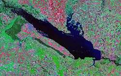
Kremenchuk Reservoir
| Kremenchuk Reservoir | |
|---|---|
 | |
| Location | Poltava and Cherkasy, and Kirovohrad Oblasts, Ukraine |
| Coordinates | 49°16′N 32°38′E / 49.267°N 32.633°ECoordinates: 49°16′N 32°38′E / 49.267°N 32.633°E |
| Type | Hydroelectric reservoir |
| Primary inflows | Dnieper River |
| Primary outflows | Dnieper River |
| Basin countries | Russia, Belarus, Ukraine |
| Max. length | 149 km |
| Max. width | 28 km |
| Surface area | 2,250 km² |
| Water volume | 13.5 km³ |
| Surface elevation | 77 m |
The Kremenchuk Reservoir (Ukrainian: Кременчуцьке водосховище, Kremenchuts’ke Vodoskhovyshche) is the largest water reservoir located on the Dnieper River. Named for the city of Kremenchuk, it covers a total area of 2,250 square kilometres in the territories of the Poltava, Cherkasy, and Kirovohrad Oblasts in central Ukraine. The reservoir was created in 1959 when the Kremenchuk Hydroelectric Power Plant was built.

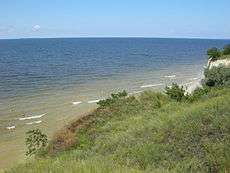
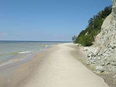
The reservoir is 149 km long, 28 km wide, and has an average depth of six meters. The total water volume is 13.5 km³. It is mainly used for irrigation, flood control, fishing, and transport within the area. The main ports on located on the reservoir are Cherkasy, and Svitlovodsk. The Sula River flows into the reservoir, forming a delta, with numerous islands.
 |
| |
|
See also
External links
| Tributaries1 | 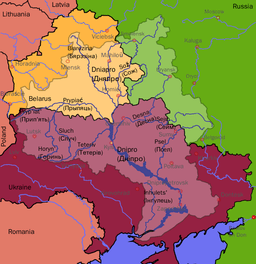 | |
|---|---|---|
| Reservoirs |
| |
| Hydroelectric stations | ||
| Canals |
| |
| Cities | ||
1 Italics indicate left tributaries | ||