Kozaklı
| Kozaklı,Turkey | |
|---|---|
| District | |
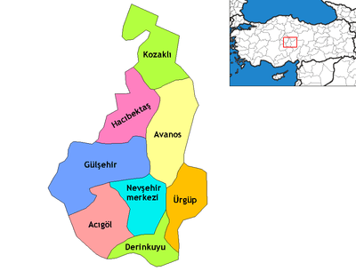 Location of Kozaklı within Turkey. | |
 Kozaklı,Turkey Location of Kozaklı within Turkey. | |
| Coordinates: 39°13′N 34°51′E / 39.217°N 34.850°E | |
| Country |
|
| Region | Central Anatolia |
| Province | Nevşehir |
| Government | |
| • Governor | Tolga Doğan[1] |
| • Mayor | Erdoğan Çelik (2009, AKP)[2] |
| Area[3] | |
| • District | 706.03 km2 (272.60 sq mi) |
| Elevation | 1,275 m (4,183 ft) |
| Population (2012)[4] | |
| • Urban | 7,070 |
| • District | 14,799 |
| • District density | 21/km2 (54/sq mi) |
| Time zone | EET (UTC+2) |
| • Summer (DST) | EEST (UTC+3) |
| Postal code | 50600 |
| Area code(s) | 0384 |
| Licence plate | 50 |
| Climate | Csb |
| Website | www.kozakli.gov.tr |
Kozaklı, formerly Hamamorta, is a town and district of Nevşehir Province in the Central Anatolia region of Turkey. According to 2010 census, population of the district is 15,519 of which 7,011 live in the town of Kozaklı.[5] The district covers an area of 706 km2 (273 sq mi),[6] and the average elevation is 1,275 m (4,183 ft).
Located in Cappadocia, Kozaklı is one of the district centers of Nevşehir. Due to its central situation to the nearest larger cities like Nevşehir, Kayseri, Yozgat, Niğde and Kırşehir (within 100 km (62 mi) distance), and particularly due to its natural spas, hamams and hotel facilities, Kozaklı has been a popular resort in Central Anatolia.
Neighbourhoods
The town of Kozaklı consists of the following quarters: Buruncuk Mahallesi, Hocaahmet Yesevi Mahallesi, Kızılkoyunlu Mahalle, Yabanlı Mahalle, Altınsu Mahallesi, Bağlıca Mahallesi, Bahçelievler Mahallesi, Hamamorta Mahallesi and Yeni Mahalle.
Villages
Kozaklı province is divided into 35 districts (capital district in bold):
- Abdi
- Aylı
- Belekli
- Büyükyağlı
- Cağşak
- Çayiçi
- Doyduk
- Dörtyol
- Gerce
- Hacıfakılı
- İmran
- Boğaziçi
- Kapaklı
- Kaşkışla
- Kuruağıl
- Küçükyağlı
- Merdanali
- Taşlıhöyük
- Hızıruşağı
- Küllüce
- Özce
- Yassıca
Notes and references
- ↑ "Tolga Doğan Kozaklı Kaymakamı" (in Turkish). District governor's official website. Retrieved 2010-07-11.
- ↑ "Kozaklı Belediyesi" (in Turkish). YerelNET. Retrieved 2010-07-11.
- ↑ "Area of regions (including lakes), km²". Regional Statistics Database. Turkish Statistical Institute. 2002. Retrieved 2013-03-05.
- ↑ "Population of province/district centers and towns/villages by districts - 2012". Address Based Population Registration System (ABPRS) Database. Turkish Statistical Institute. Retrieved 2013-02-27.
- ↑ Statistical Institute
- ↑ "Statistical information on districts of Turkey". Statoids. Retrieved 2008-04-12.
- Falling Rain Genomics, Inc. "Geographical information on Kozaklı, Turkey". Retrieved 2008-04-12.
- Municipality of Kozaklı, Turkey. "General information on Kozaklı, Nevşehir" (in Turkish). Retrieved 2008-04-12.
External links
| Wikimedia Commons has media related to Kozakli. |
- KOZTEB
- District governor's official website (Turkish)
- District municipality's official website (Turkish)
- District municipality's official website (Turkish)
- [ Map of Kozaklı district]
- Administrative map of Kozaklı district
Coordinates: 39°13′00″N 34°51′00″E / 39.21667°N 34.85000°E